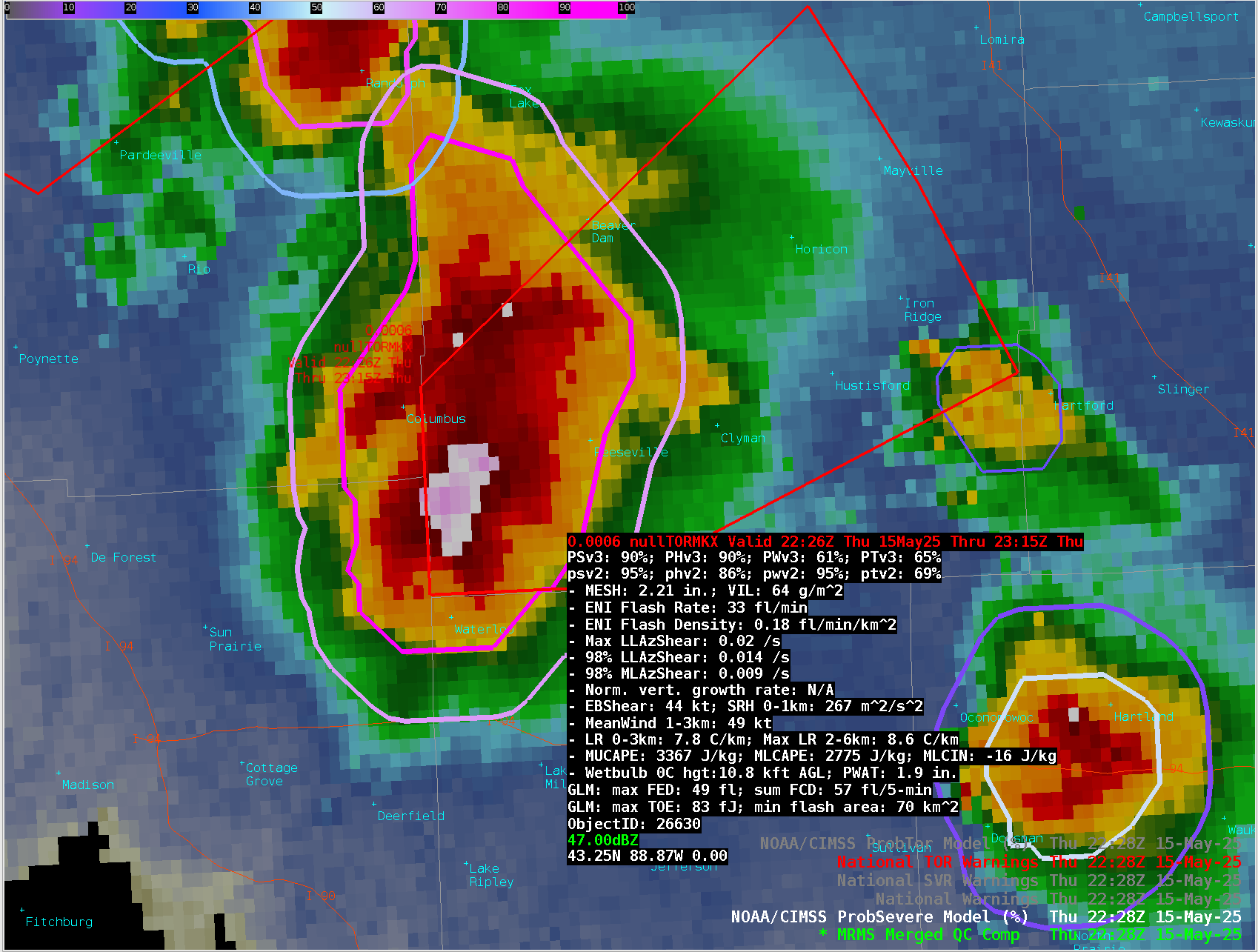
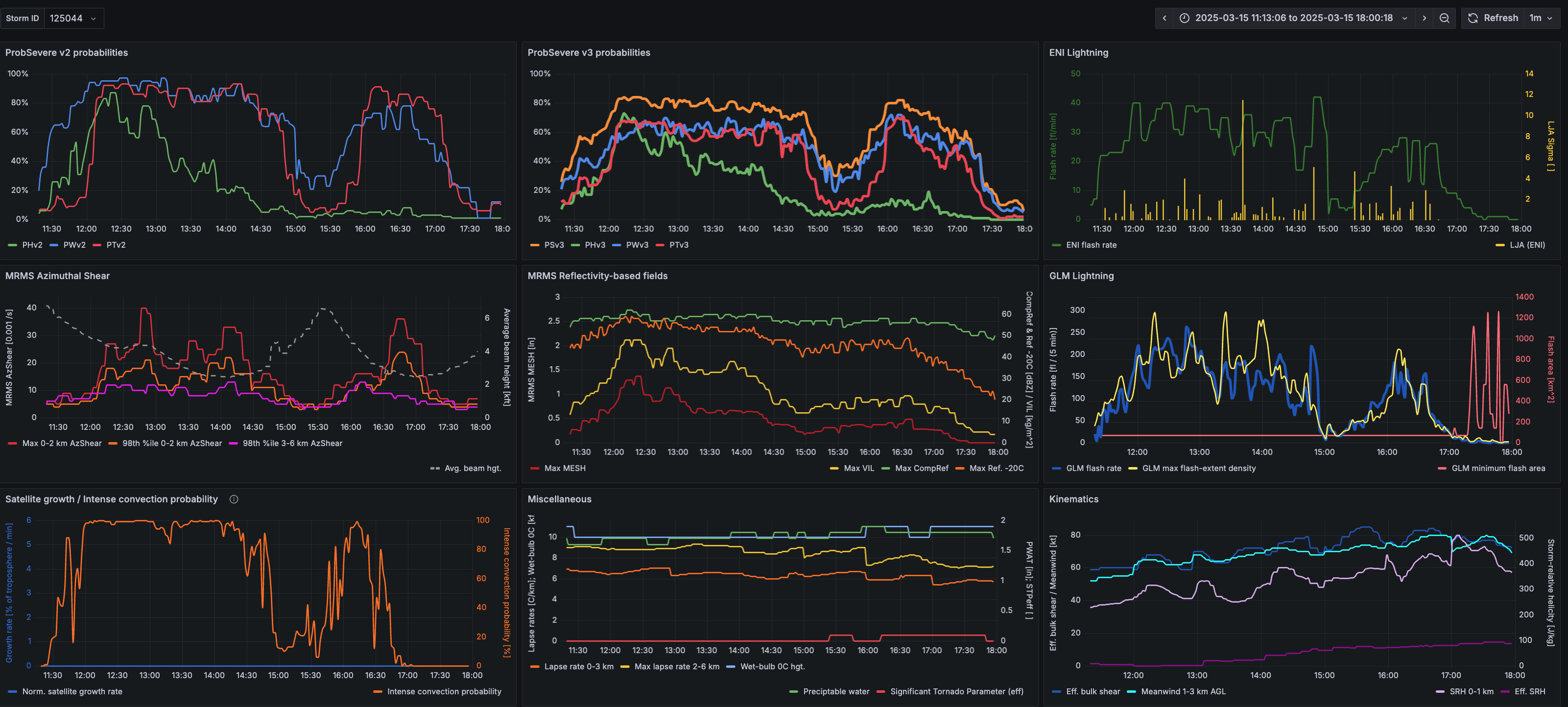
This website works best with a newer web browser such as Chrome, Firefox, Safari or Microsoft Edge. Internet Explorer is not supported by this website.

Tag: LightningCast

Midwest Mayhem

A negatively tilted shortwave trough and associated dynamical response created a rapidly deepening surface low in the Dakotas on May 15. These features worked together to bring high theta-E air from the southern U.S. up into Minnesota and Wisconsin, creating ample instability in the region. A strong mid-level jet streak... Read More

Wild Weather Weekend

Blizzards, dust storms, fires, floods, thunderstorms and tornadoes were the result of very strong back-to-back negatively tilted shortwave troughs through the eastern half of the U.S. From Texas to Wisconsin, New York to Florida, severe wind gusts, large hail, and deadly tornadoes were recorded. The hardest hit states during the... Read More

LightningCast version 2

The ProbSevere LightningCast version 1 (v1) model uses machine learning and GOES-R Advanced Baseline Imager (ABI) data to predict the probability of lightning in the next 60 minutes. This version will be operational at NOAA later in 2025.As research and development continues, a new version of the model (LightningCast v2) adds... Read More

LightningCast applied to new sensors

GOES-19 is slated to become the next operational GOES-East in April. Despite being trained on GOES-16 data, CIMSS and NOAA scientists have been busy evaluating the AI lightning-prediction model, LightningCast, on GOES-19 output to prepare for the operational transition and see how adaptable the model is.Overall, the LightningCast output on... Read More