Yet another powerful storm strikes the British Isles
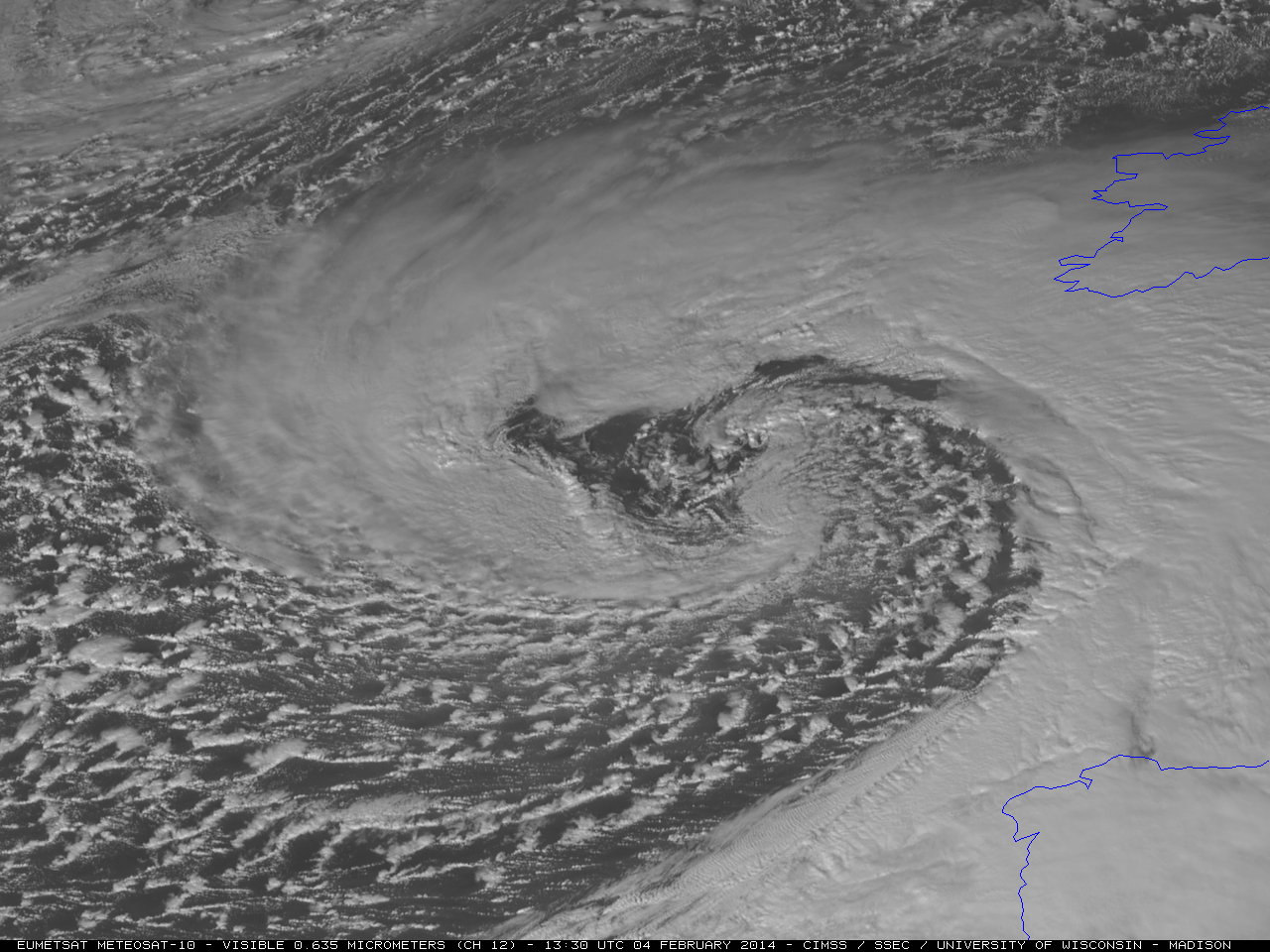
McIDAS images of EUMETSAT Meteosat-10 0.635 µm visible channel data (above; click image to play animation) showed the cloud structure associated with a powerful midlatitude cyclone that was moving northeastward toward the British Isles on 04 February 2014. This storm — the latest in a series of intense... Read More