This website works best with a newer web browser such as Chrome, Firefox, Safari or Microsoft Edge. Internet Explorer is not supported by this website.

Category: Winter weather

Snow Squall in the Northeast U.S.

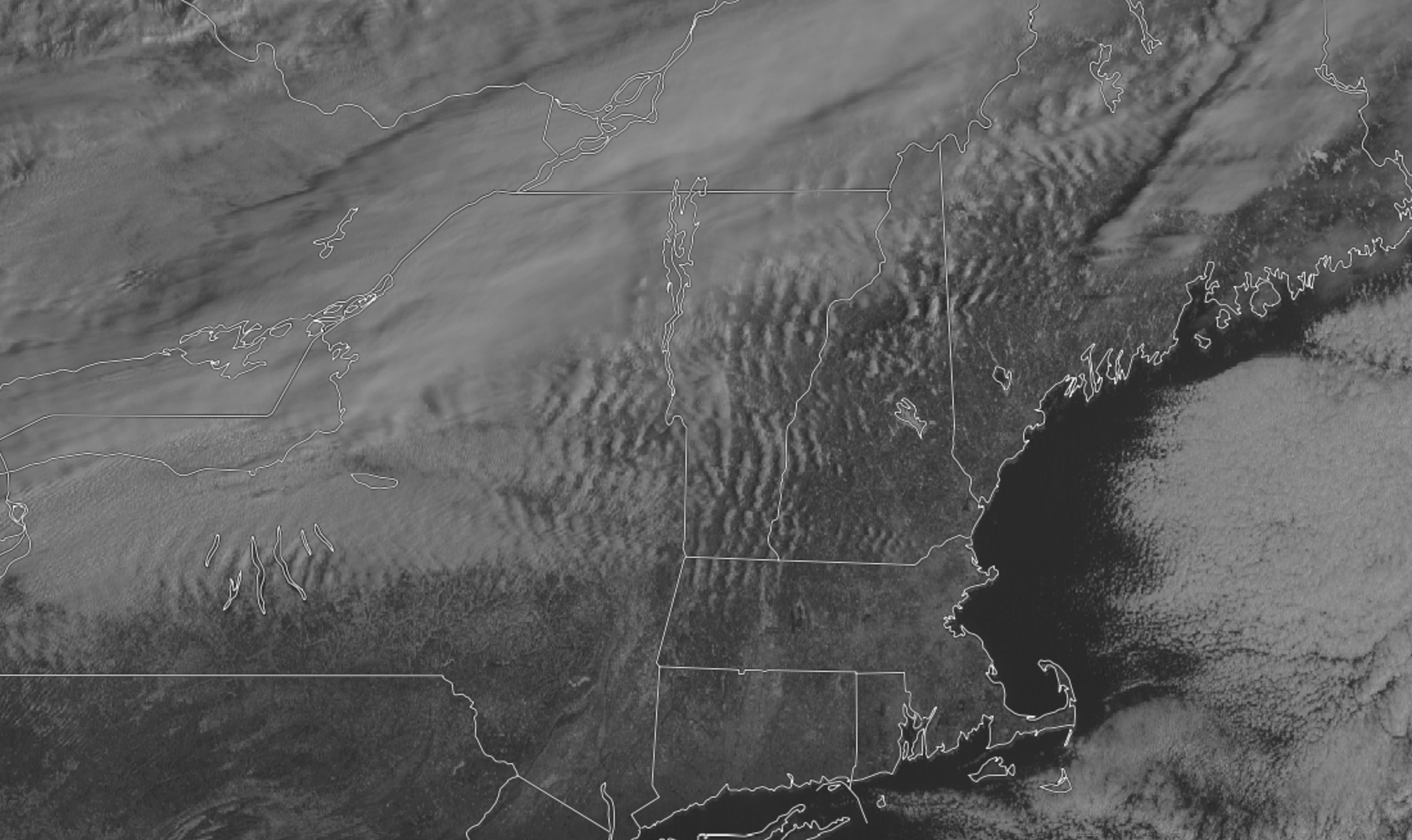
A squall warning was issued for areas of southern Quebec and Ontario as well as New York, Vermont, New Hampshire, and Maine on Sunday, February 27, 2022. The eastward moving system was surrounded by a lower deck of organized stationary wave clouds as seen in this high-resolution GOES-16 Band 2... Read More

True- and False-color imagery over the Great Lakes

VIIRS True-Color (above) and False-Color (below) imagery (available as an LDM pull from CIMSS) over the western Great Lakes at 1753 UTC (NOAA-20), 1844 UTC (Suomi-NPP) and 1937 UTC (NOAA-20, again) show the recent expansion of late-winter snowcover into southern Wisconsin and northern Iowa. Additionally, ice over the lake (more... Read More

Lake effect snow in Kansas

VIIRS True Color and False Color RGB images from Suomi-NPP and NOAA-20 (above) revealed narrow swaths of lake effect snow cover — which appeared as shades of cyan in the False Color images — downwind of Milford Lake (located NW of Junction City) and Turtle Creek Lake (located NNW of... Read More

Using NUCAPS data to anticipate freezing rain/ice pellets

NUCAPS profiles from NOAA-20 provide a widespread swath of thermodynamic information that occurs (over CONUS) when normal radiosondes are not available (for example, around 1800 UTC as above). In addition, NUCAPS provides information in regions away from the sparse radiosonde network. The image above shows NUCAPS sounding availability points over... Read More