Low-Earth Orbit satellite views of Ian as it formed, and comparisons to Geostationary imagery
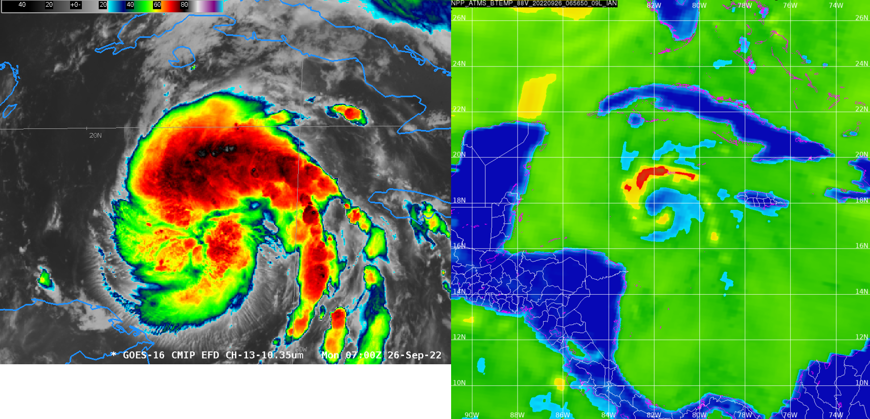
Polar-orbiting satellites have microwave detectors that give important information about the low-level structure of an evolving tropical cyclone. If high clouds are omnipresent, it can be difficult for an analyst to diagnose storm strength with accuracy. Microwave energy penetrates clouds, however, and low-earth orbit (LEO) observations of microwave frequencies can... Read More
