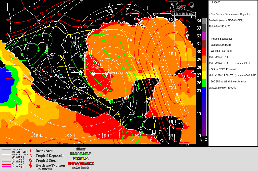
Sheared Tropical System approaching the coast of Georgia
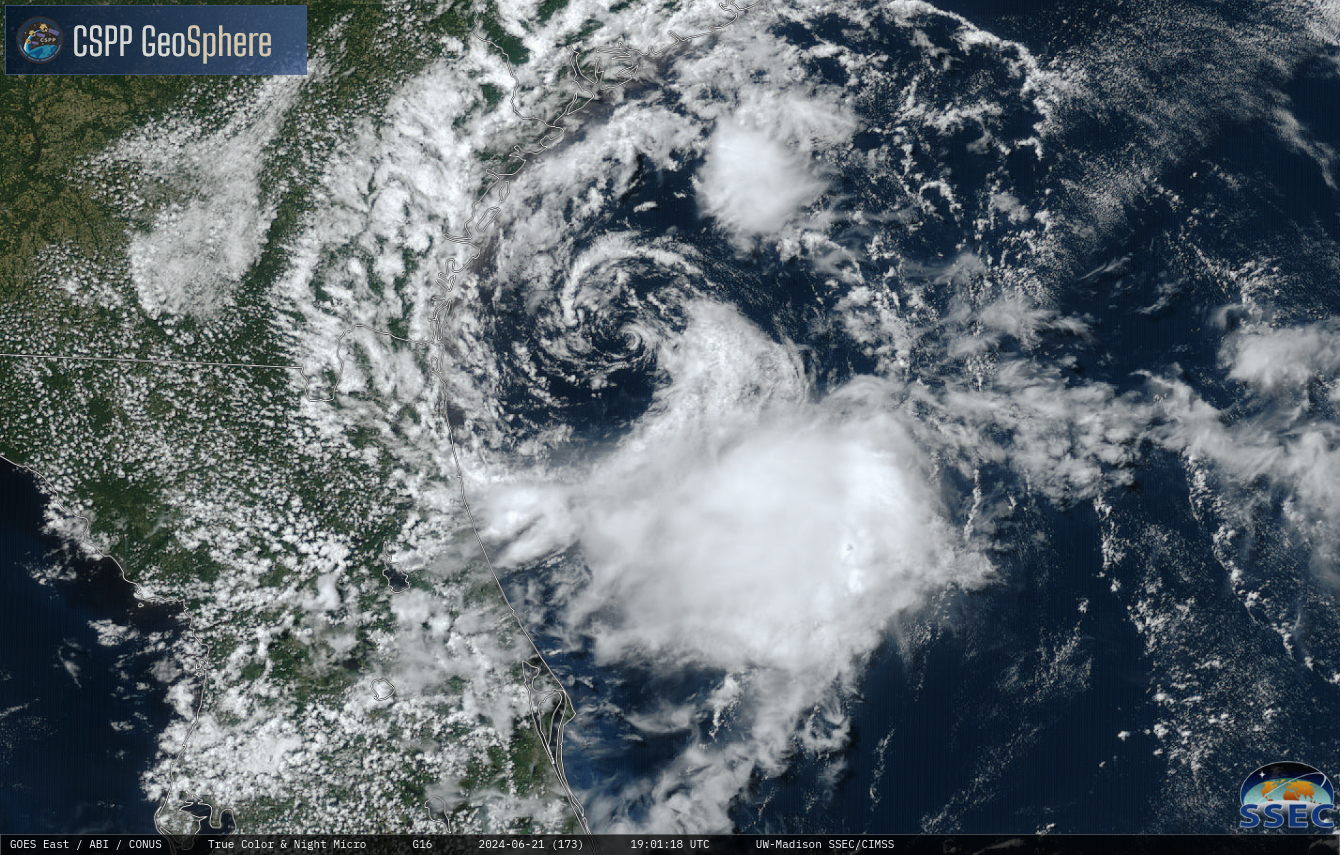
Geosphere true-color imagery over the Atlantic Ocean to the east of Florida and Georgia, above, shows a low-level cyclonic circulation with strong convection to its south. The appearance of the system suggests strong shear; an analysis of shear from the SSEC Tropical Weather website, below, shows the northerly shear over the storm... Read More