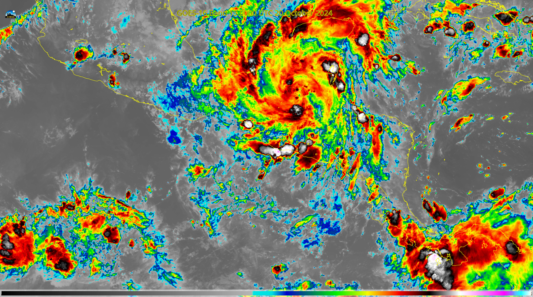
This website works best with a newer web browser such as Chrome, Firefox, Safari or Microsoft Edge. Internet Explorer is not supported by this website.

Category: GOES-16

Lake Effect Season begins

CSPP Geosphere imagery, above (link), shows a band of cumulus clouds over central Lake Michigan. The still image, below, from 1600 UTC shows cool air and surface winds converging into this band. The toggle from 1201 UTC, below, shows the band in the Night Microphysics RGB with NEXRAD reflectivity overlain,... Read More

Milton approaches Florida

GOES-16 Infrared Imagery overnight on the 9th of October shows the evolution of Milton as it moves towards landfall over southwestern Florida. Of note is the disappearance of a pronounced eye. Lightning continues within the eye, however, as shown by the GLM overlay below, and deep convection (black/grey in the... Read More

Stereoscopic views of Milton on October 8

GOES-19 is at its post-launch check-out location over the Equator at 89.5oW and GOES-16, as GOES-East is over the Equator at 75.2oW. Mesoscale sectors from both satellites were positioned over the eye of Milton up until about 1330 UTC; subsequent to that time, GOES-19 calibration exercises meant that mesoscale scanning... Read More