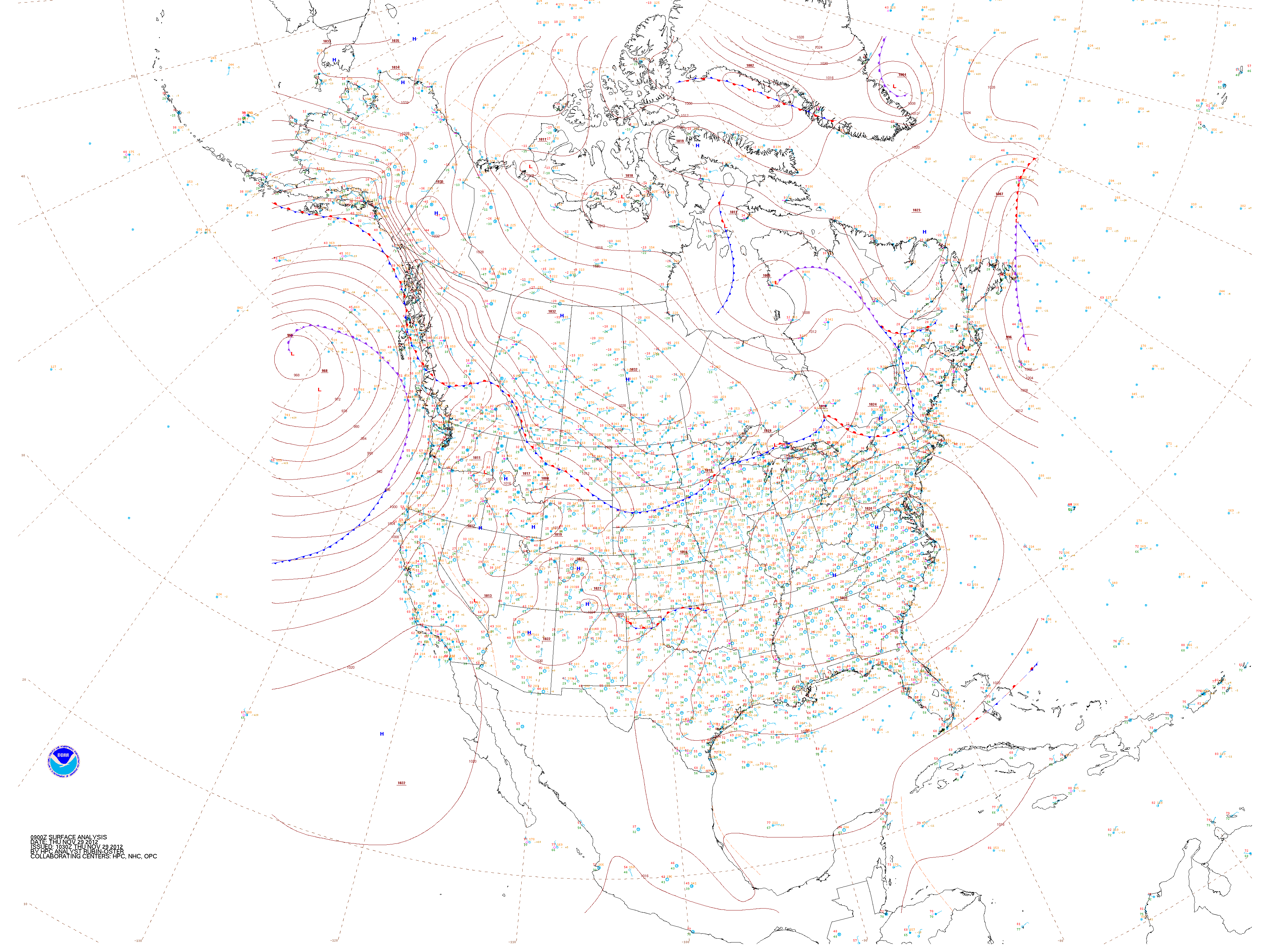
This website works best with a newer web browser such as Chrome, Firefox, Safari or Microsoft Edge. Internet Explorer is not supported by this website.

Category: Fog detection

River valley fog features on VIIRS Day/Night Band imagery

An AWIPS image of Suomi NPP VIIRS 0.8 µm Day/Night Band data with overlays of surface observations (above) revealed the “dendritic fingers” signature of river valley fog across parts of southwestern Wisconsin and the adjacent Mississippi River Valley region at 08:17 UTC (3:17 AM local time) on 04 September 2012.... Read More

Wildfires in the northwestern US

McIDAS images of GOES-13 0.63 µm visible channel data during the day and 3.9 µm shortwave IR data at night (above; click image to play animation) revealed a number of very large and dense smoke plumes from wildfires that were burning in parts of the northwestern US (primarily in Idaho)... Read More

Fog and Low Stratus Detection

Water clouds, such as those that develop when fog and low stratus form, have different emissivity properties at short IR wavelengths (around 3.9 µm) compared to longer IR wavelengths (around 11 µm). At shorter IR wavelengths, water cloud do not emit as blackbodies, meaning less radiation is emitted than is... Read More

Suomi/NPP Observations of fog

The Visible-Infraread Imager Radiometer Suite (VIIRS) instrument on Suomi/NPP samples longwave radiation emitted at 11.45 µm and shortwave radiation emitted at 3.74 µm. Because liquid water clouds have different emissivity properties at those two wavelengths, the difference in brightness temperature can be used to determine the presence of clouds (such... Read More