Category: ATMS

If you like it, then you should put a color bar on it
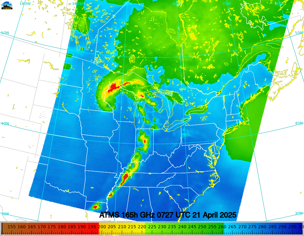
The Madison DBPS site (and other DBPS sites as detailed here) allows a user to view — in near-real time — derived MIRS imagery at different frequencies, such as the 165 GHz imagery below from NOAA-20 at 0728 UTC on 21 April 2025.You’ll notice that (at present), a colorbar is not embedded within the... Read More
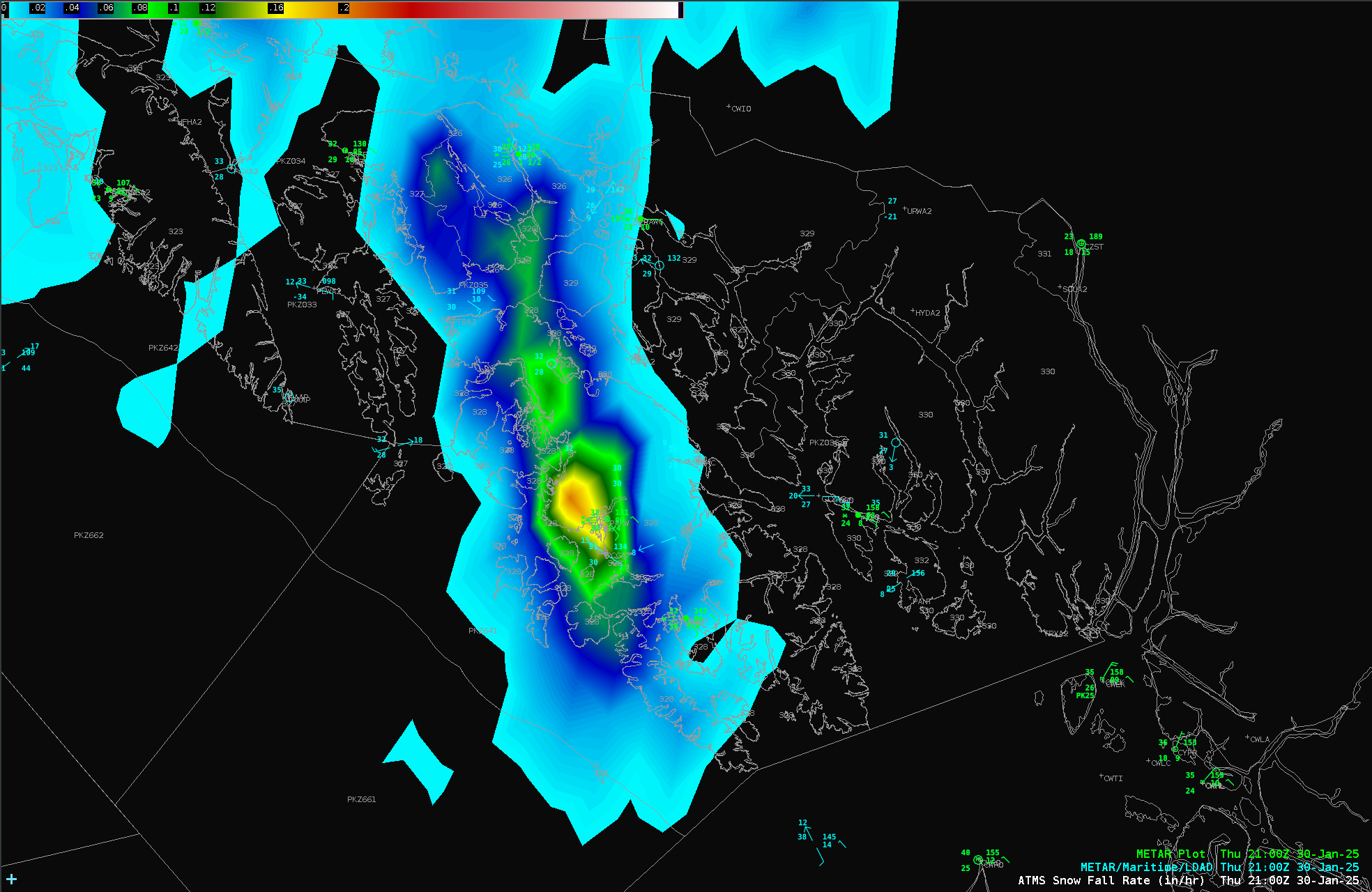
Microwave Snowfall Rate over southeast Alaska
GOES-18 infrared imagery, above, shows a cyclonic circulation over the northeastern Gulf of Alaska. Shower development is suggested by the evolution of brightness temperatures changing from cyan to blue to green (showing cooling); showers then dissipate as the brightness temperatures warm. Do you think these are showers of rain or... Read More
NUCAPS and microwave snow estimates over Alaska

NUCAPS estimates of temperature and dewpoint give swaths of information over the Arctic — a region where conventional observations are uncommon and widely spaced. The toggle above shows a disorganized low pressure system over central Alaska — light snow is widespread as shown by the surface observations, below (and in... Read More
