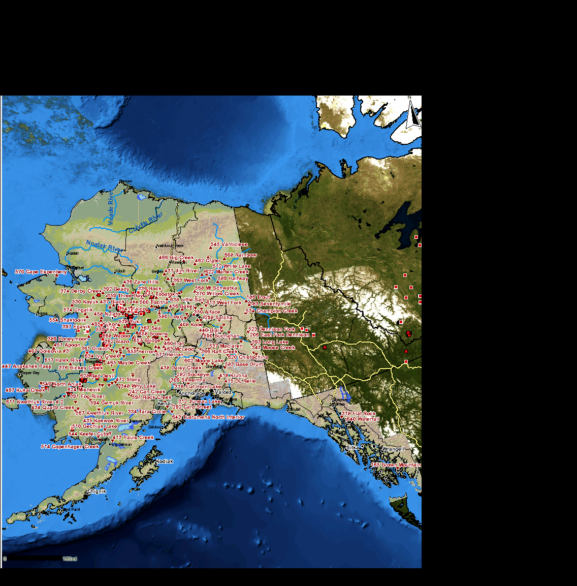
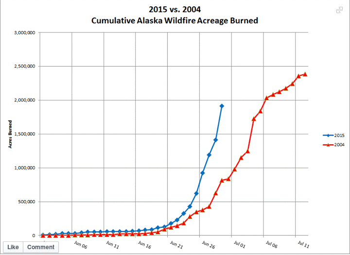
Hourly Infrared Animation for June 2015
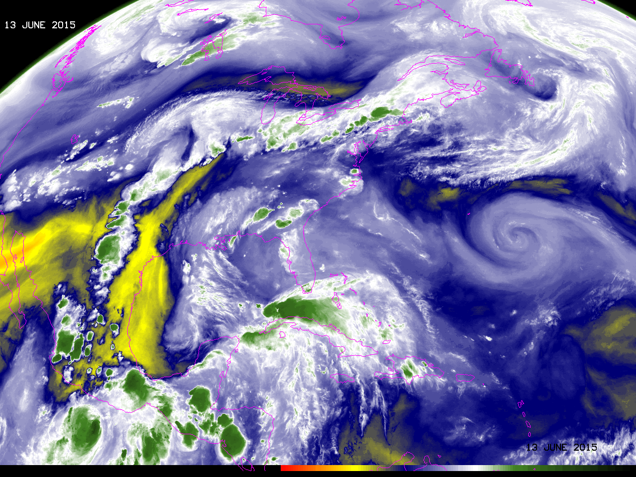
The video embedded above shows GOES-13 Water Vapor imagery each hour for all of June. Water vapor imagery (6.5 µm) is handy for tracking features in the atmosphere, and various circulations are plain in the animation, including Tropical Storm Bill and Pacific Hurricanes Blanca and Carlos. The 10.7 µm... Read More
