This website works best with a newer web browser such as Chrome, Firefox, Safari or Microsoft Edge. Internet Explorer is not supported by this website.

Stories by Scott Lindstrom

GOES-16 Tools to Observe and Monitor Fires

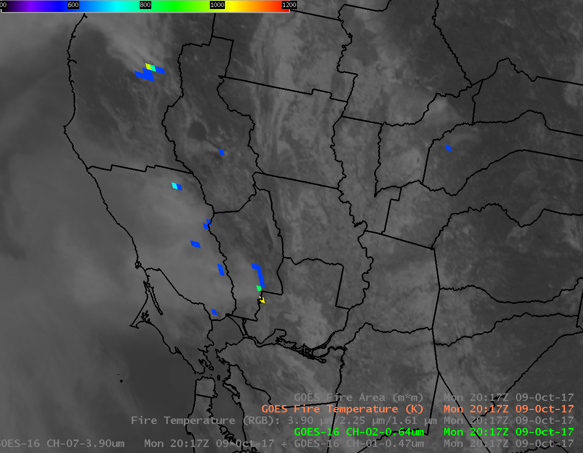
GOES-16 data posted on this page are preliminary, non-operational and are undergoing testing.GOES-16 provides many tools to the Operational Meteorologist, and to National Weather Service Incident Meteorologists (IMETs), to monitor fires when they occur, such as those over Napa and Sonoma Counties in California (Blog Post). Visible (0.64 µm) and Shortwave... Read More

Tropical Storm Nate forms near Nicaragua

GOES-16 Visible Imagery, above, shows convection (imagery at 1-minute intervals) surrounding Tropical Storm Nate, just onshore in northeastern Nicaragua.GOES-16 data posted on this page are preliminary, non-operational and are undergoing testingThe Tropical Depression (#16) in the western Caribbean Sea has strengthened to become a minimal Tropical Storm, acquiring the name... Read More

The Active Atlantic Basin in August and September

The YouTube link, above, shows the GOES-16 “Clean Window” (10.3 µm) Infrared Imagery over the Atlantic, showing the evolution of Hurricanes Franklin through Maria, from 7 August through 1 October. (The original mp4 video (250 Meg) is available.)GOES-16 data posted on this page are preliminary, non-operational and are undergoing testing ... Read More