Unusual October Tornado in Wisconsin
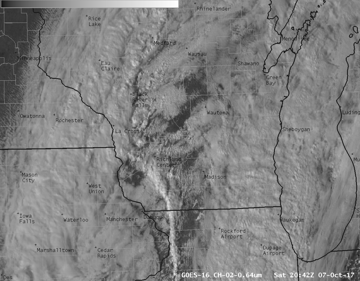
GOES-16 ABI Visible (0.64 µm) Imagery, 2042-2227 UTC on 7 October 2017 (Click to animate)
GOES-16 data posted on this page are preliminary, non-operational and are undergoing testing
October is typically not a month when tornadoes are expected in Wisconsin. (And in fact, the month ranks fourth in the numbers of fewest tornadoes nationwide). Nevertheless, a brief tornado occurred on the east side of Madison WI late in the afternoon on 7 October (NWS Milwaukee/Sullivan). The visible animation, above, from GOES-16, shows a thin line of weak convection moving through the central part of the state. A slower animation centered on the reported time of the tornado (2200 UTC), is below. The dynamic state of the thunderstorm tops is apparent, and the 5-minute time-step may not be sufficient to resolve the small time-scale changes in the tornadic storm (the two GOES-16 Mesoscale sectors that provide 1-minute imagery were covering the pending landfall of Hurricane Nate at this time, and were giving severe weather support to Puerto Rico, radar-less in the wake of Hurricane Maria).
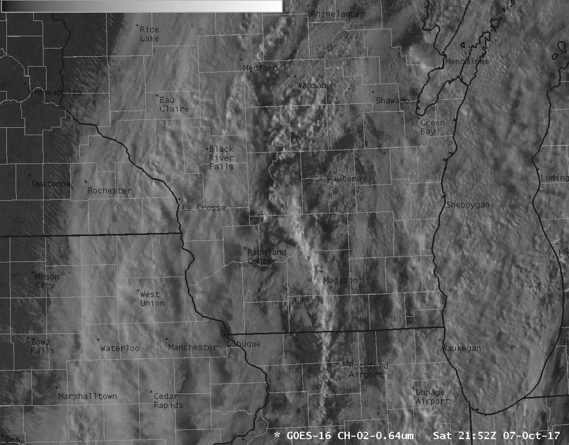
GOES-16 ABI Visible (0.64 µm) Imagery, 2152-2222 UTC on 7 October 2017 (Click to enlarge)
The Clean Window Channel, below, with the default AWIPS enhancement, shows little cloud-top structure.
GOES-16 ABI Infrared (10.3 µm) Imagery, 1917-2302 UTC on 7 October 2017, default enhancement (Click to animate)
Coldest cloud-top brightness temperatures with this event were in the -15º to -20º C range, and the default enhancement (with a range from -109º to 55º) showed little gradation in that range. By changing the coldest temperature in the enhancement from -109º C to -43º C, however, a structure in the cold clouds emerged, as shown below. Do not be afraid to change enhancements!
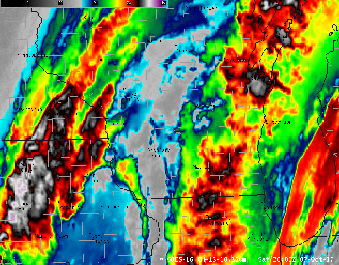
GOES-16 ABI Infrared (10.3 µm) Imagery, 1917-2302 UTC on 7 October 2017, adjusted enhancement (Click to animate)
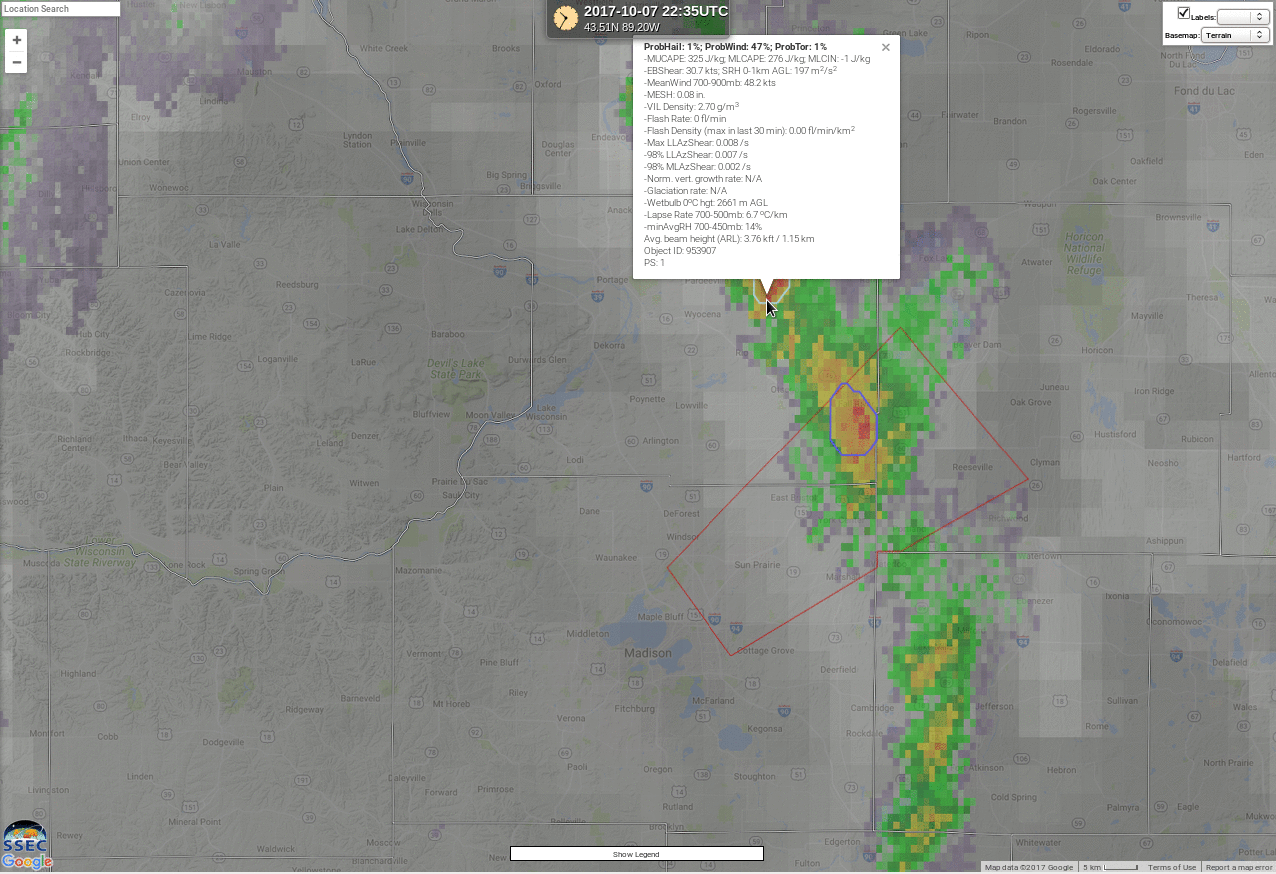
The NOAA/CIMSS ProbSevere products for this event is shown below (from this site). ProbTor values were negligible; however, ProbWind values for the tornadic cell were around 20-24% leading up to the event. In addition, the cell that produced the tornado had the highest probabilities in the identified cells along the line of convection. The single exception occurred at 2235 UTC, after the severe weather event, when the cell to the north briefly (for only five minutes) showed Probabilities exceeding 40%.
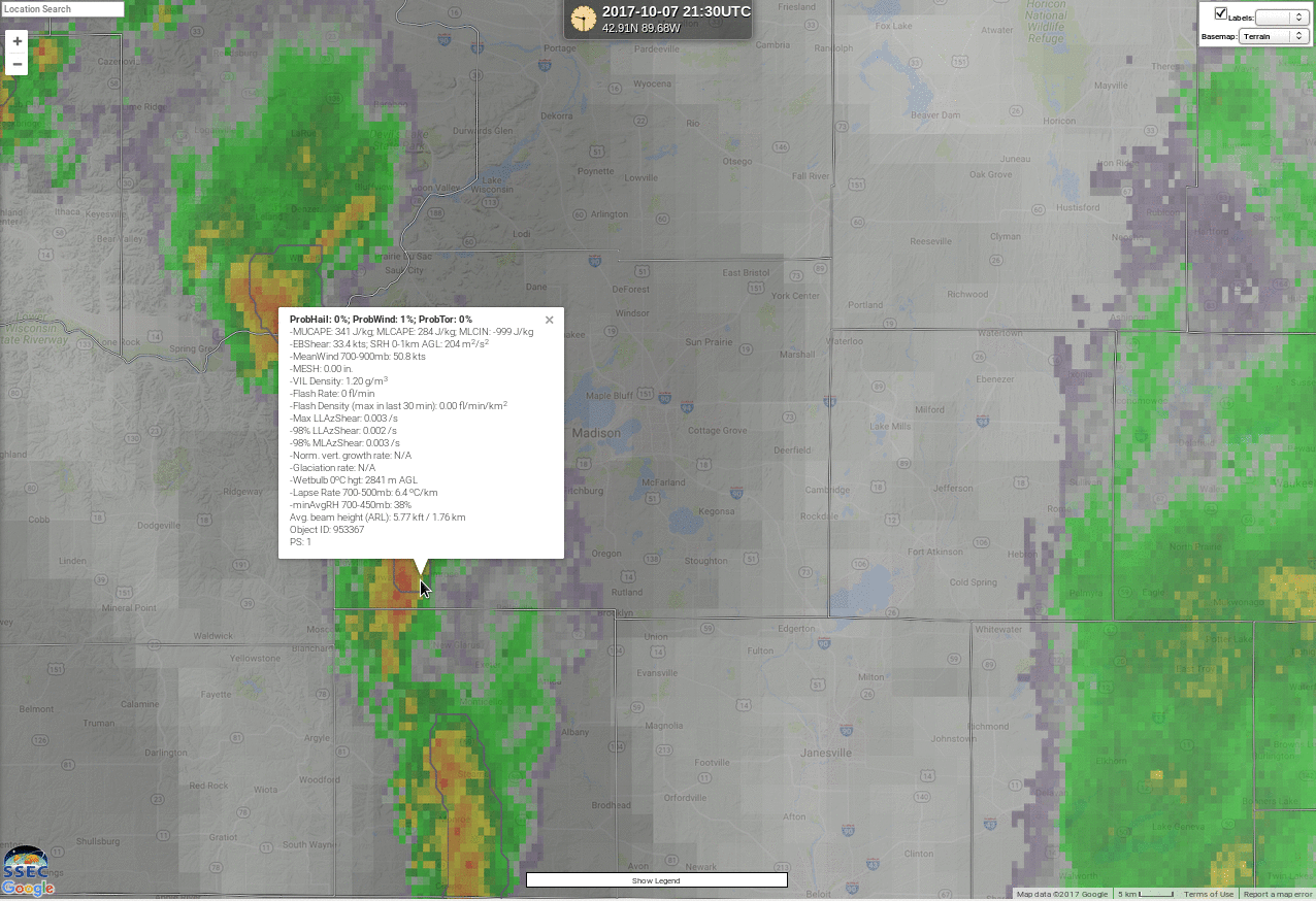
NOAA/CIMSS ProbTor, 2130-2235 UTC on 7 October 2017 (Click to enlarge)
============================== Added =============================
The National Weather Service in Milwaukee/Sullivan WI determined that the tornado was an EF-0 based on a damage assessment. They provided radar imagery at the start of the tornado, during the tornado, at its end, and after dissipation.