Tropical Depression #3 forms off the East Coast of the United States
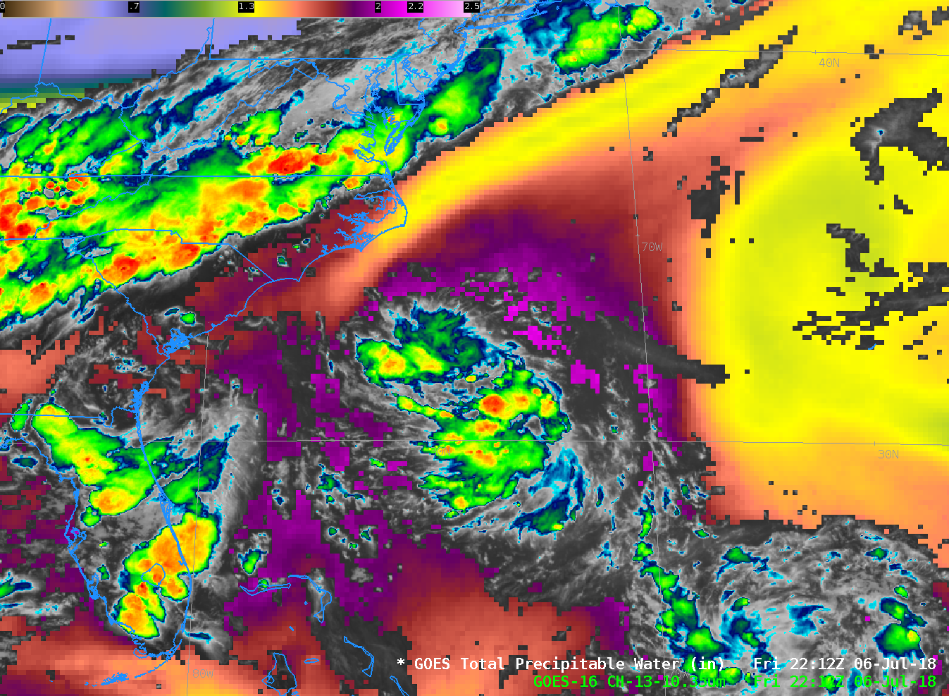
Tropical Depression Three has formed in the Atlantic Ocean southeast of Cape Hatteras. The visible animation above (click the image to play an animated gif) shows strong convection with overshooting tops mostly south and west of a low-level circulation. The cold front over the eastern United States, and an upper-level... Read More
