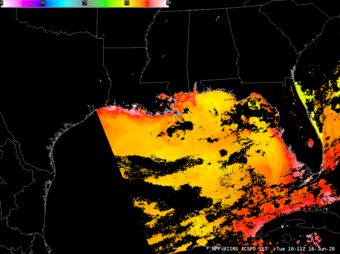
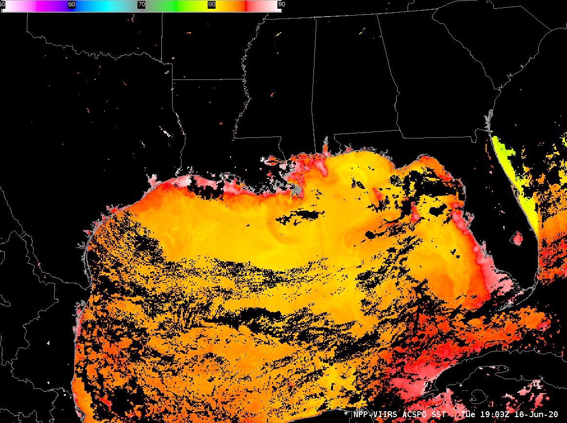
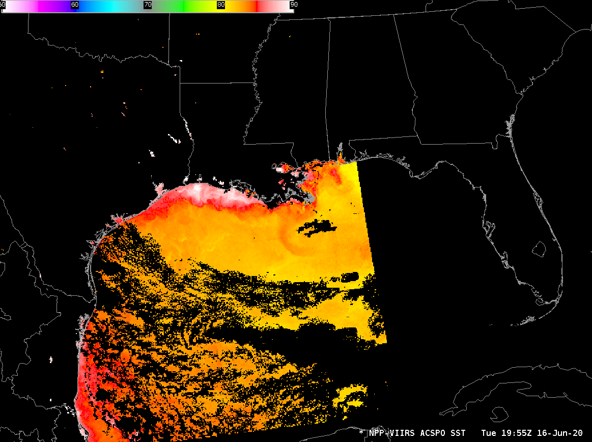
Inferring wind speed from ACSPO SSTs
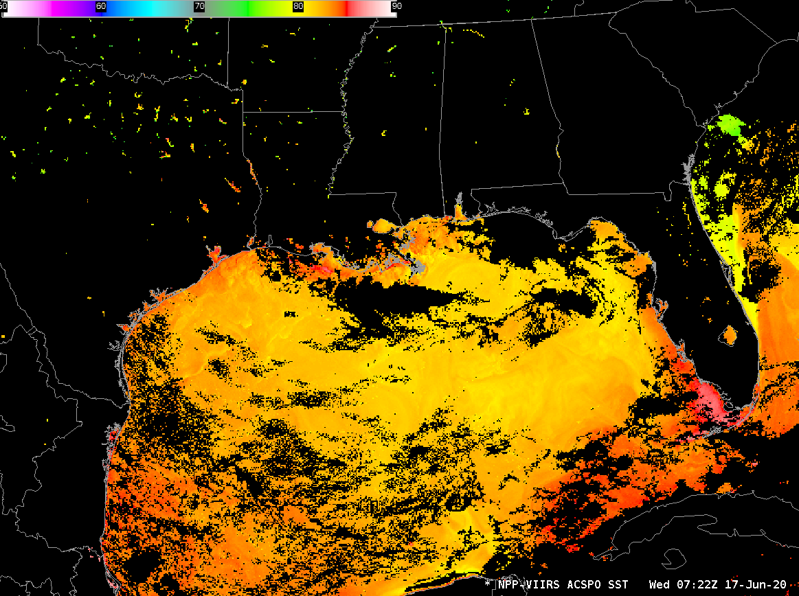
The animation above shows Advanced Clear-Sky Processor for Ocean (ACSPO) sea-surface temperatures at three different times on 16 June: 1811 UTC (using data from Suomi NPP), 1903 UTC (using data from NOAA-20) and 1955 UTC (using data, again from Suomi NPP). (Orbit paths for the satellites can be viewed here). Note that the... Read More
