This website works best with a newer web browser such as Chrome, Firefox, Safari or Microsoft Edge. Internet Explorer is not supported by this website.

Stories by Scott Lindstrom

Dry Air in the southwest Atlantic Ocean

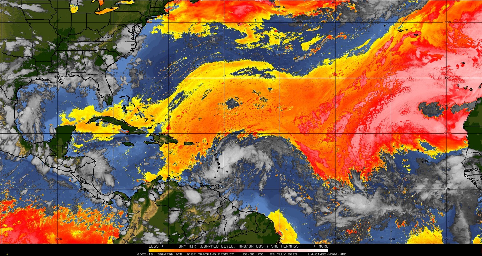
An analysis of the Saharan Air Layer, above (from this website), shows dry conditions stretching from Africa to the southwestern Atlantic, wrapping around the clouds associated with a strong tropical disturbance that is forecast to move northwestward over the Lesser and Greater Antilles in the next couple days.  (Both the dry air... Read More

Microwave Estimates of Total Precipitable Water

https://cimss.ssec.wisc.edu/satellite-blog/wp-content/uploads/sites/5/2020/07/MIMICTPW_LastTenDaysEPAC_end27July2020.rockanim.mp4 MIMIC TPW rocking animations from 17-27 July 2020 (and back) [click to play mp4 animation] Morphed Microwave Imagery at CIMSS (MIMIC) estimates of Total Precipitable Water are derived from microwave sensors such as AMSU and ATMS on different polar-orbiting platforms. MIRS retrievals are used to estimate Total Precipitable Water from each polar swath, and those swaths are then advected... Read More

NUCAPS Soundings and microwave-based and GOES Level 2 Rain Rates

The animation above steps between NUCAPS Sounding Availability points and MIRS estimates of Rain Rate derived from NOAA-20’s Advanced Technology Microwave Sounder (ATMS) instrument (and available via LDM download from CIMSS).  ‘Red’ points in NUCAPS sounding availability are usually associated with precipitation, and that relationship is apparent in the toggle.  With the exception of four red points... Read More