Running a forecast model with locally downloaded satellite data
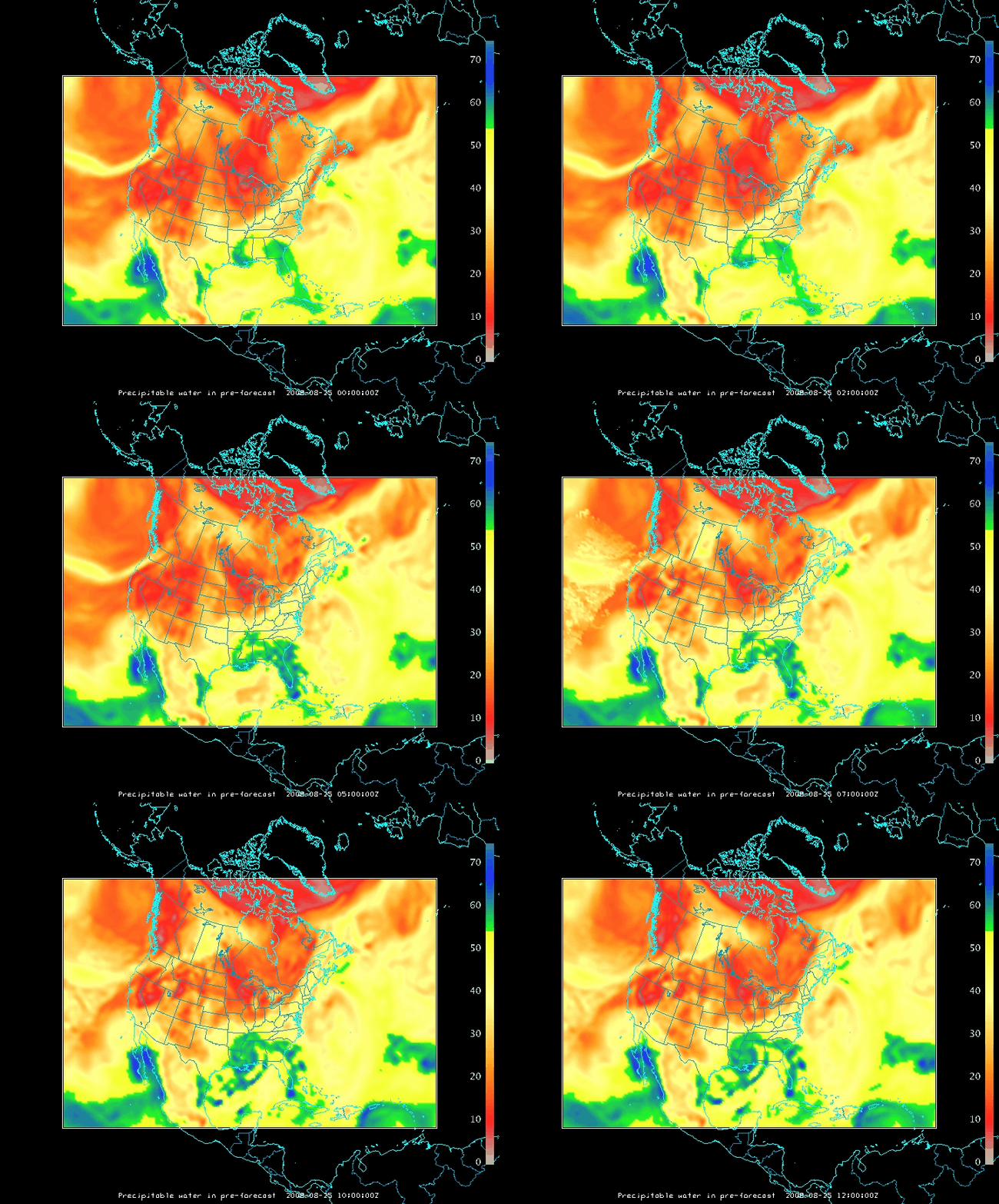
MODIS instruments (see here, as well) on board NASA’s Terra and Aqua satellites offer high resolution multi-banded views of the Earth’s atmosphere. Information from the channels can be used to derive total precipitable water in regions where clouds do not exist (as explained here). In the present case, MODIS TPW is compared to colocated TPW values in a CRAS model run that is centered on the direct broadcast MODIS ground station site at SSEC. Where the values differ, mixing ratios are adjusted so that the model value more closely matches the satellite-observed TPWs (Lapse rates are preserved in the adjustment). Satellite-observed TPWs are available only in clear fields of view; cloud initializations, however, are adding information where clouds are observed.
The case above (imagery produced using McIDAS-V) shows the 12-hour pre-forecast spin-up for the model with an initial time of 12:00 UTC on 25 August 2008. Six different MODIS orbits that were received at the SSEC direct broadcast ground station between 00:00 UTC and 12:00 UTC directly affect the initial model fields that are derived from GFS output. Note how the addition of MODIS data moistens the atmosphere in and around the remains of Tropical Storm Fay over the south central US, and also moistens the atmosphere over the Pacific Ocean west of California.
This method is used to introduce satellite information downloaded locally into a model run; more accurate initial fields are helpful in producing a more accurate forecast. In the present case, once the more accurate initial fields are generated, the model then steps forward in time (with GFS fields used to constrain the boundaries).


