NGFS detections of a small marsh fire in Brookfield WI
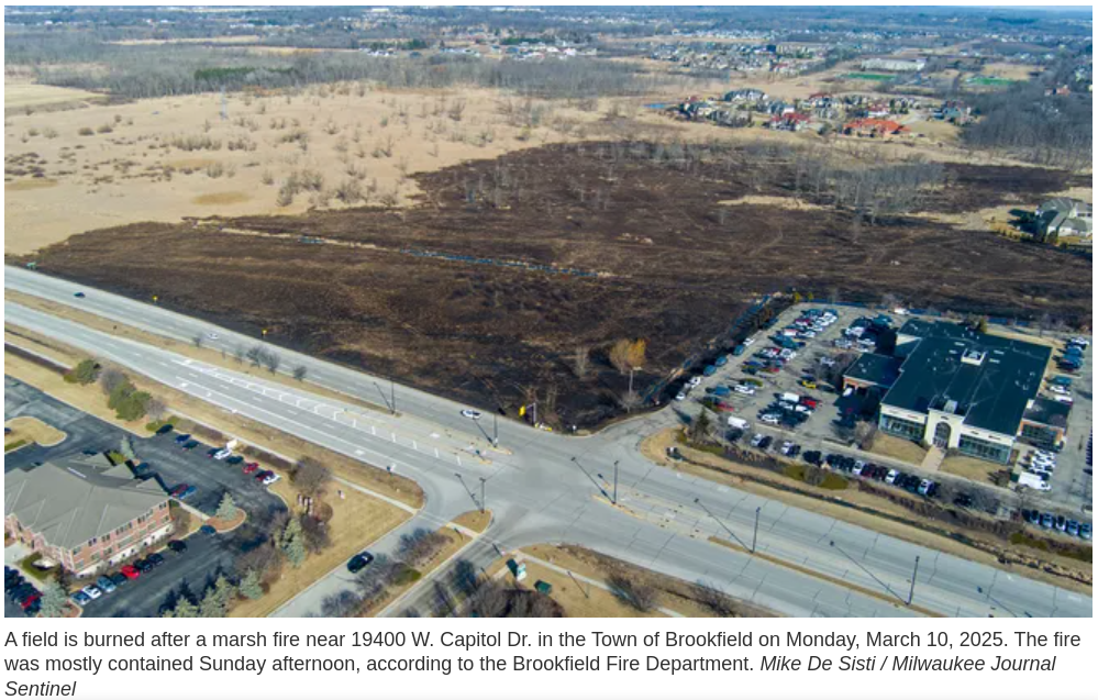
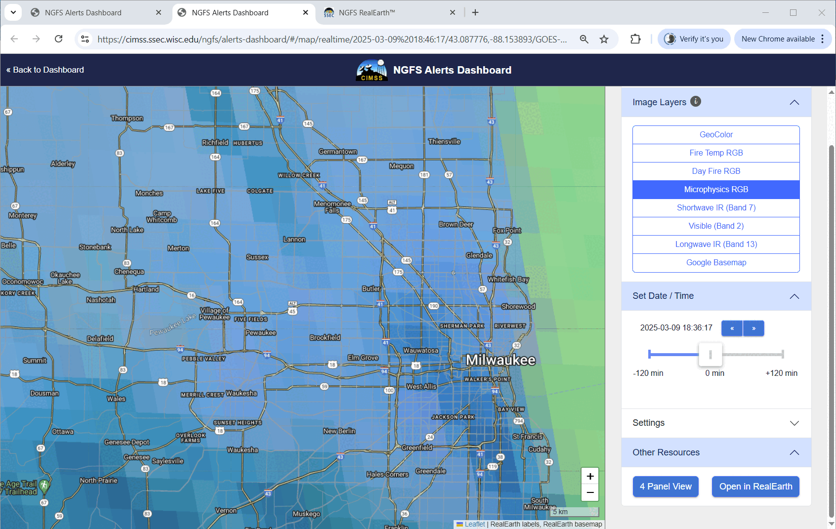
A fire on Sunday 9 March in suburban Milwaukee (Milwaukee Journal Sentinel articles 1, 2, 3; I read it about it in the paper: Page 1; Page 2) burned about 100 acres just north of Capitol Drive as shown in the 10 March 2025 image above from the Journal Sentinel. What kind of alert did NGFS provide for this small fire? The slow animation below shows the NGFS Microphysics RGB from routine CONUS scanning (that is, every 5 minutes; mesoscale sectors producing imagery every minute were positioned elsewhere on the 9th). The first NGFS alert was at 1846 UTC, a bit after the 1:39 PM 911 call that alerted first responders.
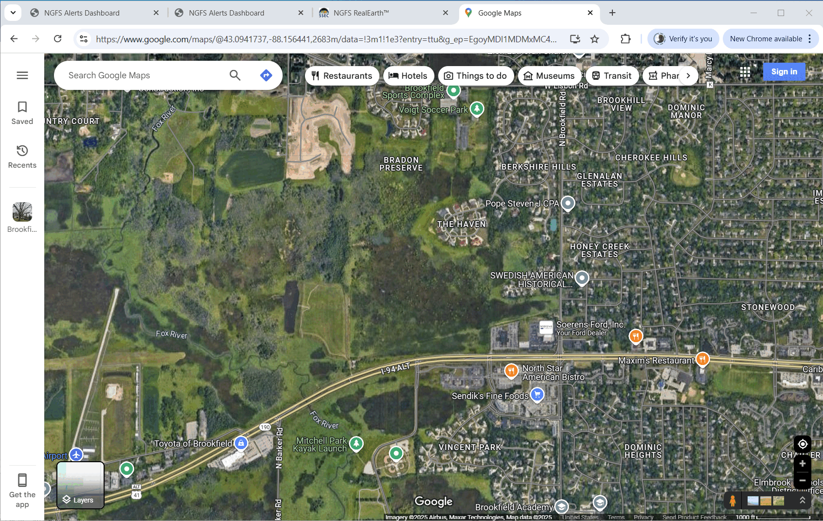
NGFS imagery includes Google Maps that can inform a user about the location where the burn is detected. The slider below reveals the pixel size relative to the burning region, the marsh that burned, and the roads and businesses near the fire. (Here’s another google maps view — direct link — that includes the Ford Dealership mentioned in the article, and a circle that highlights the intersection at the bottom of the burn-scar image shown up top). The area of the infrared pixel used to detect this fire is about twice the size of the area consumed; you might conclude that very little of the pixel at any one time was burning, and the detection of a fire of this small size is remarkable.