High Pressure Doesn’t Always Mean Clear Skies
One of the first things that meteorologists learn in their Intro to Weather class is that low pressure means cloudy skies and rain while high pressure means clear skies and sun. Of course, the second thing that meteorologists learn is that weather often doesn’t behave in a textbook way. The southeastern United States today is a good example of that.
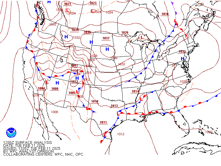
Looking just at the surface observations from the Weather Prediction Center, one would think that the Atlantic southeast is under fairly quiescent conditions. A strong high pressure system is centered over southeastern Pennsylvania, but an arm of this high extends south all the way into northeastern Georgia. A stationary front parallels the northern border of Florida. Even the low pressure system in northern Mississippi is quite weak, with a central pressure that is higher than the average mean sea level pressure. All in all, it looks to be a fairly ordinary day.
But the satellite on SSEC’s Real Earth tells a different story. Here’s a loop of true color imagery from GOES-16 this morning.

Obviously, the Atlantic southeast is dominated by clouds, which seems to stand in opposition to what the surface map indicates should be happening. Some of the cloudiness is due to overflow from the midwestern cold front. But a good deal of the cloudiness is caused by the cyclonic flow around the high pressure in the northeast. The flow is coming from over the ocean, where is becomes laden with moisture. As it moves ashore, it runs into the southern extend of the Appalachian Mountains where orographic uplift forces it aloft and clouds and rain ensue.
One of the localized phenomena that arises from this kind of flow in northeastern Georgia has been dubbed the “wedge.” In wedge events, a shallow, stable layer of cold air forms due to cold air damming against the Appalachians. A sounding from the 1500 UTC RAP analysis shows this clearly:
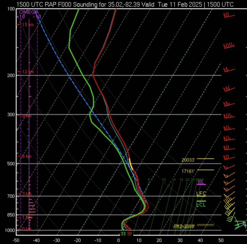
This time of year is historically home to the strongest cold air damming events in this region, and their effects can be significant. Low level inversions like the one seen today can contribute to hazardous wintertime precipitation like freezing rain, as snow formed in a saturated layer aloft melts as it falls through the elevated warm layer then freezes again when it contacts the surface. In April 2023, a wedge event received national attention: the Masters golf tournament was interrupted by a backdoor cold front that formed from the wedge of cold air flowing southward along local terrain. During that event, winds exceeded 30 mph, trees were felled near spectators, and play was interrupted due to these hazardous conditions.
Days like today are a reminder that it’s always a good idea to get a bird’s-eye view of the weather using the wealth of observations that satellites can provide.