Cold/dry arctic air mass over South Dakota (with some lake effect snow)
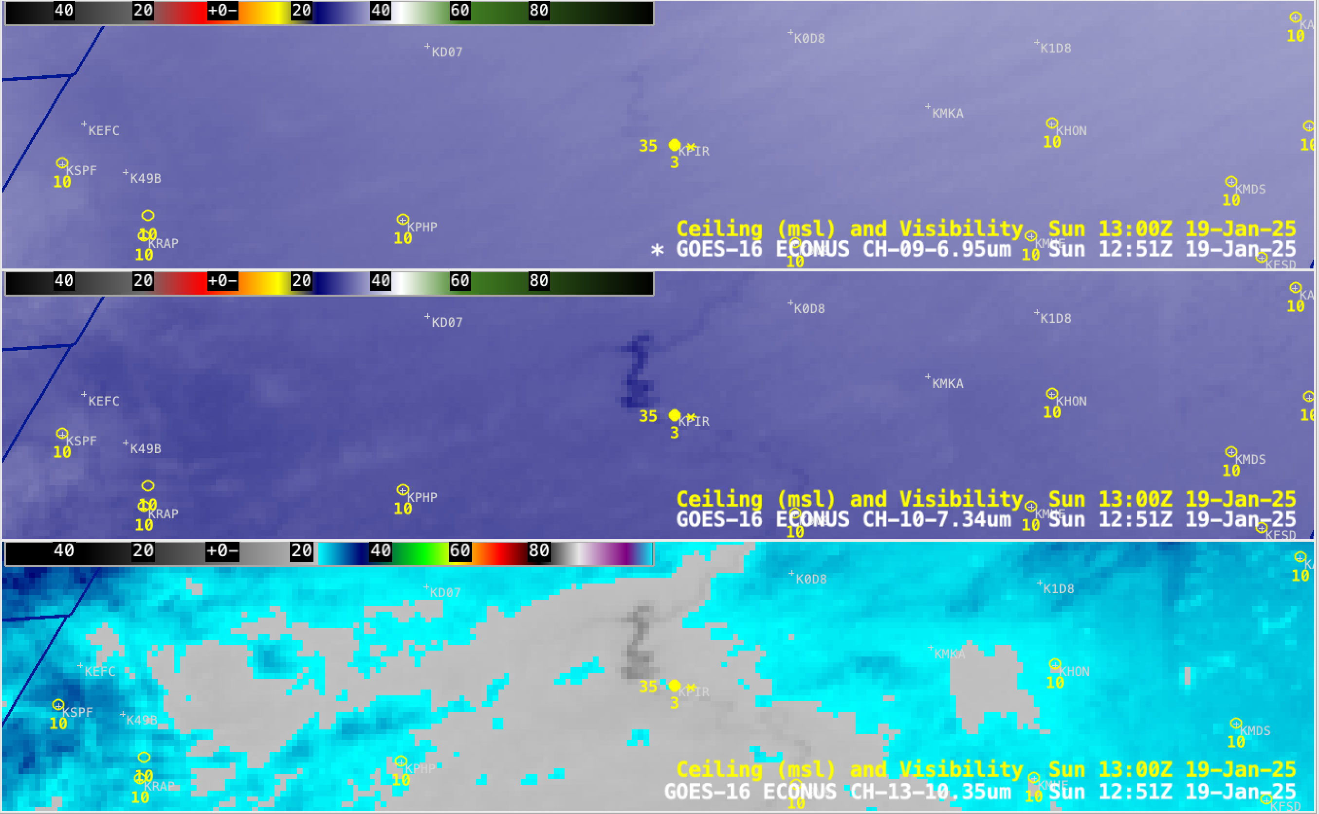
GOES-16 Mid-level Water Vapor (6.9 µm, top). Low-level Water Vapor (7.3 µm, middle) and Clean Window Infrared (10.3 µm, bottom) images from 0001-1801 UTC on 19th January [click to play MP4 animation]
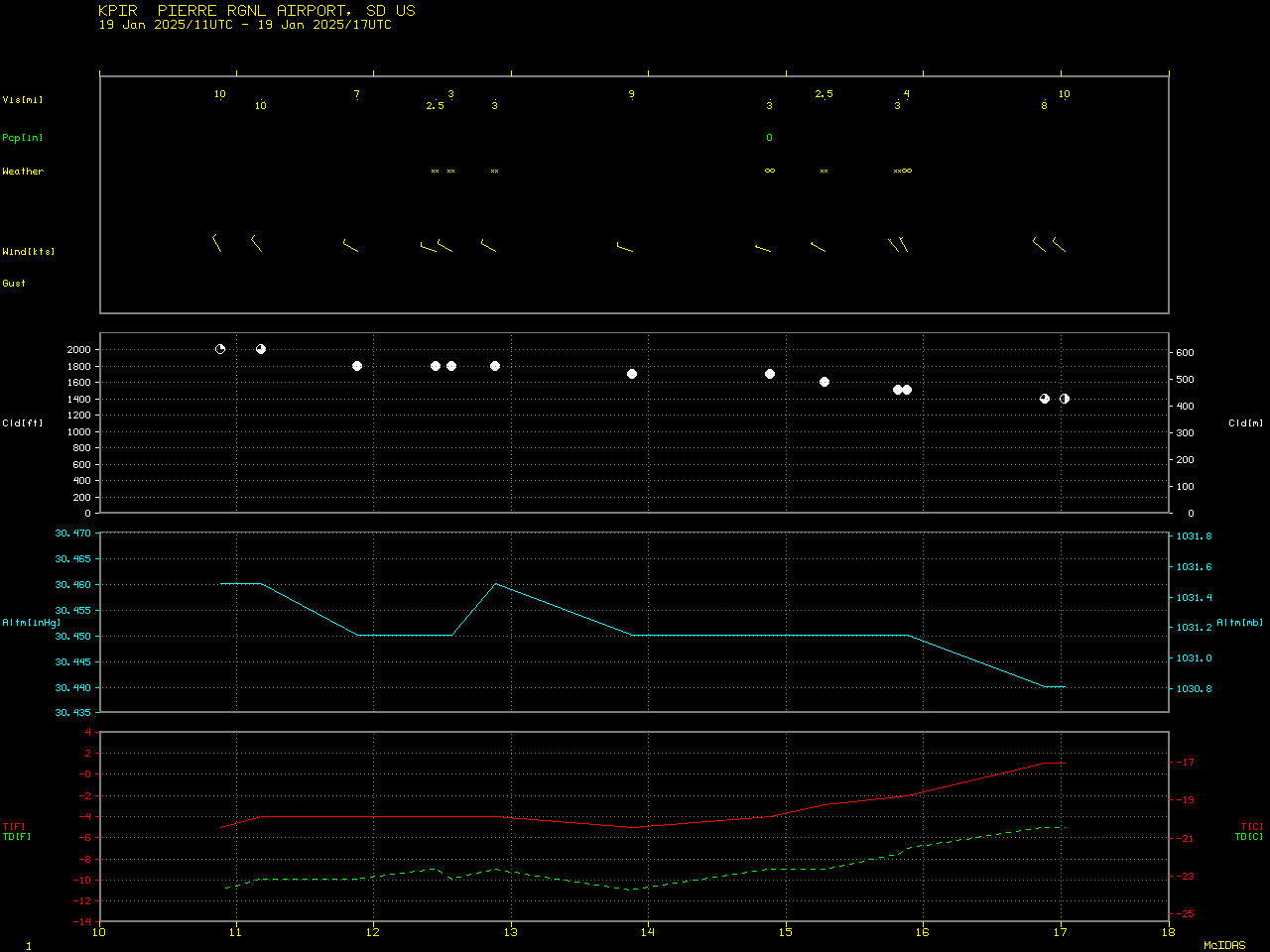
Plot of surface observation data from Pierre, South Dakota from 1100-1700 UTC on 19th January [click to enlarge]
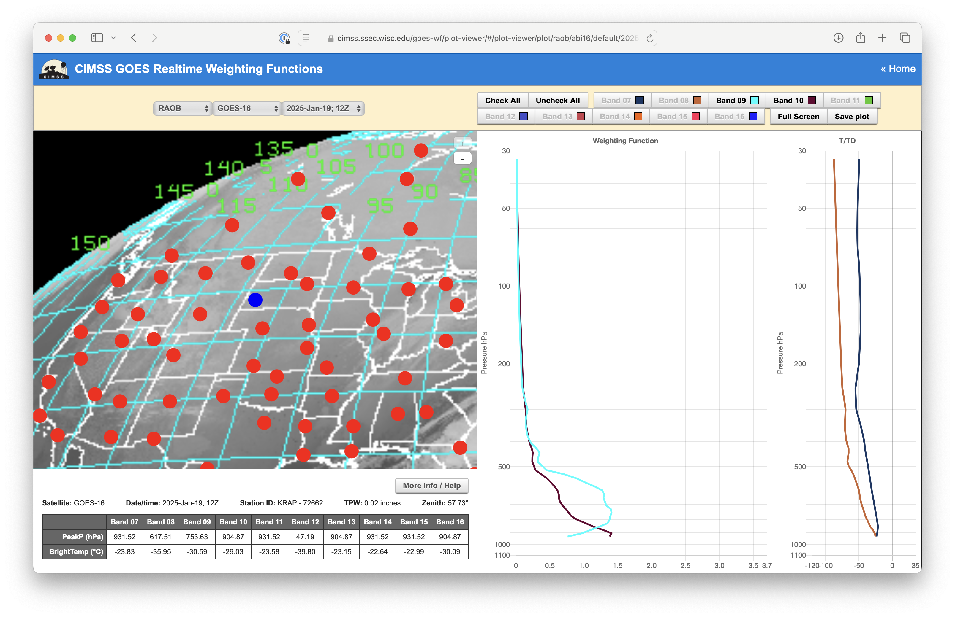
Plot of Weighting Functions for GOES-16 Water Vapor Bands 09 (cyan) and 10 (brown), calculated using 1200 UTC rawinsonde data from Rapid City, South Dakota on 19th January [click to enlarge]
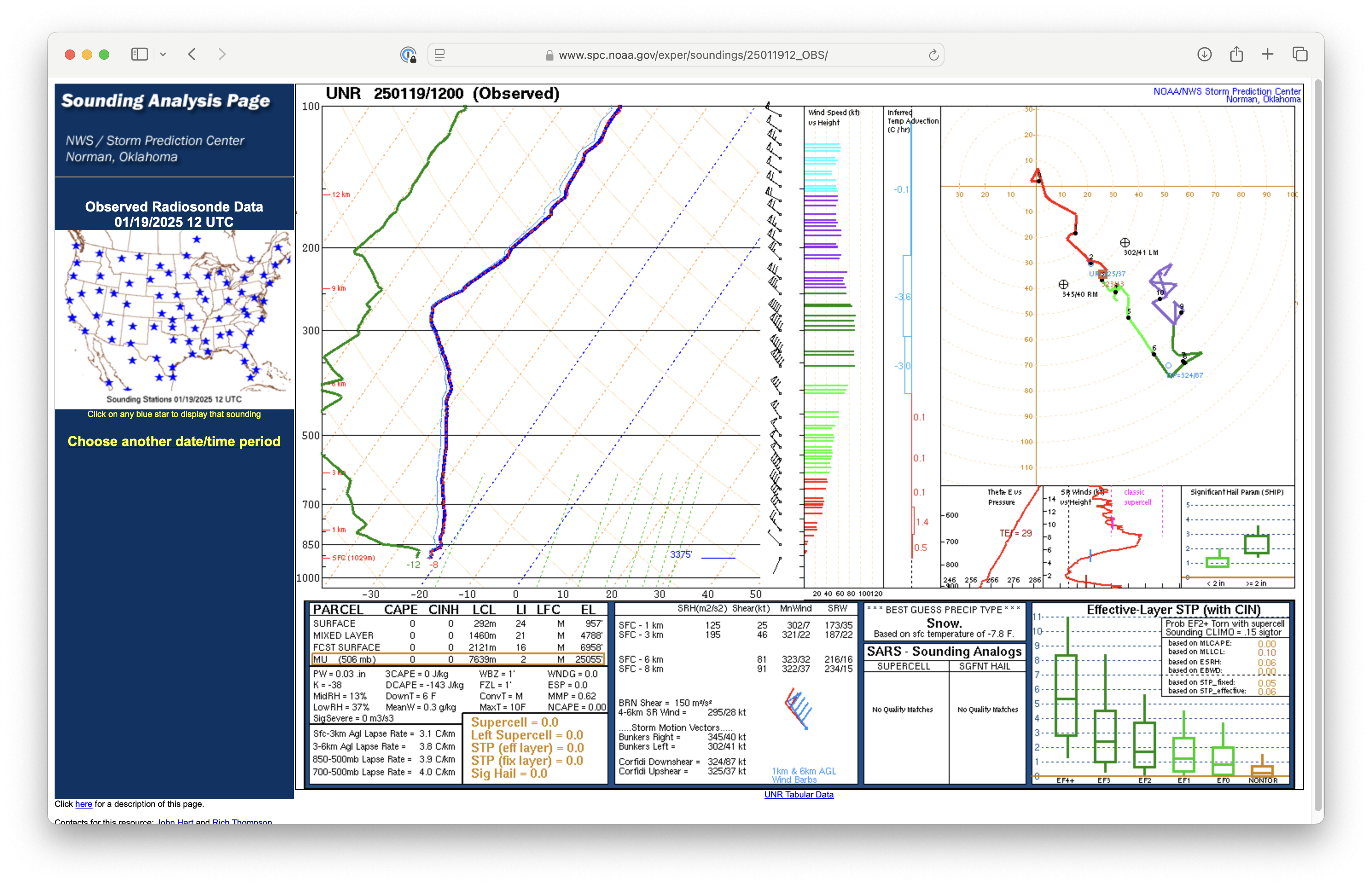
Plot of rawinsonde data from Rapid City at 1200 UTC on 19th January [click to enlarge]
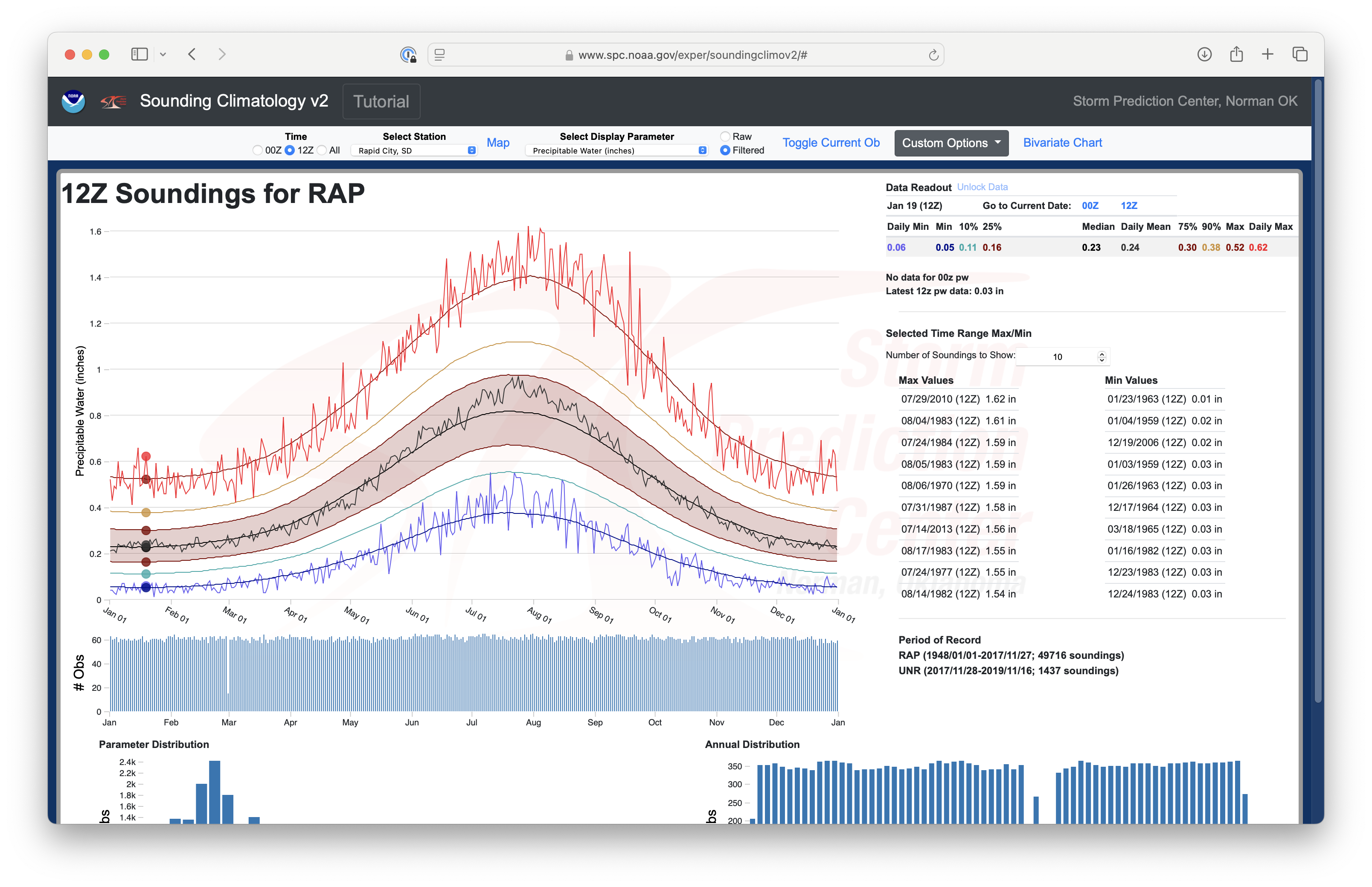
Rapid City rawinsonde climatology of Total Precipitable Water for all 1200 UTC soundings on 19th January [click to enlarge]