Clear skies over the Great Lakes

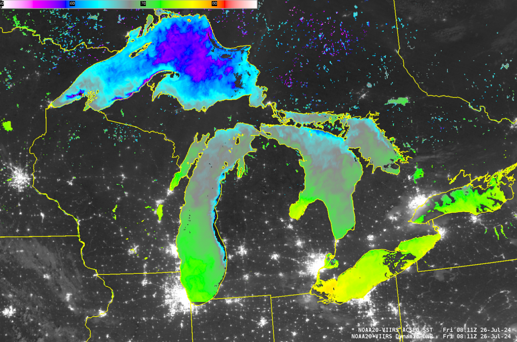
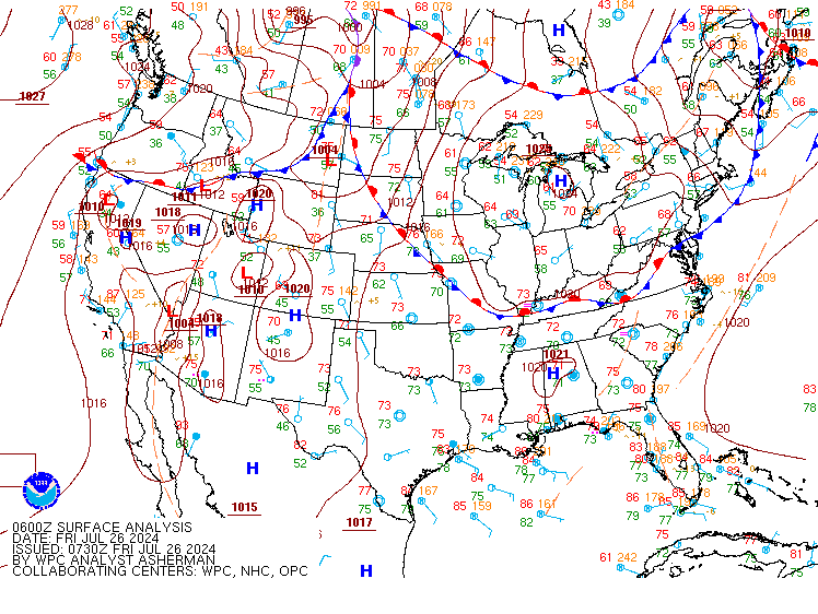
A clear night over the Great Lakes — associated with a large High Pressure System, shown below in the 0600 UTC Surface Analysis — allowed a high-resolution view of Lake Surface Temperatures. There are thin filaments of colder waters hugging different coastlines: the eastern shore of Lake Michigan, the western shore of the Upper Peninsula of Michigan, the southern shore of Manitoulin Island in northern Lake Huron. In these regions, off-shore winds are likely causing deeper (colder) sub-surface waters to upwell. The National Weather Service in Duluth noticed a similar event on 23 July (link to Twitter/X).
Do you think those surface temperatures are warmer than normal as a whole? The purple enhancement over Lake Superior shows temperatures cooler than 60oF. Michigan and Huron show temperatures around 70oF (green) except for Saginaw Bay, where it’s in the mid-70s. Western Lake Erie is 77-78 oF; Lake Ontario is around 75oF at its warmest point. GLERL maintains line plots of basin-wide averages: Superior, Michigan, Huron, Erie and Ontario. All five lakes are warmer on 25 July than the long-term average.


