Severe weather across the southern and central Plains

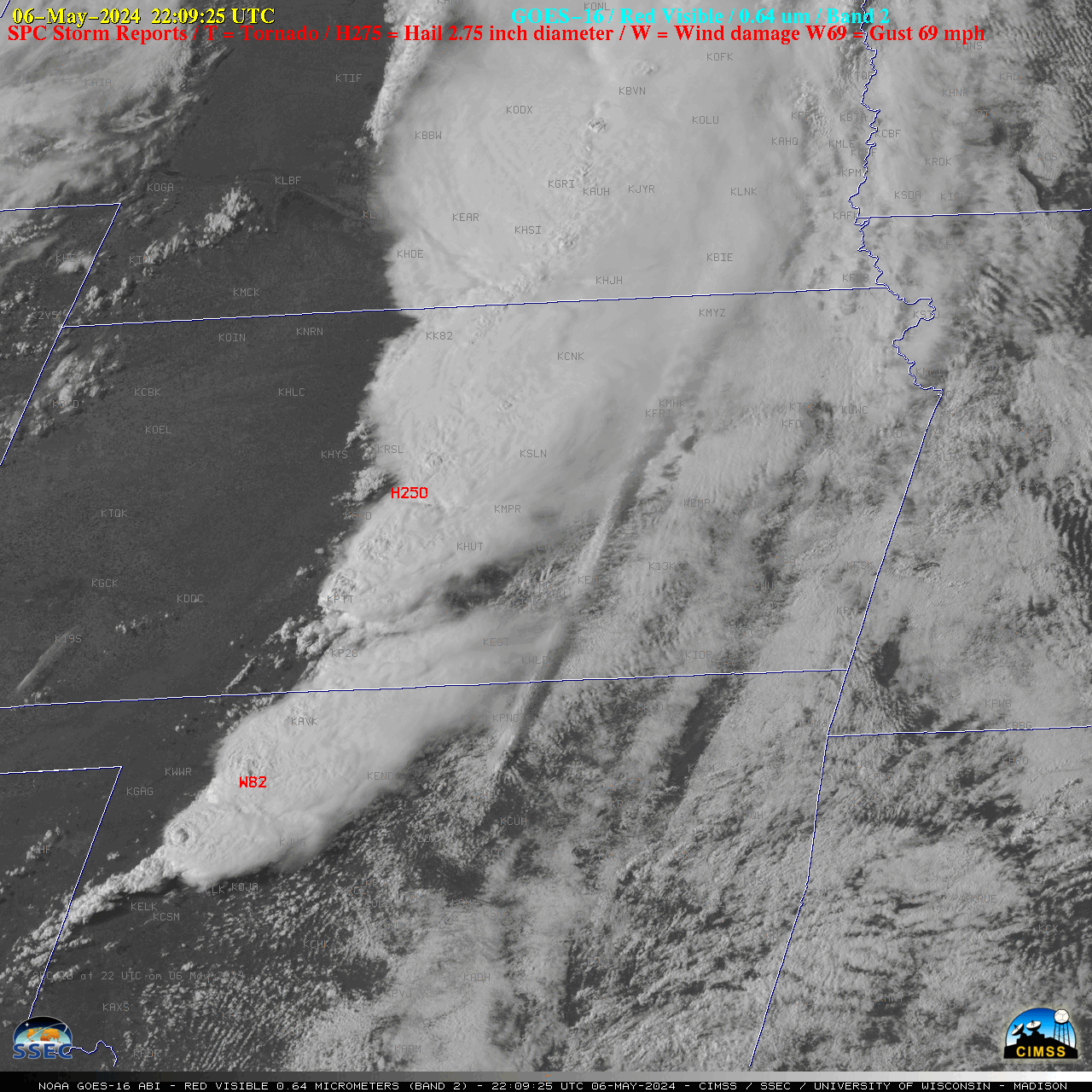
1-minute GOES-16 “Red” Visible (0.64 µm) images with time-matched SPC Storm Reports plotted in red [click to play animated GIF | MP4]
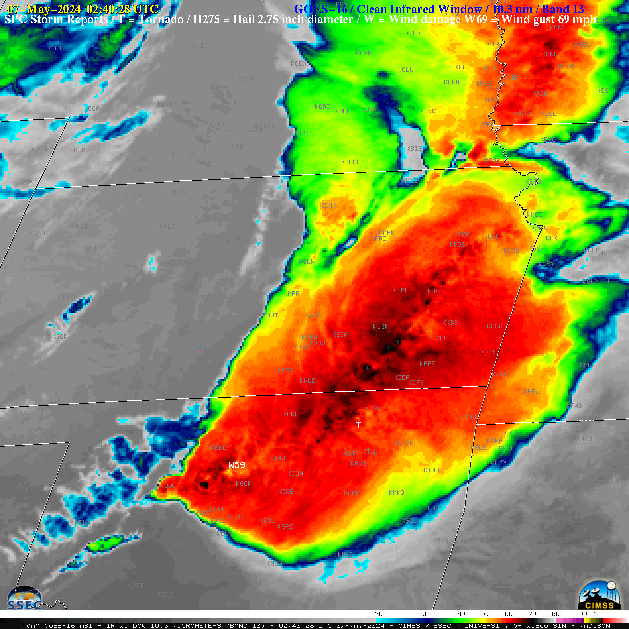
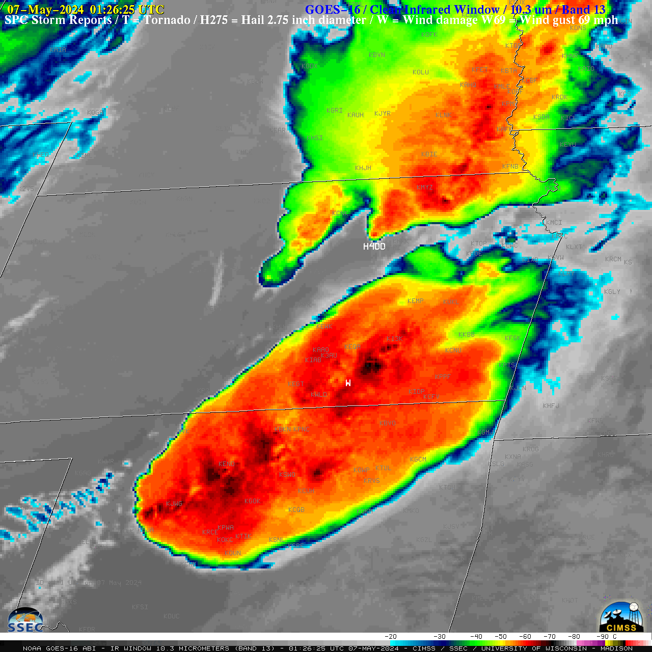
A longer animation of 1-minute GOES-16 “Clean” Infrared Window (10.3 µm) images (below) extended several hours past sunset. The coldest overshooting top infrared brightness temperatures were in the -70 to -75ºC range (darker black to embedded shades of white). These thunderstorms produced the deadly EF4-rated tornado in Barnsdall, Oklahoma around 0240 UTC, hail as large as 4.00″ in diameter near Moonlight, Kansas around 0126 UTC and a wind gust as high as 82 mph near Chester, Oklahoma around 2209 UTC.

1-minute GOES-16 “Clean” Infrared Window (10.3 µm) images with time-matched SPC Storm Reports plotted in white [click to play animated GIF | MP4]

5-minute GOES-16 Visible (and after 1911 UTC, Infrared) images, combined with GOES-16 CAPE, LI and TPW derived products [click to play animated GIF | MP4]