The Little Cloud that Could — until it couldn’t
Imagery from the CSPP Geosphere site, above (link to animation), shows a curiously static low cloud (click here to see mp4 of cloud heights) separating from clouds along the southern shore of Lake Michigan and subsequently moving north. For several hours the cloud persists, until it moves under cirrus streaming in from the west, at which point it dissipates rapidly. The reason for its persistence and dissipation is left as an exercise for the reader.
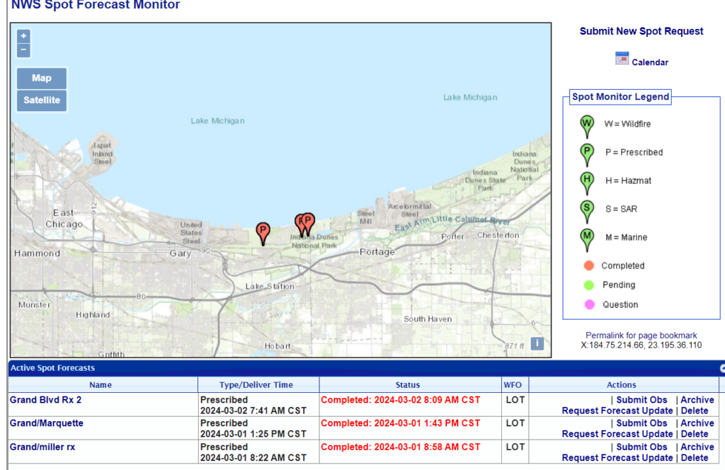
In the inbox, from a forecaster at WFO GRR: “…prescribed burns occurred on March 1st and 2nd in/near Indiana Dunes. At the end of the loop you can see the smoke plume from that area. Could that cloud feature have been something linked to the two burns the day prior?” The controlled burn locations are shown below. In addition to the smoke plume at the end of the animation above, there are several pixels — magenta — that could be hot spots at the start of the animation. (In reality, those pixels might also be industrial activity).


