Severe Weather in North Texas
The North Texas panhandle is experiencing severe weather on October 4, 2023. Animation 1 shows Radar reflectivity in tight areas of convection across the panhandle. The GOES Day Cloud Phase Distinction RGB shown in Animation 2 confirms convection, showing overshooting tops becoming wispy ice clouds (appearing orange in the RGB).
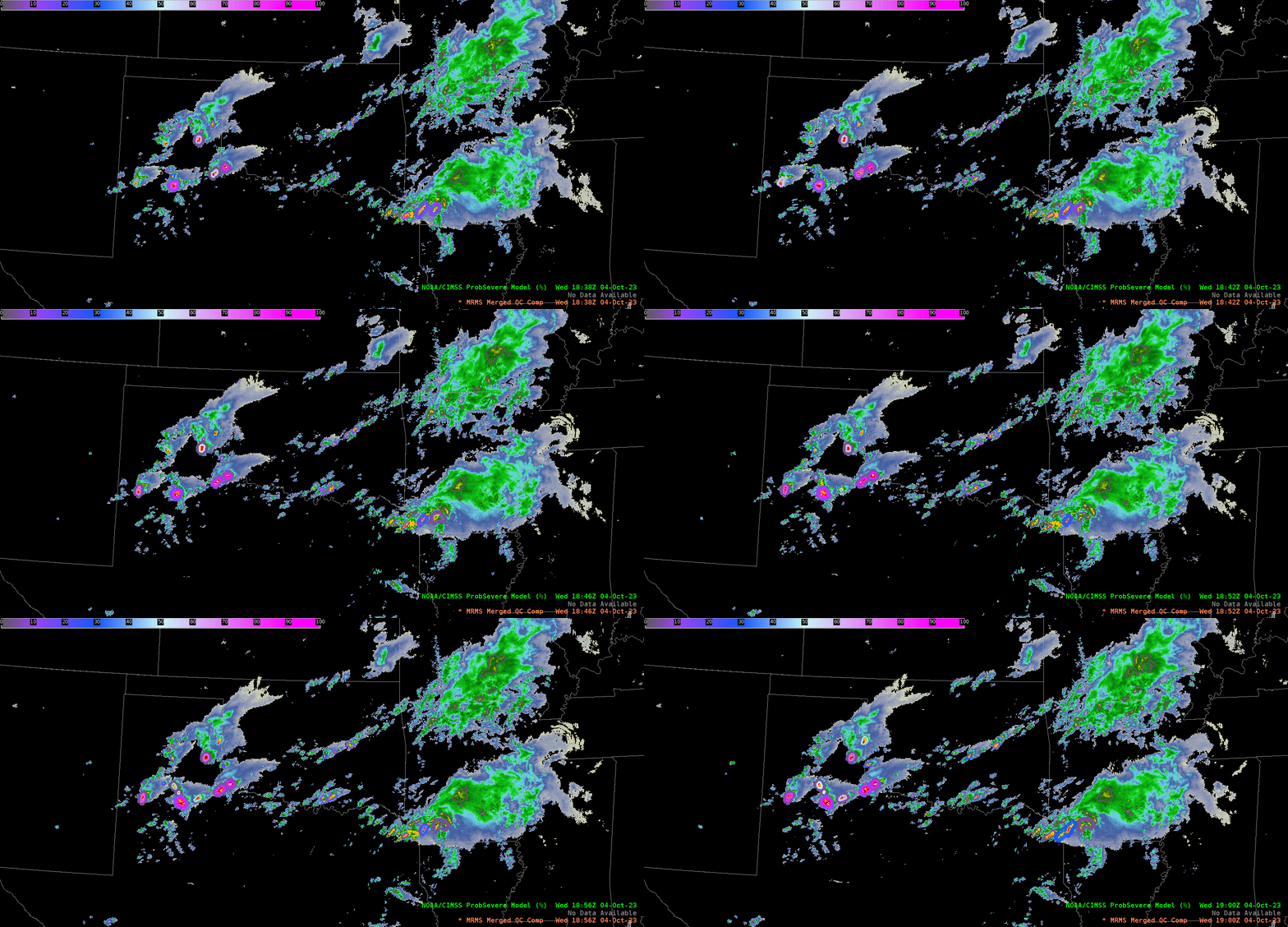
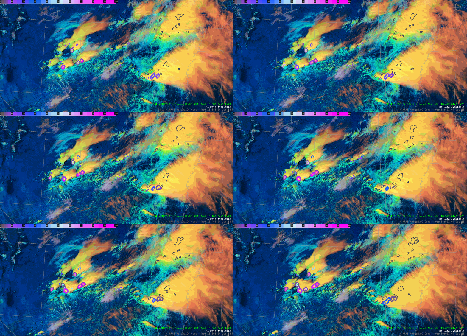
An enhanced risk of convection was predicted by the Storm Prediction Center for this exact area. More precise forecasts of weather severity can be assessed using the ProbSevere product. ProbSevere uses a combination of satellite data, ground-based data, and numerical weather models. It can be thought of as a probability of severe weather. Note how ProbSevere follows areas of high reflectivity.
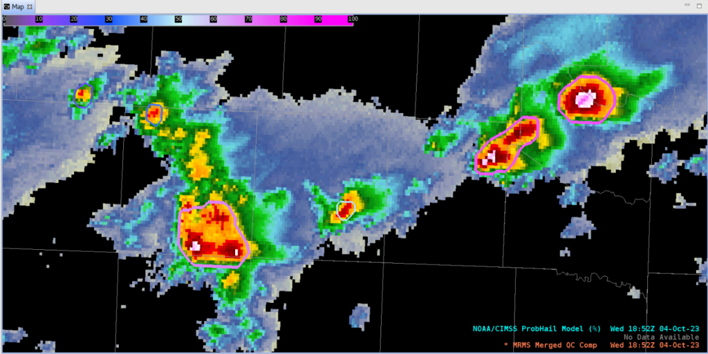
Part of ProbSevere includes ProbHail, which signifies the probability of hail. The figure above overlays ProbHail with Radar Reflectivity. Focus on the bright region to the far right, near the border of Hardeman and Jackson counties. This area has a hail probability equal to 77% and corresponds with reflectivity values near 64 dBZ. With reflectivity values that high, hail is a definite likelihood.
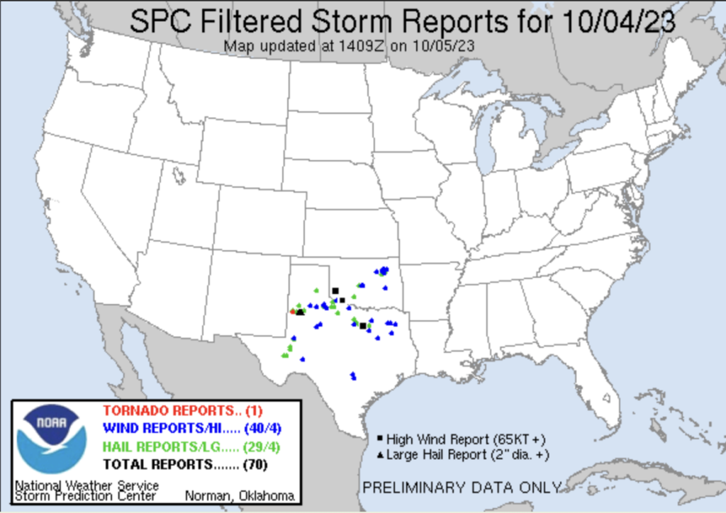
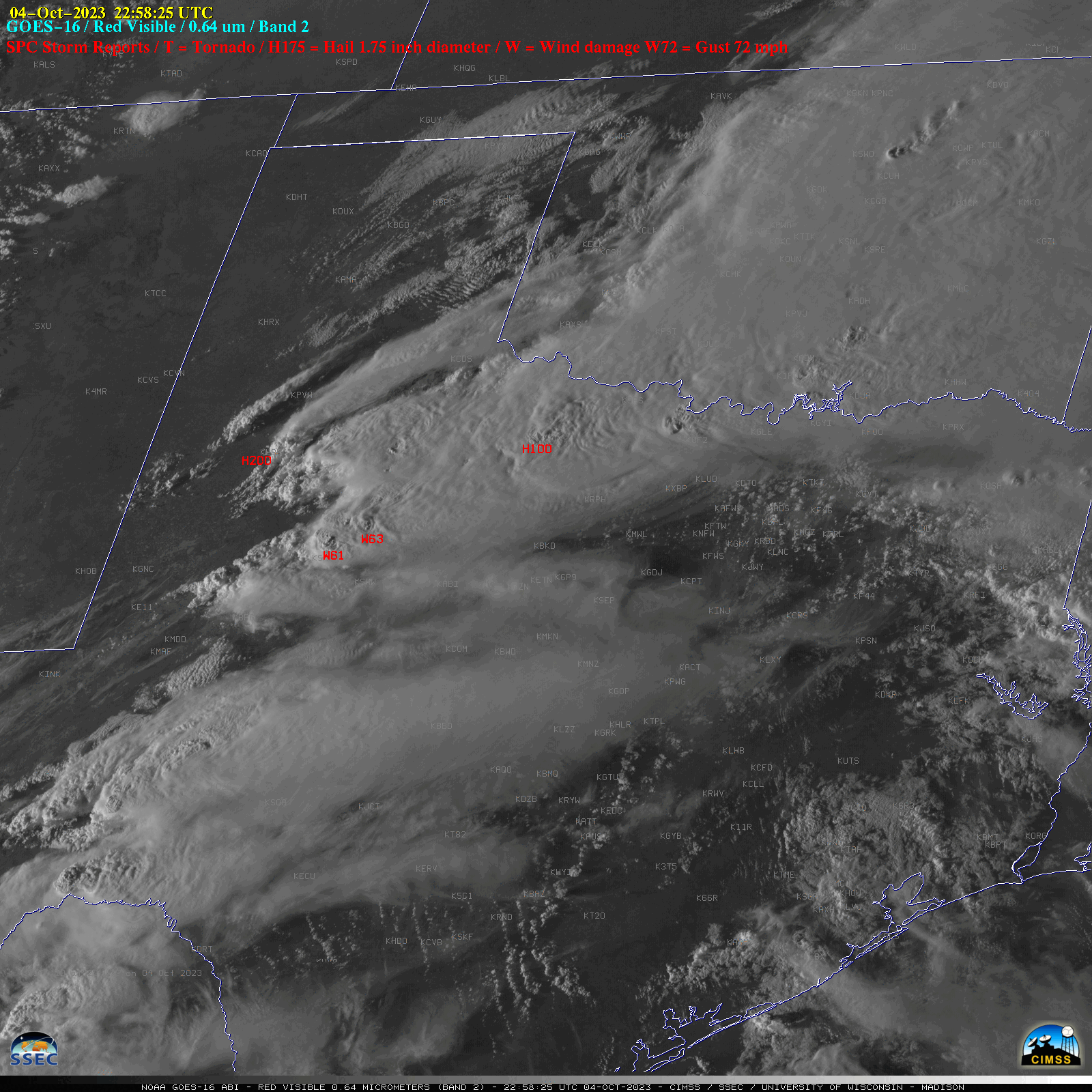
GOES-16 “Red” Visible (0.64 µm) images, with time-matched SPC Storm Reports plotted in red (courtesy Scott Bachmeier, CIMSS) [click to play animated GIF | MP4]
1-minute Mesoscale Domain Sector GOES-16 (GOES-East) “Red” Visible (0.64 µm) images (above) included time-matched (+/- 3 minutes) plots of SPC Storm Reports associated with the severe thunderstorms that moved eastward across parts of Oklahoma and Texas on 04 October 2023.

