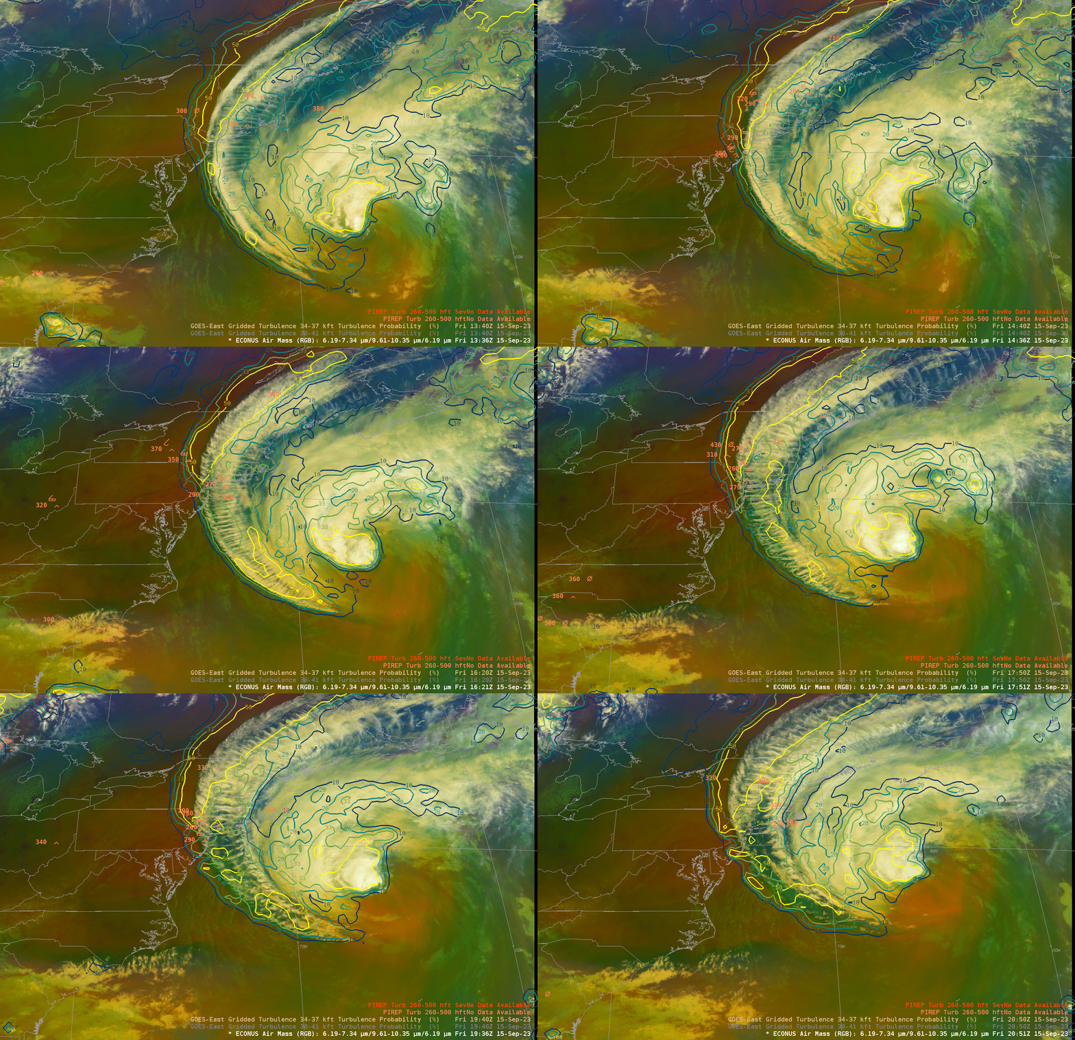
Turbulence over New England caused by Lee

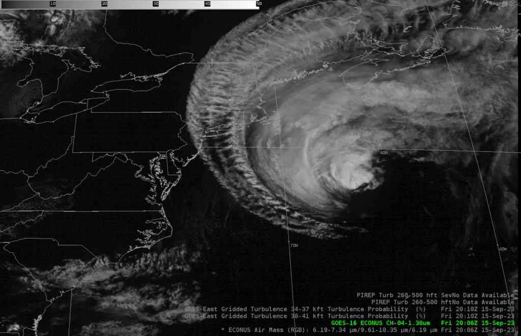
Hurricane Lee, moving northward off the east coast of the United States, is generating a large cirrus shield (see the ABI Band 4 image below) at high levels over New England, as also shown in the Air mass RGB shown above. The corrugated features in the cirrus are well-known predictors of aircraft turbulence, and pilot reports of observations are common within the field of cirrus (as shown in these blog posts). Additionally, the CIMSS Turbulence product, a prediction developed using Machine Learning and ABI Channels 8 (Upper-level water vapor, 6.19 µm) and 13 (Clean window infrared, 10.3 µm), along with GFS thermondynamic fields, shows a high probability of turbulence in the region where turbulence is observed. CIMSS turbulence probability fields are also available online here. A training recording (mp4) on the product is here.

For the latest on Hurricane Lee, refer to the National Hurricane Center (USA, Canada). Information is also available at the NWS Forecast Offices in Boston, Portland (Gray Maine), and Caribou.
Many thanks to Professor Rick DiMaio at Lewis University for focusing our attention on this event!

