Tornado in Racine County, Wisconsin
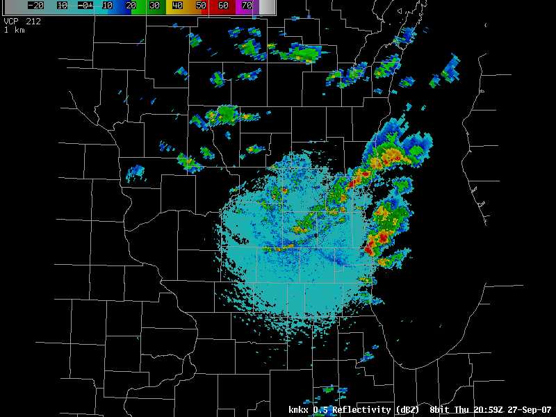
A weak tornado occurred Thursday 27 September in Racine County of southeast Wisconsin. (North Cape Wisconsin, the site of the brief EF-0 touchdown, is in north-central Racine County). The tornado occurred about 15 minutes before the radar image below; the cell that produced the tornado is moving offshore into Lake Michigan at the time of the radar image.
The weather in Wisconsin on Thursday, 27 September was initially dominated by descent in the wake of a departing cold front. Generally clear skies were the rule for most of the morning. However, solar heating combined with cooling at 500 mb and an approaching mid-level shortwave helped cause the development of isolated thunderstorms.
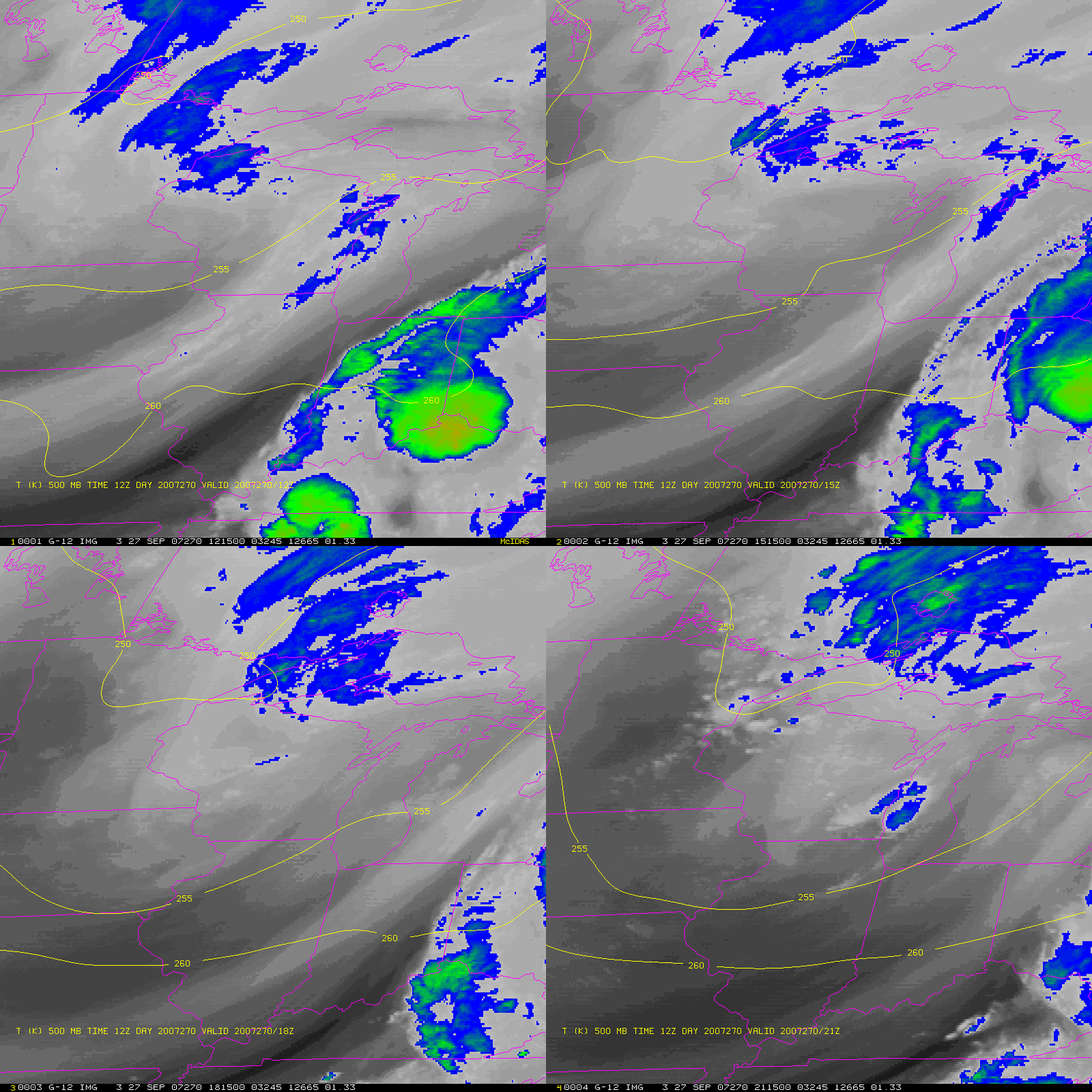
The loop above shows the quick eastward progression of the cold front that started the day (at 1200 GMT) in eastern Wisconsin — the front propagates rapidly through lower Michigan. At the same time, 500-mb temperatures (as depicted by the RUC forecast from 1200 GMT, above) steadily fall as a short wave (depicted by colder brightness temperatures in the water vapor imagery) moves eastward across Wisconsin.
The cooling temperatures and approaching shortwave were discussed in the convective outlook issued by the Storm Prediction Center in Norman, OK at 1200 GMT on Thursday 27 September:
…MN/WI…
WATER VAPOR IMAGERY SHOWS STRONG SHORTWAVE TROUGH DIGGING
SOUTHEASTWARD ACROSS ND. THIS FEATURE WILL MOVE INTO WESTERN MN BY
THIS EVENING…AND LIKELY RESULT IN ONE OR MORE CLUSTERS OF
THUNDERSTORMS TRACKING EASTWARD INTO WI. COLD TEMPERATURES ALOFT
/500MB TEMPS AOB -20C/ AND STEEP MID LEVEL LAPSE RATES ARE FORECAST
OVER THIS AREA…RESULTING IN MARGINAL INSTABILITY DESPITE LIMITED
LOW LEVEL MOISTURE. THERMODYNAMIC PARAMETERS APPEAR FAVORABLE FOR A
RISK OF HAIL IN STRONGER CELLS THIS AFTERNOON AND EVENING.
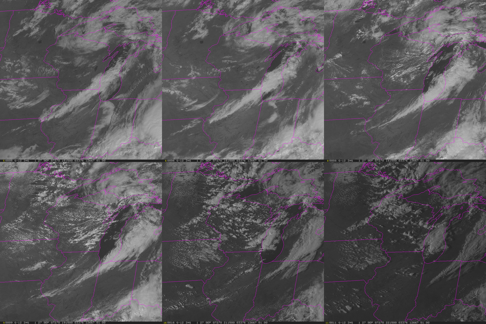
The visible loop (below) shows the development of vigorous convection in the destabilizing atmosphere over the course of the afternoon. In fact, structures in the convection at the end of the loop suggest convective towers overshooting the tropopause. The coldest brightness temperatures associated with the deep convection were around 234 K; the 00 UTC sounding from Green Bay Wisconsin suggests those temperatures occurred around 350 mb. Lightning in this tornadic storm was uncommon; although other parts of the convective line showed more electrical activity. Dewpoint temperatures before the thunderstorms moved through were in the low 50s, adequate to support tornadoes, but not ideal.
One additional note: Sounder DPI products nicely captured the development of the instability over Wisconsin. This image, from 2046UTC, shows lifted indices in the -4 to -8 range.
Finally, the image below is from GOES-West, and it shows the updraft of the tornadic storm merging with a spreading cirrus shield aloft. The outlines of Racine County are included on the satellite image.


