Severe weather (and record low pressure) across the Tennessee/Ohio Valley

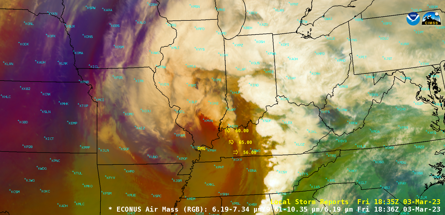
GOES-16 Air Mass RGB images, with and without plots of time-matched Local Storm Reports [click to play animated GIF | MP4]
GOES-16 (GOES-East) Air Mass RGB images (above) include plots of time-matched Local Storm Reports — which showed some of the impacts of a deep low pressure system (surface analyses) that moved northeastward across the Tennessee and Ohio Valley on 03 March 2023.
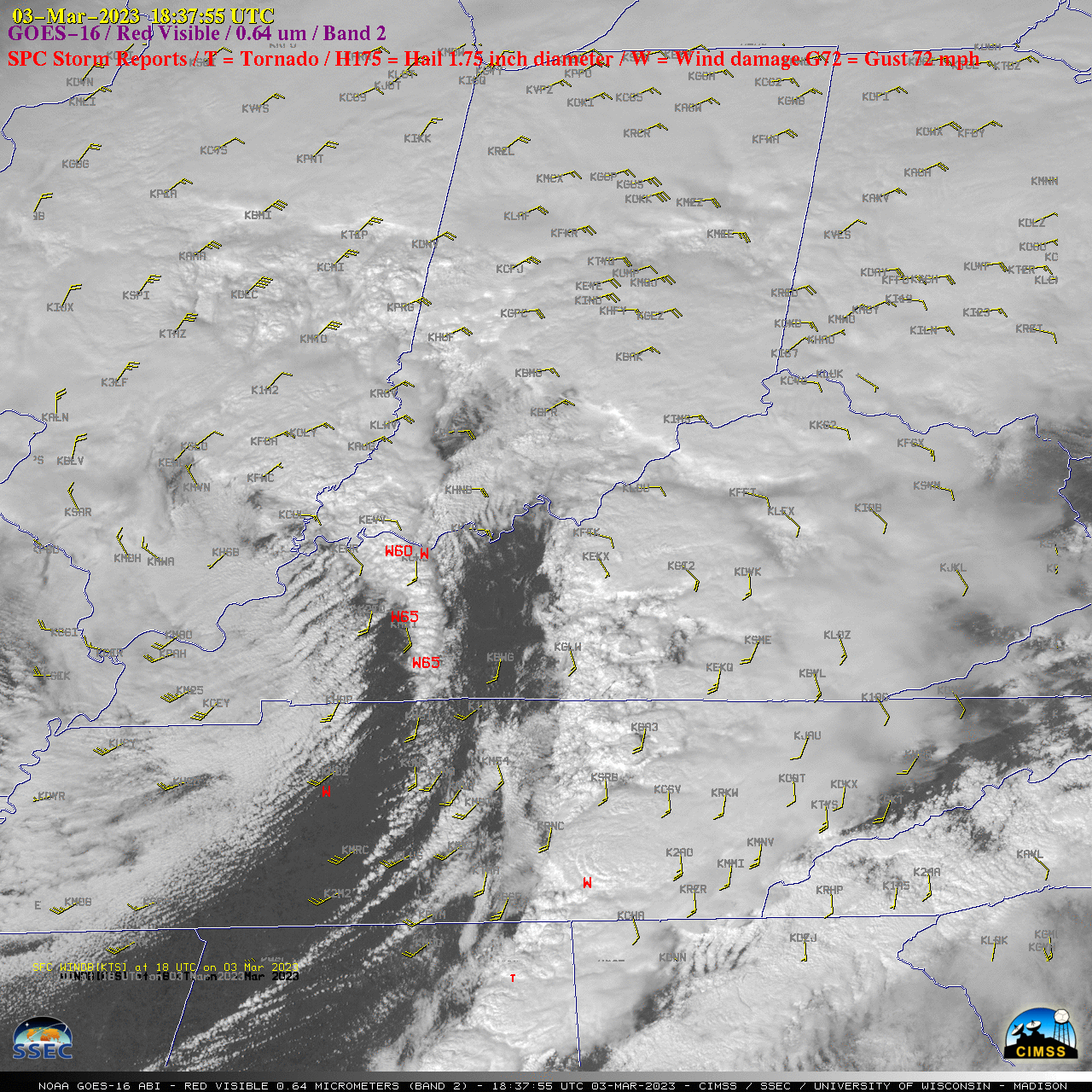
A Mesoscale Domain Sector was positioned over part of that area — and 1-minute GOES-16 “Red” Visible (0.64 µm) images (below) included time-matched (+/- 3 minutes) plots of SPC Storm Reports. Tornadoes, wind gusts to 77 mph and hail of 1.00 inch diameter were reported.

GOES-16 “Red” Visible (0.64 µm) images, with time-matched SPC Storm Reports plotted in red [click to play animated GIF | MP4]
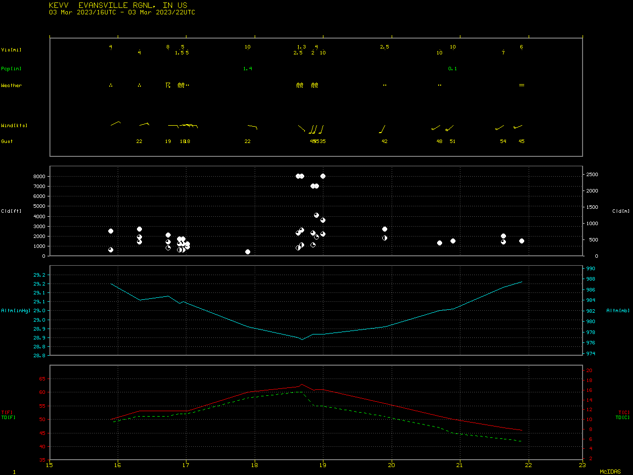
This storm also set new all-time record low pressures at a few locations.
The lowest pressure record (977.5 hPa) was set at Evansville, Indiana — a plot of their weather conditions is shown below.


