Hurricane Force low in the North Atlantic Ocean

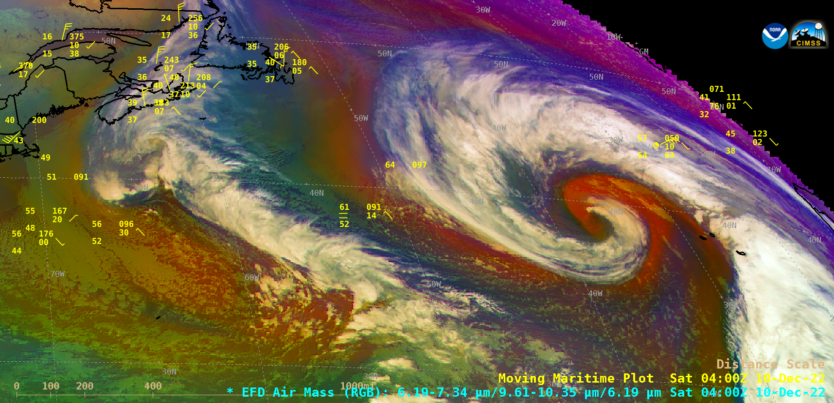
GOES-16 Air Mass RGB images, with ship reports plotted in yellow [click to play animated GIF | MP4]
GOES-16 (GOES-East) Air Mass RGB images (above) showed the signature of dry air (brighter shades of orange-red, which also indicate the presence of a lower tropopause with higher levels of stratospheric ozone within the atmospheric column) wrapping into the circulation of an anomalously-deep Hurricane Force low pressure system — which had recently rapidly intensified over the North Atlantic Ocean — during the 09 December – 10 December 2022 period (surface analyses).
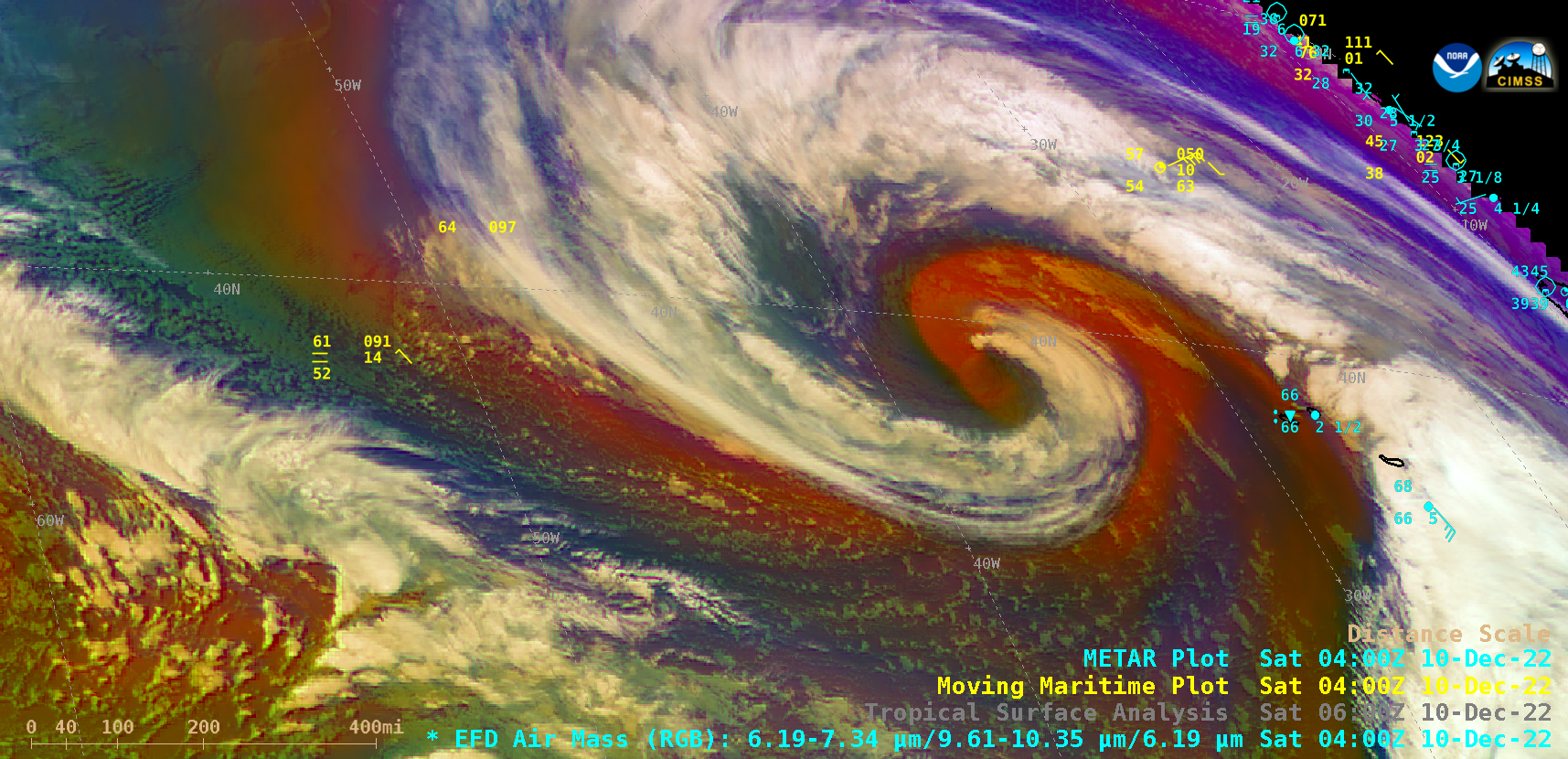
A closer view of GOES-16 Air Mass RGB images (below) includes plots of land-based surface reports — and as the system slowly weakened to a Storm Force low about 200 miles NW of the Azores at 12 UTC on 10 December, a wind gust to 55 knots (63 mph) was recorded at Flores Airport in the far NW part of that island chain (RGB image | plot of surface data).

GOES-16 Air Mass RGB images, with ship reports plotted in yellow and land-based surface reports plotted in cyan [click to play animated GIF | MP4]
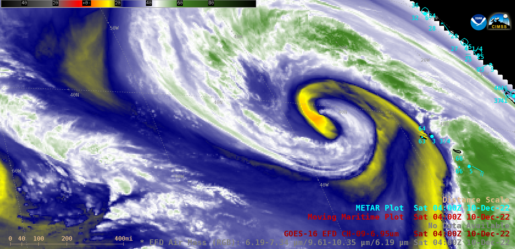
GOES-16 Mid-level Water Vapor (6.9 µm) images (below) exhibited a similarly-striking appearance, with the ribbon of dry air wrapping into the center of the storm’s circulation having 6.9 µm infrared brightness temperatures as warm as +4 to +5ºC (darker shades of orange).

GOES-16 Mid-level Water Vapor (6.9 µm) images, with ship reports plotted in yellow and land-based surface reports plotted in cyan [click to play animated GIF | MP4]

