Lake effect cloud plume in northeastern Montana

GOES-16 Nighttime Microphysics RGB and Day Snow-Fog RGB images, with surface observations plotted in yellow and highways plotted in violet; Fort Peck Lake is outlined in blue [click to play animated GIF | MP4]
During the hours leading up to sunrise, GOES-16 Nighttime Microphysics RGB images with an overlay of the GOES-16 Cloud Top Phase derived product (below) indicated that the majority of this lake effect fog/stratus plume had tops consisting of supercooled water droplets.

GOES-16 Nighttime Microphysics RGB images, with an overlay of the GOES-16 Cloud Top Phase derived product [click to play animated GIF | MP4]
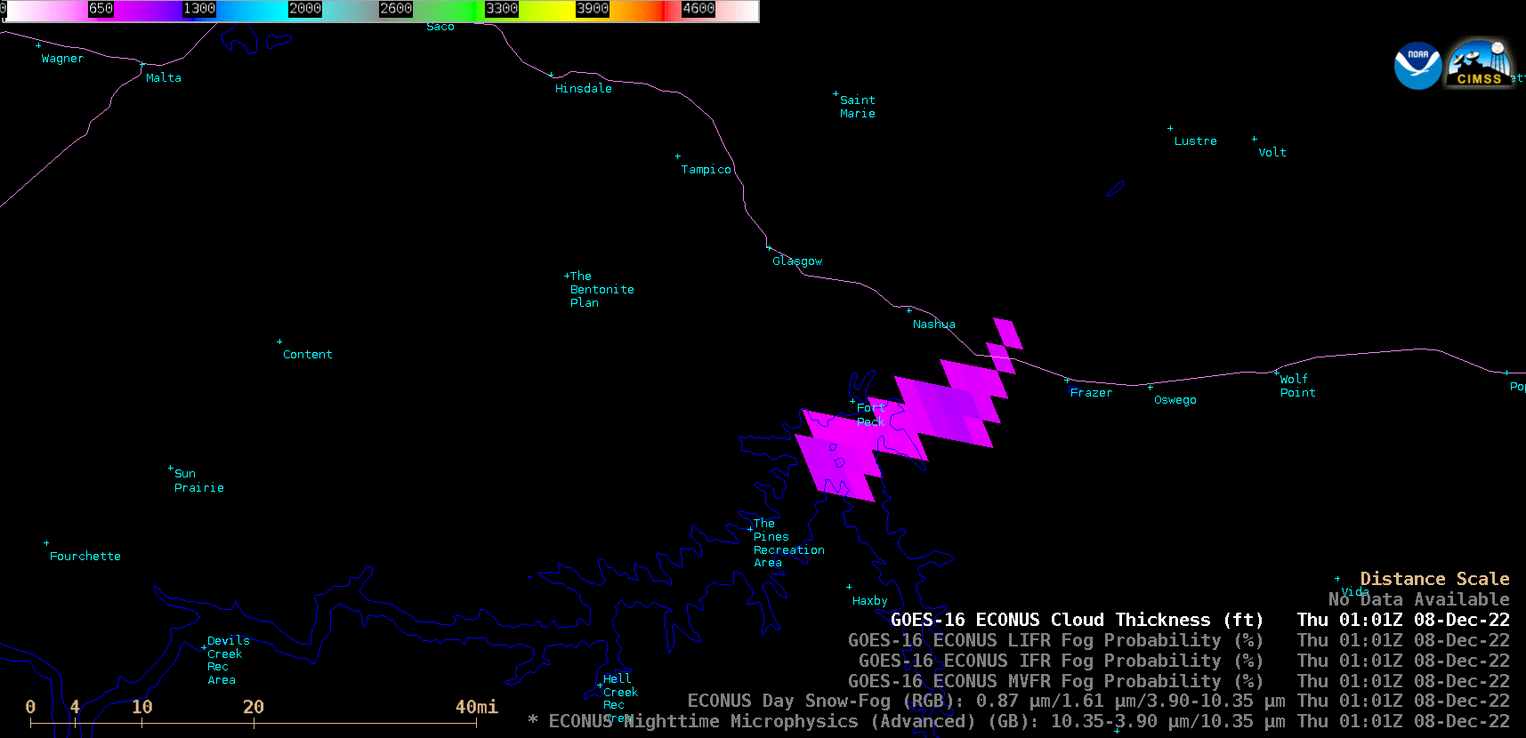
GOES-16 Cloud Thickness product [click to play animated GIF | MP4]
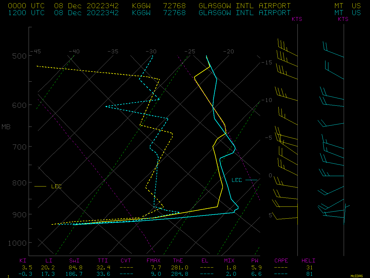
Plots of lower-tropospheric rawinsonde data from Glasgow, Montana at 0000 UTC (yellow) and 1200 UTC (cyan) [click to enlarge]
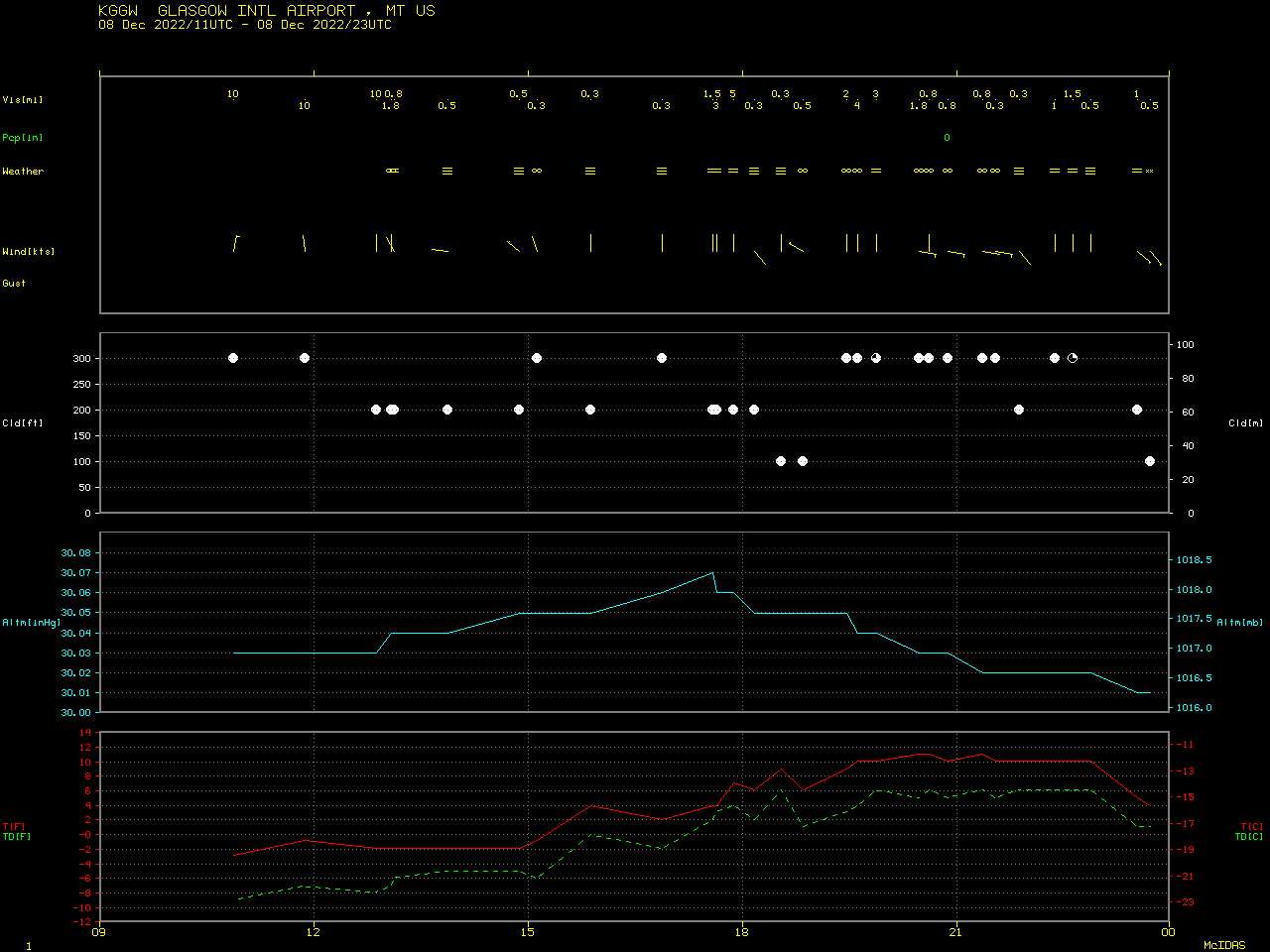
Plot of surface observation data from Glasgow, Montana [click to enlarge]