Snowfall across parts of Texas and New Mexico
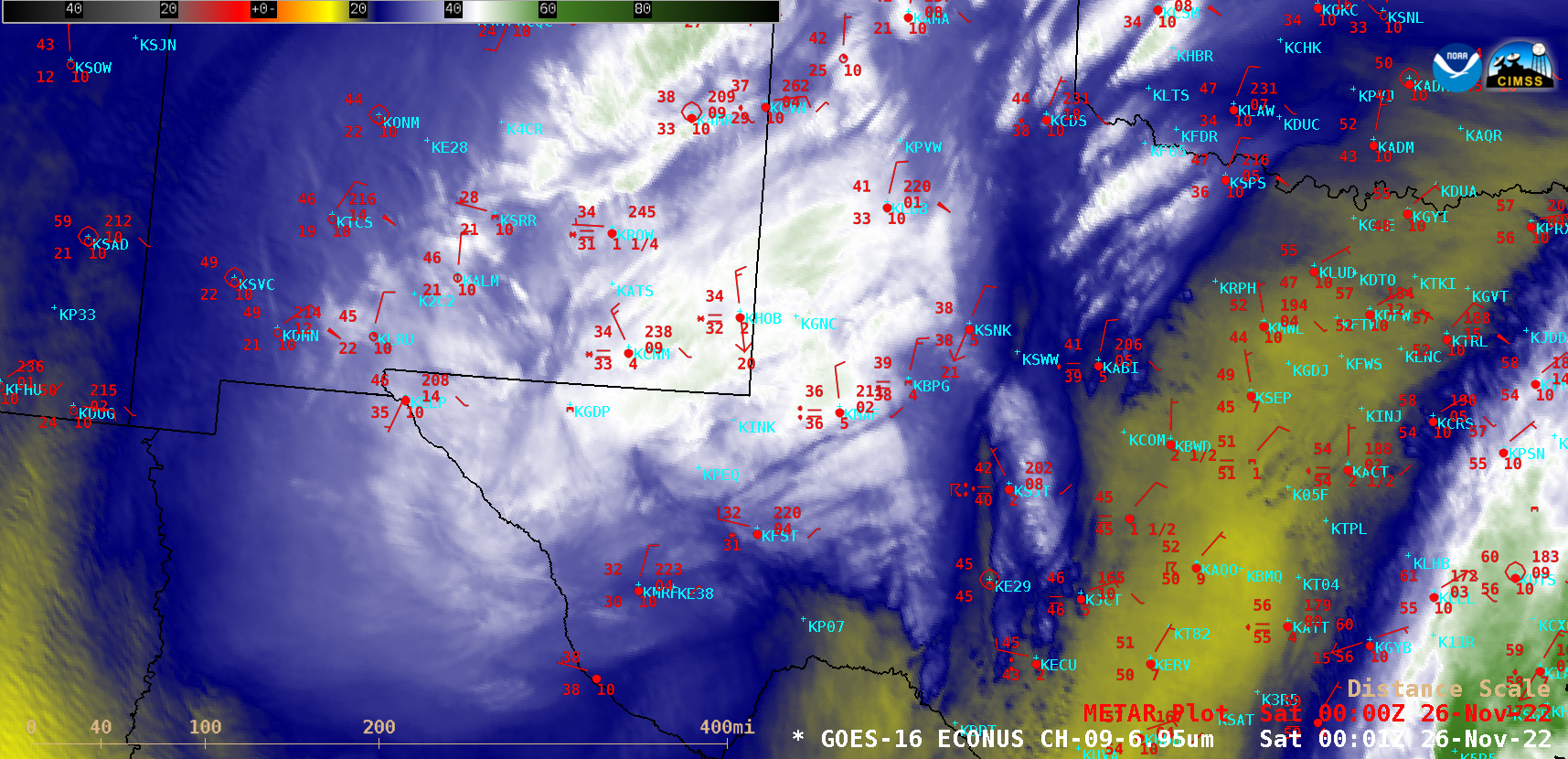
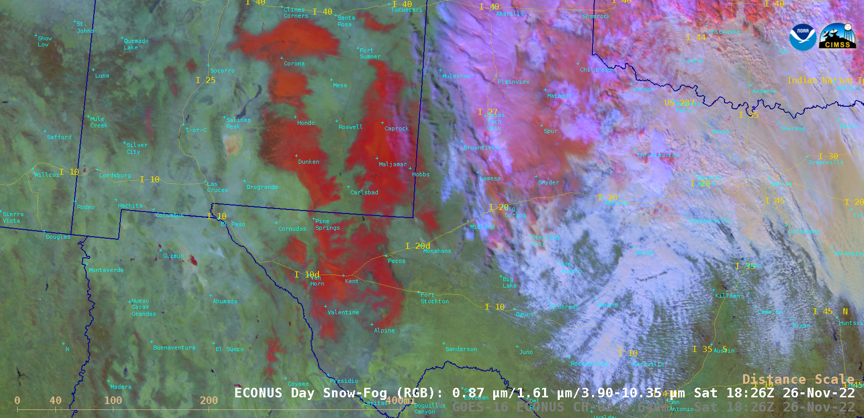
GOES-16 (GOES-East) Mid-level Water Vapor (6.9 µm) images (above) showed the circulation associated with an anomalously-deep middle tropospheric cutoff low as it moved from northern Mexico across Texas during the 1301 UTC on 25 November to 2101 UTC on 26 November 2022 time period. Elevated convective elements rotating within the cutoff low helped to enhance precipitation rates in portions of western Texas and eastern New Mexico — with accumulating snowfall occurring at many locations.As the system moved off to the east during the day on 26 November, GOES-16 “Red” Visible (0.64 µm) and Day Snow-Fog RGB images (below) revealed the extent of snow cover (darker shades of red in the RGB imagery) across parts of southeastern New Mexico and southwestern Texas.
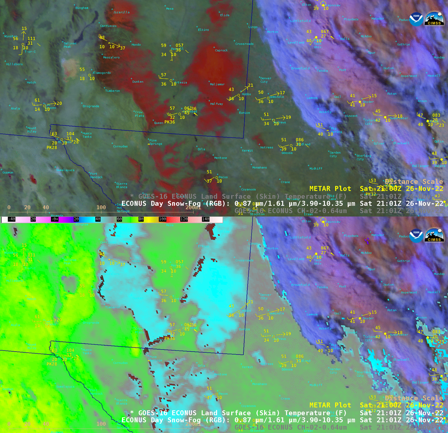
In a toggle between GOES-16 Day Snow-Fog RGB and Land Surface Temperature (LST) derived product images at 2101 UTC (below), LST values over the deepest snow cover just west of the New Mexico / Texas border were as cold as the mid 30s F (compared to 50s and 60s F over bare ground just to the east and west of that snow cover). 12 UTC snow depth reports within that patch of snow cover were 4-5 inches.