Parallax shifts in VIIRS views of Fiona

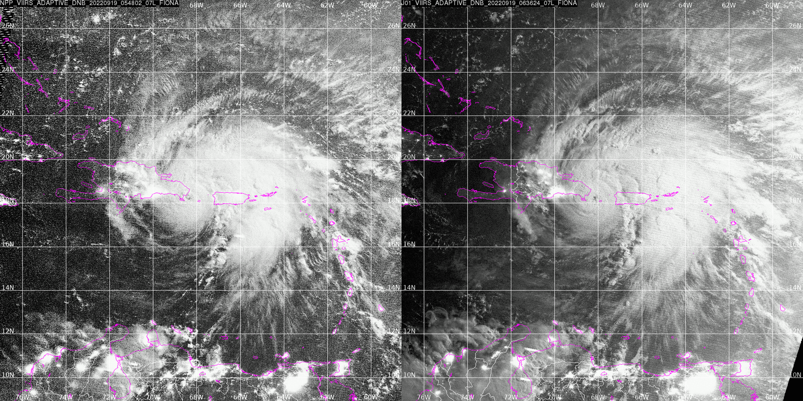
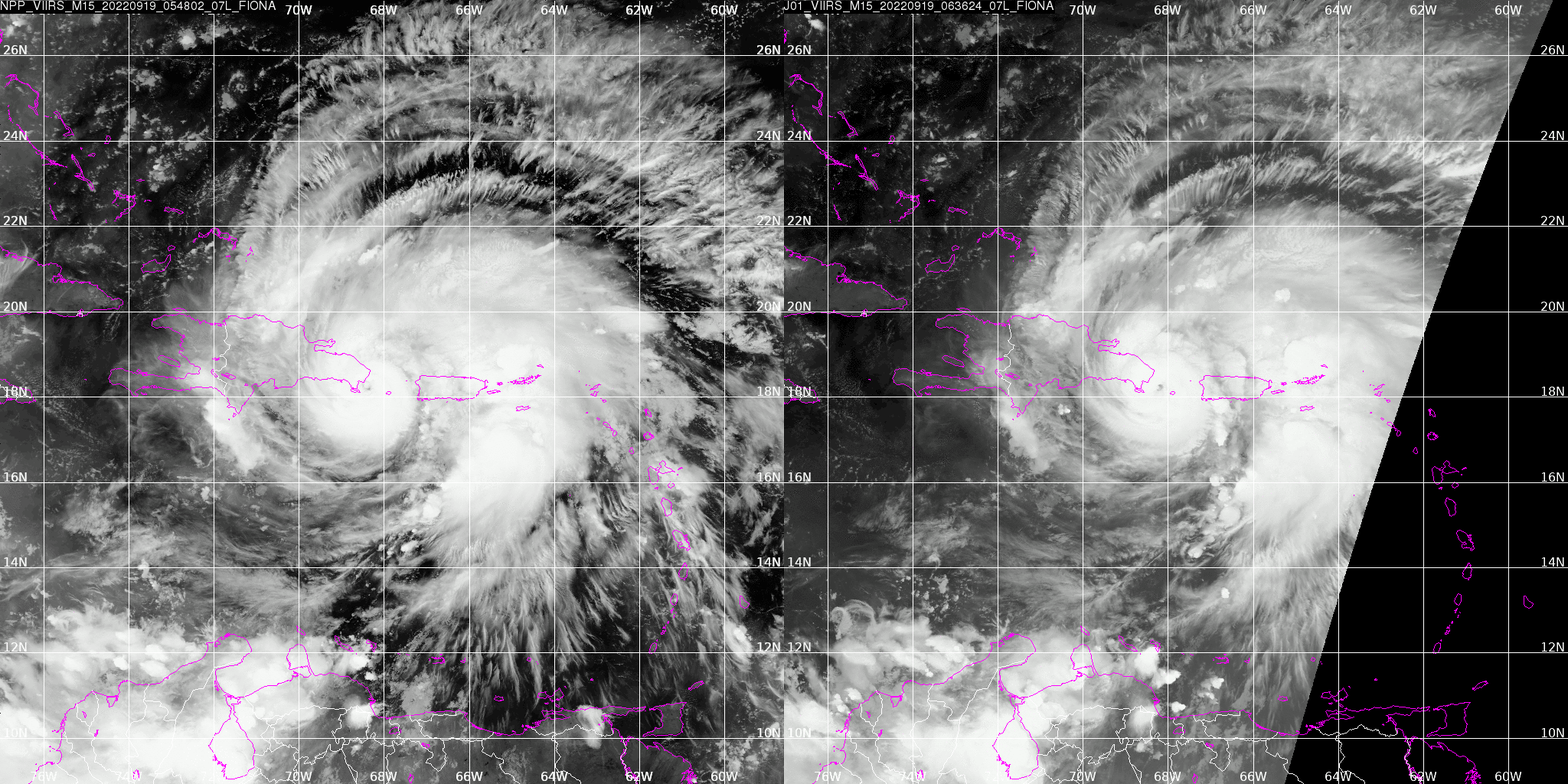
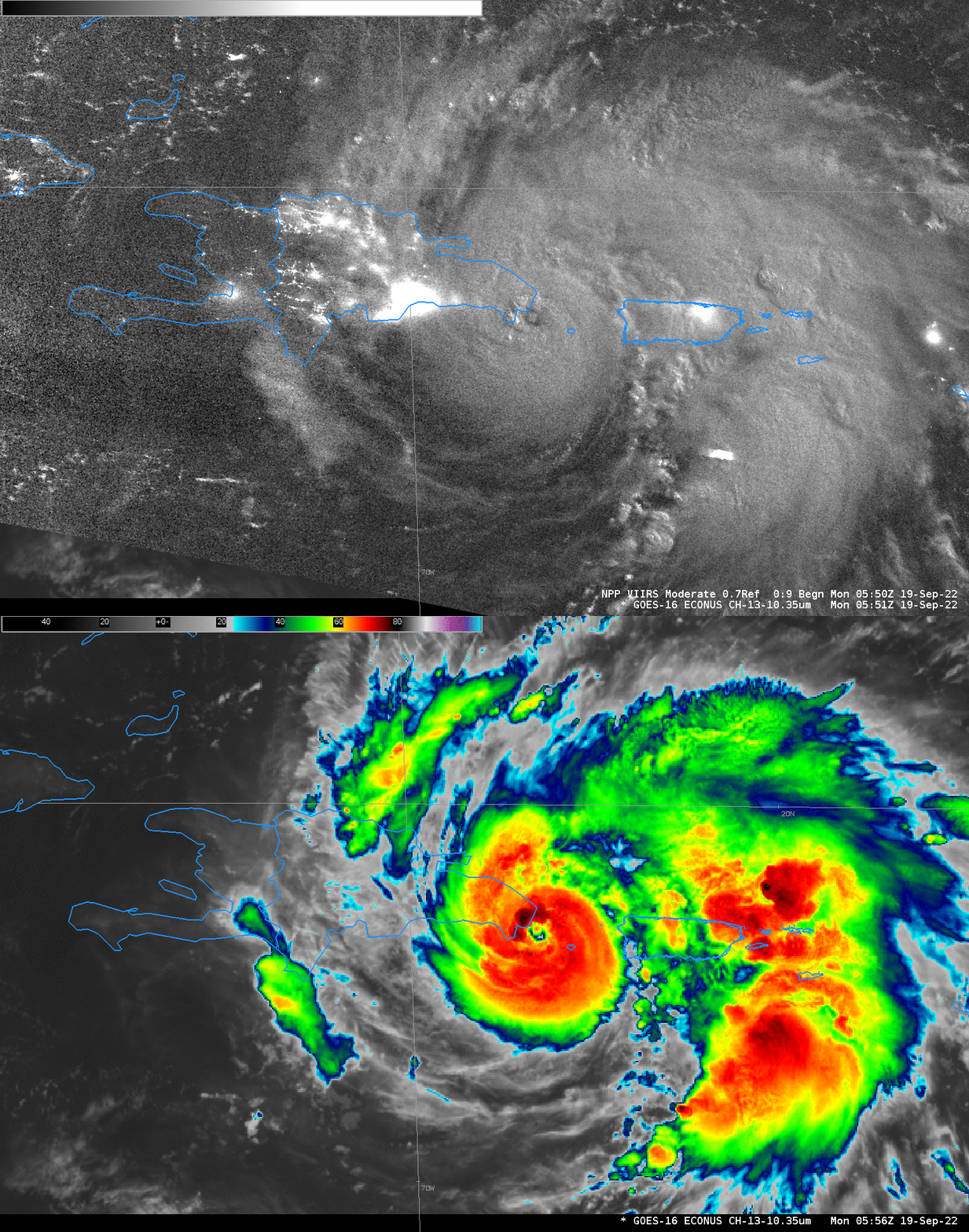
Suomi NPP and NOAA-20 both overflew Hurricane Fiona (NPP flew overhead to the east, NOAA-20 flew overhead to the west) in the early morning of 19 September 2022, as shown above in imagery created at AOML (The Atlantic Oceanagraphic and Meteorological Laboratory) and displayed at the Direct Broadcast site there. The images appear to show an eastward motion of the eye — but GOES-16 animations, below, show a persistent west-northwest motion (landfall occurred in the Dominican Republic around 0730 UTC).

The apparent eastward motion of the eye also shows up in the infrared imagey, which rules out artifacts related to shadowing.


This might be an example of a Parallax shift in VIIRS imagery causing a shift in a feature. NOAA-20’s nadir was over Jamaica, considerably to the east of the Mona Passage where Fiona’s eye was developing. A parallax error may be responsible, because satellite navigation will place the tall clouds farther from the sub-satellite point than observed.
The full-resolution Day Night band imagery from Suomi NPP, and from NOAA-20 (both available from the CIMSS ftp site here and here) show strong convection starting ca. 0530 UTC and continuing through ~0630 UTC near the eye.

