5.1 micrometers and IASI
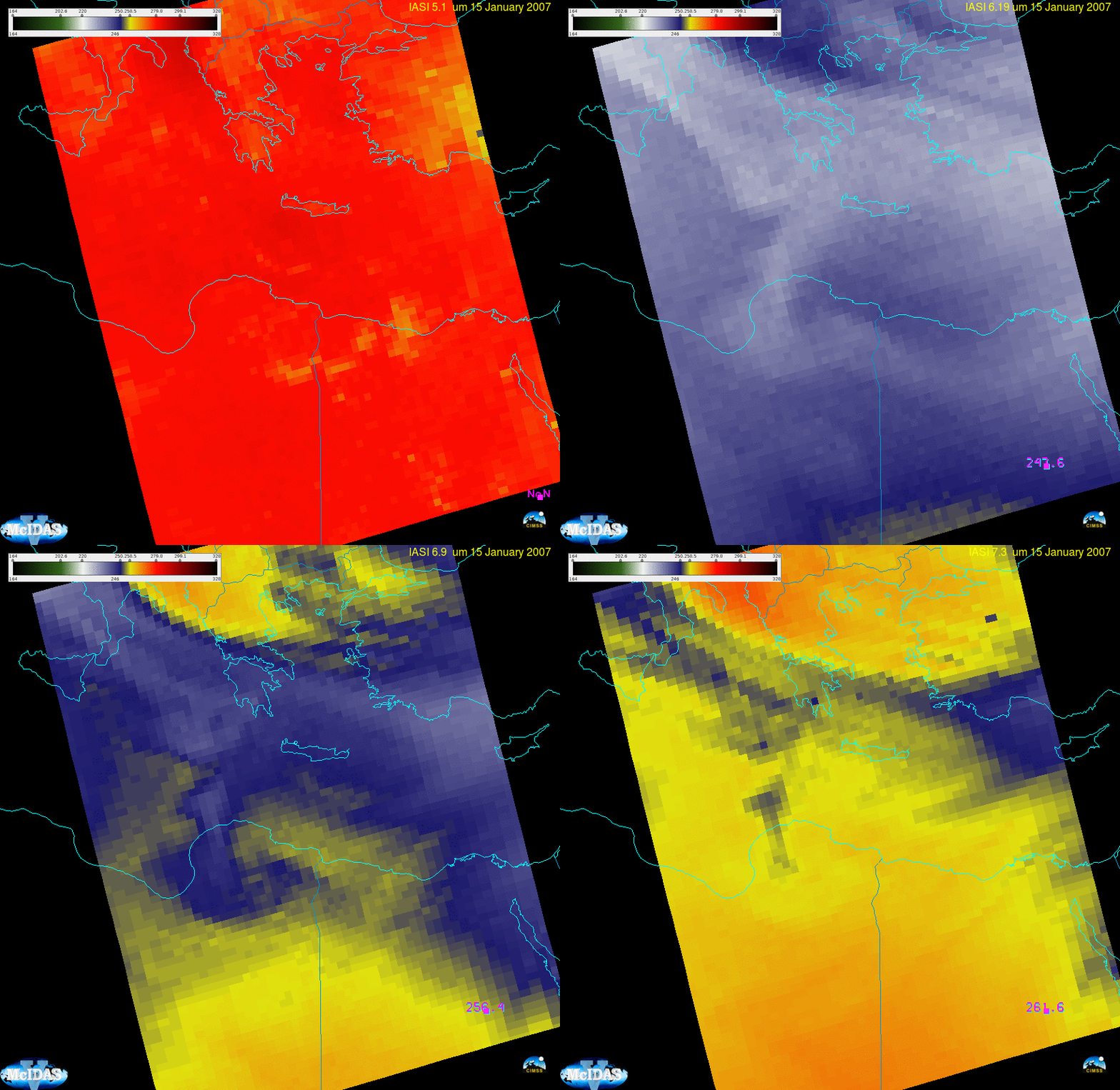
A previous post discussed the 5.1 micrometer channel that might be part of the imager (GXI) to fly on GeoXO, the next-generation satellite (beyond GOES-R) to be launched in the 2030s. That previous post, however, used Cross-track Infrared Sounder (CrIS) data, and CrIS observes close to, but not at, 5.1 micrometers. However, the Infrared Atmospheric Sounding Interferometer (IASI) that is part of the payload on Metop-B and Metop-C (it was on Metop-A as well!) does take observations at 5.1 micrometers. The animation shows a Metop-A IASI observations at 5.1, 6.19, 6.9 and 7.3 micrometers (or wavenumbers 1950, 1615, 1438 and 1369) from a granule over Europe. Of note is apparent moisture aloft — shown as cooler brightness temperatures especially at 6.9 micrometers — that has no apparent signal at 5.1 micrometers because of less sensitivity to mid-tropospheric water vapor at the shorter wavelength. Indeed, 5.1 micrometer brightness temperatures are much warmer than the other channels.

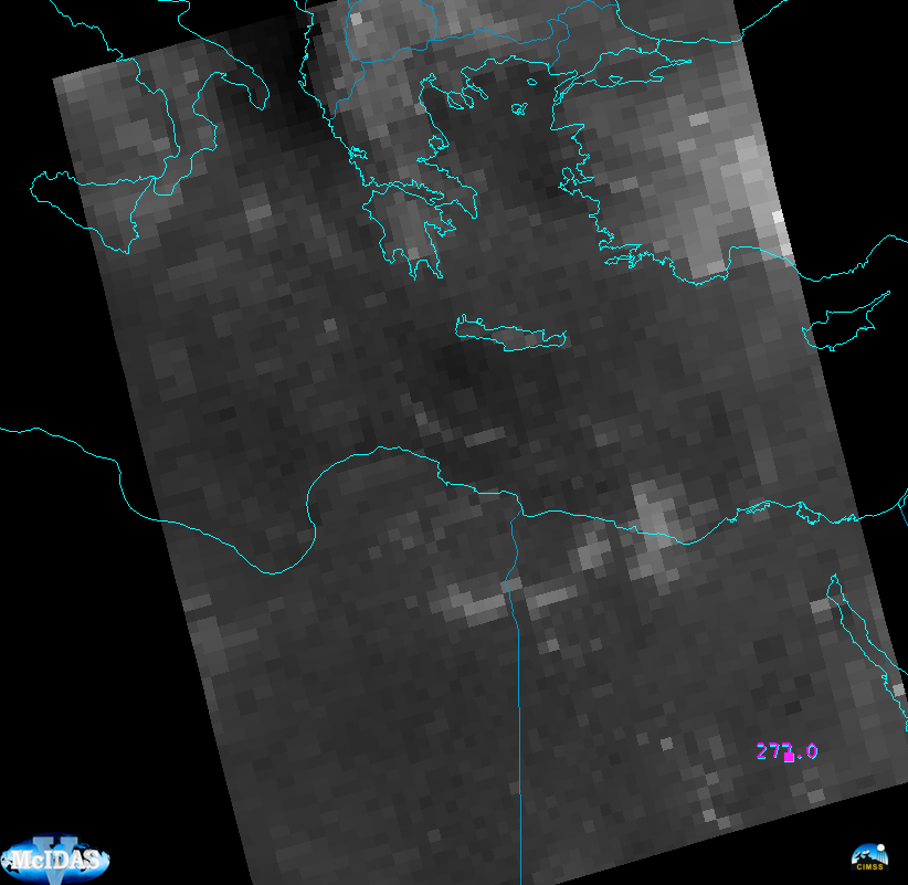
A greyscaled image of 5.1 micrometers, below, shows how the boundary layer influences the signal in clear air.

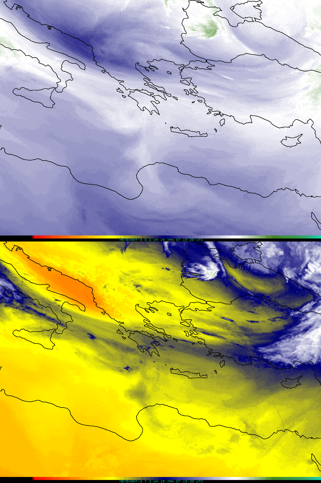
What did geostationary imagery look like on this day? Meteosat-8 imagery at 6.19 and 7.3 micrometers is shown below.

How dry was this airmass over the Mediterranean? Soundings from 0000 and 1200 UTC on 15 January 2007 (link, from the Wyoming Sounding site) show total precipitable water values between 10 and 14 mm.
The addition of the 5.1 micrometer channel is designed to aid in convective forecasting: gradients in water vapor very low in the atmosphere should be apparent.

