ACSPO Temperatures from VIIRS and GOES-R

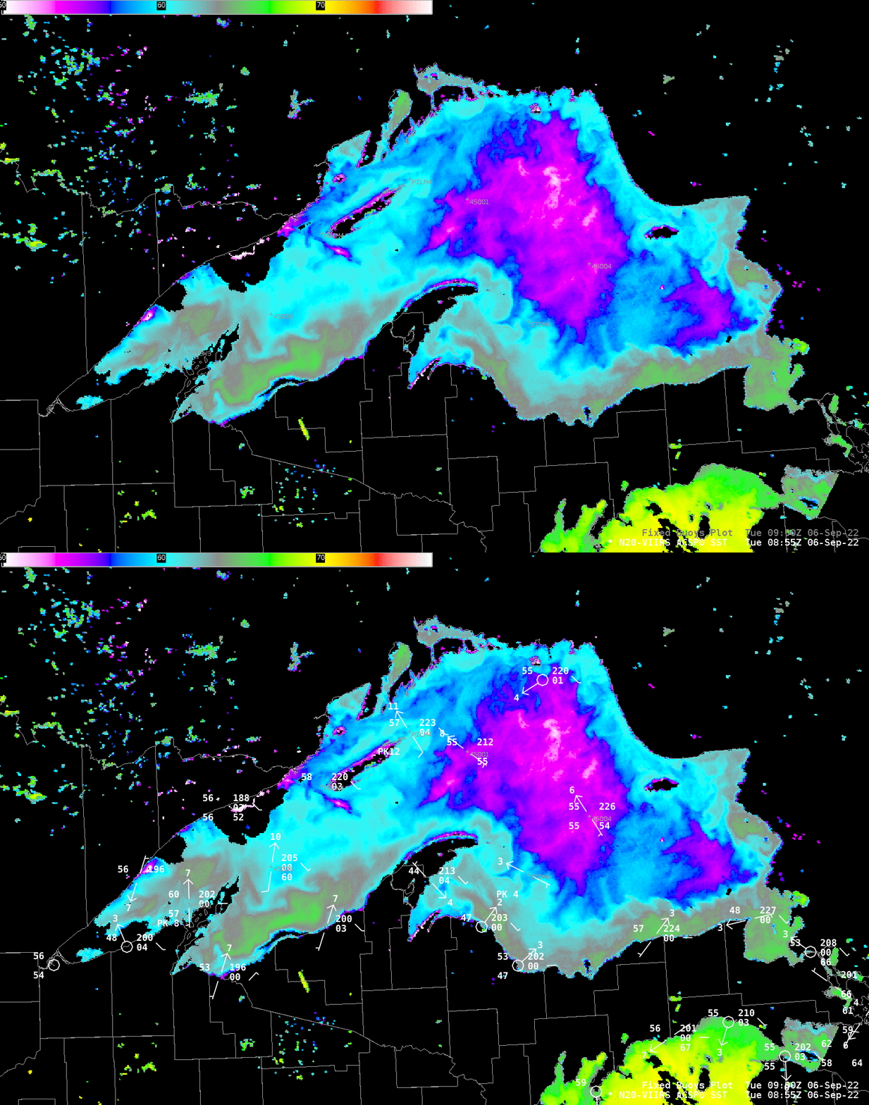
Advanced Clear-Sky Processor for Ocean (ACSPO) temperatures over Lake Superior on 6 September, shown above, show a large area of surface temperature below 55oF (magenta and white in the enhancement) over central Lake Superior. Clear early-Autumn skies allowed for this mostly complete view of the Lake Surface. Although Lake Superior was quite cold with respect to normal in late June (see this graph), its surface waters are now very close to normal. Note how much warmer the northern end of Lake Michigan is! The yellow enhancement shows temperatures close to 70oF.
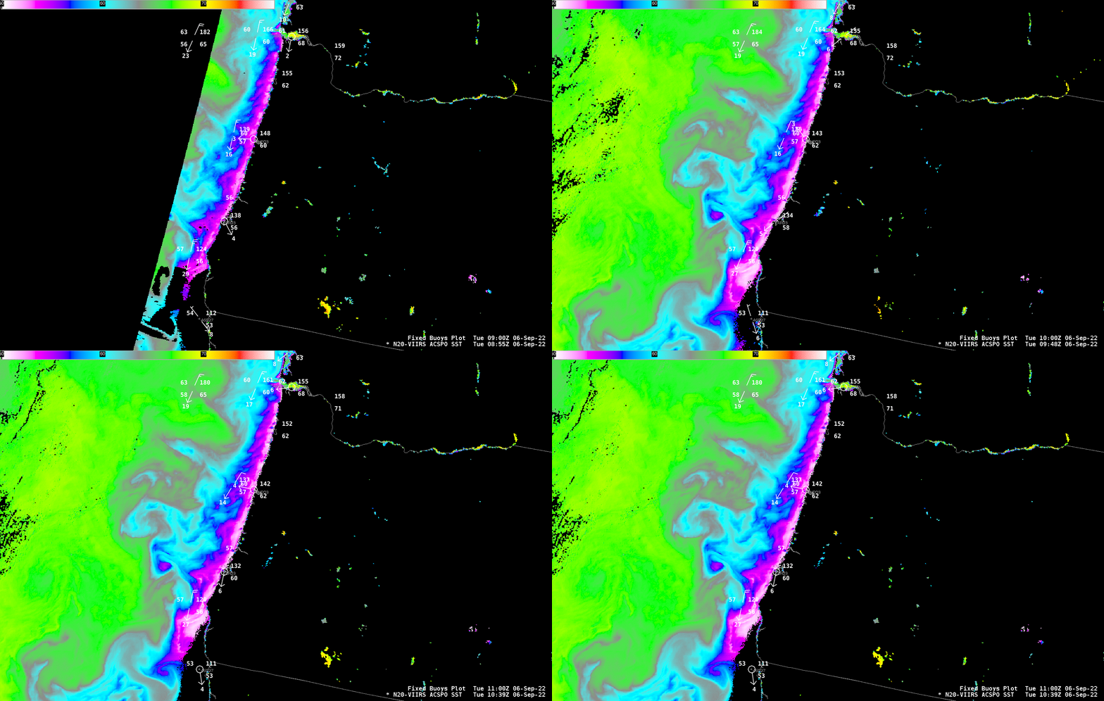
The animation below shows VIIRS ACSPO temperatures off the coast of Oregon from 3 separate overpasses. The strong north winds observed at the buoys strengthen oceanic upwelling, leading to the very cold ocean surface temperatures (51o – 52oF) along the Oregon coast.

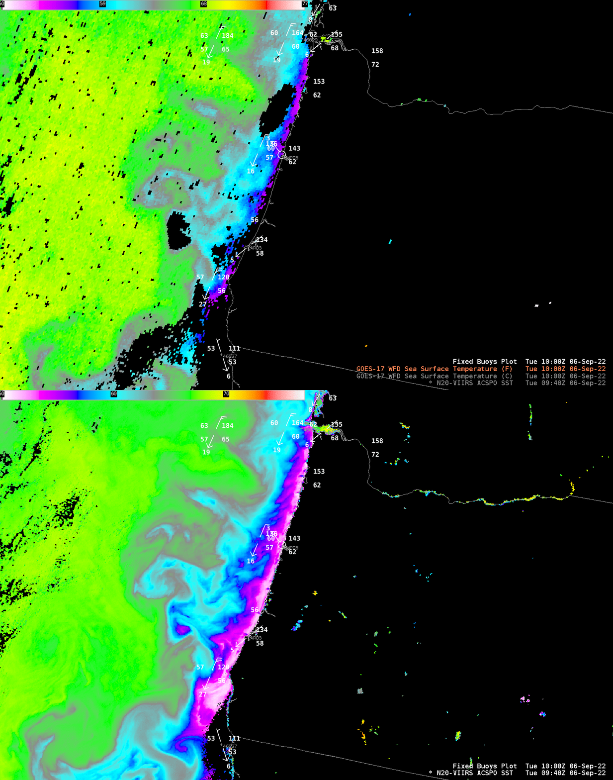
GOES-R Satellites have level-2 Sea Surface Temperature products as well (link) that something like the ACSPO algorithm — albeit at lower spatial resolution. The toggle below compares the two products. VIIRS better captures the cold ribbon of water right along the coast. The GOES-R algorithm cloud mask at the time below is perhaps too stringent.

On 4 September, strong nighttime radiation cooling led to the Lake Superior water temperatures being several degrees F warmer than the surface air temperatures at nearby inland locations (overnight minimum temperatures included 33ºF in far northern Wisconsin and 34ºF in Upper Michigan; note that the color scale used in the tweet below differs from the one above):

