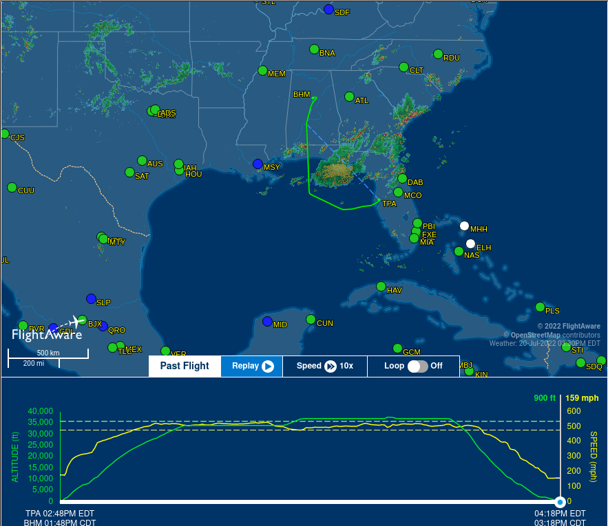
Turbulence on a flight from Tampa to Nashville
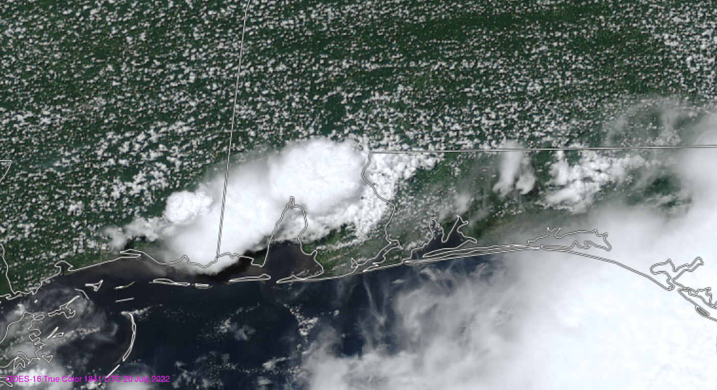
An Embraer 175L took off from Tampa shortly before 1900 UTC on 20 July 2022. About an hour into the smooth flight (as shown here, i.e., around 1945-1950 UTC), turbulence injured about 7 passengers that resulted in a diversion to Birmingham AL (news article; Here is the flight path). The animation of true-color imagery, above, taken from the CSPP Geosphere site (link), shows the region of turbulence, a region of strong convection developing west-to-east along a boundary just inland from Gulf Coast from Mississippi to Florida.
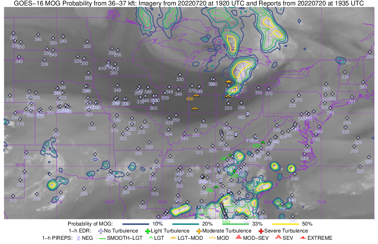
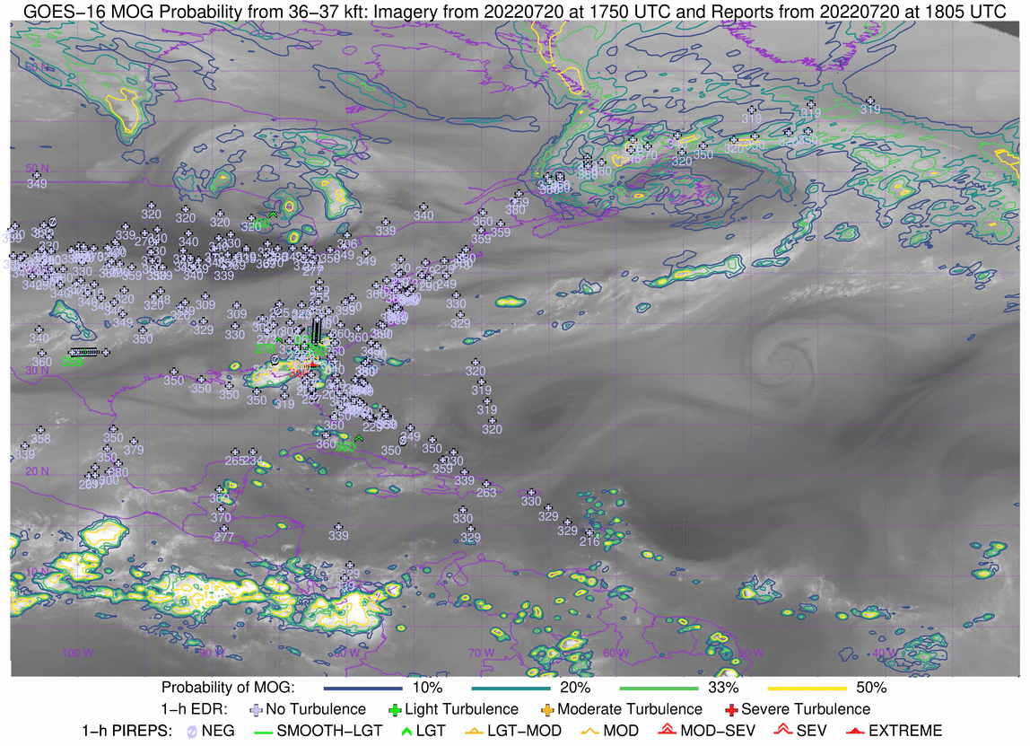
The CIMSS Turbulence site (link) shows probabilities of Moderate-of-Greater (MOG) Turbulence. This machine-learning product was developed using satellite imagery and NOAA/NWS Global Forecasting System (GFS) model output as well as observations of Eddy Dissipation Rate (EDR) on board large aircraft (Here is a training video on the product). MOG Probability fields over North America — along with EDR observation points and Pilot Reports of turbulence — from 1750 to 2140 UTC on 20 July 2022.
The CIMSS turbulence site also includes a Midwest sector that shows the Gulf Coast region; MOG Probability contours and observations are revealed for this event with more clarity. The turbulence was observed in between two different regions of higher probability. This matches an observed feature of this product as noted in the training: We notice that often turbulence occurs on the edge of a predicted feature, not in the center. This indicates that an aircraft that skirts just around a known feature is not “in the clear”. That was the case on this day.