ProbSevere (and NUCAPS) with the Gaylord Tornado

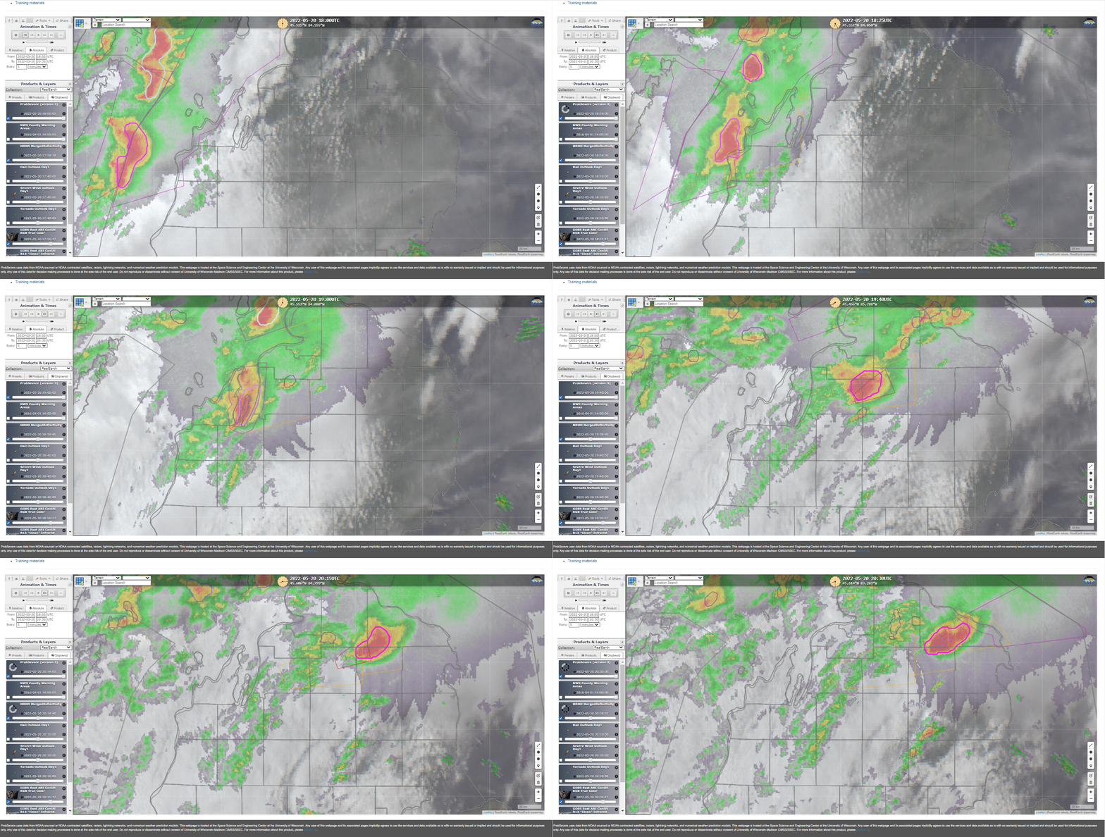
ProbSevere (version 3) is an online tool that is available at this link. It gives the probability that the designated radar object will product severe weather in the next 60 minutes, and it was designed to be used in conjunction with other radar, satellite and model data to increase confidence in warning issuance. It is available online here; ProbSevere (version 2) is also online — and available within AWIPS. The RealEarth-based readout, above, shows the radar object that produced the EF-3 Tornado in Gaylord. (Click here for the NWS Gaylord writeup). ProbSevere values were consistently high with the radar object thoughout the trek across the northern Lower Peninsula of Michigan. Here is an image showing the accumulated ProbSevere values across northern Michigan (from this RealEarth link)
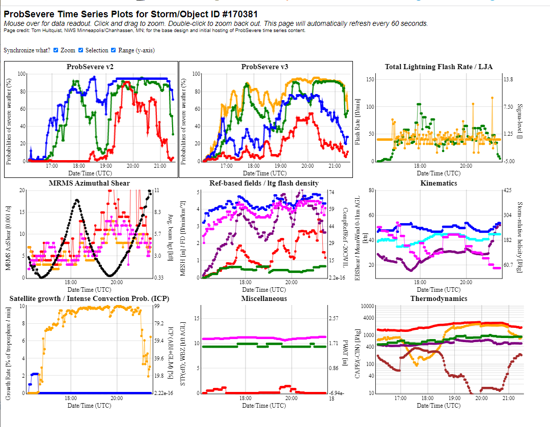
Read-outs of PSv3 and PSv2 values are available at this link, and the plot for the radar object in the animation above (#170831) is shown below (Here is a permanent link that allows you to view values!). Of note here is that PSv2 values are larger than PSv3 values. This is because PSv3 is better calibrated. For example, the Gaylord Tornado has a ProbTor value (plotted in red) of 90%! However, it is not the case that ProbTor (version 2) predictions with values of 90% lead to tornadoes 90% of the time: ProbTor v2 is overpredicting values in that case. ProbTor (version 3) is better calibrated, and the lower values are more in line with observations. Users familiar with ProbTor version 2 will need to adjust their expectations when transitioning to ProbTor version 3 (or indeed from any of the ProbSevere version 2 products to ProbSevere version 3 products).

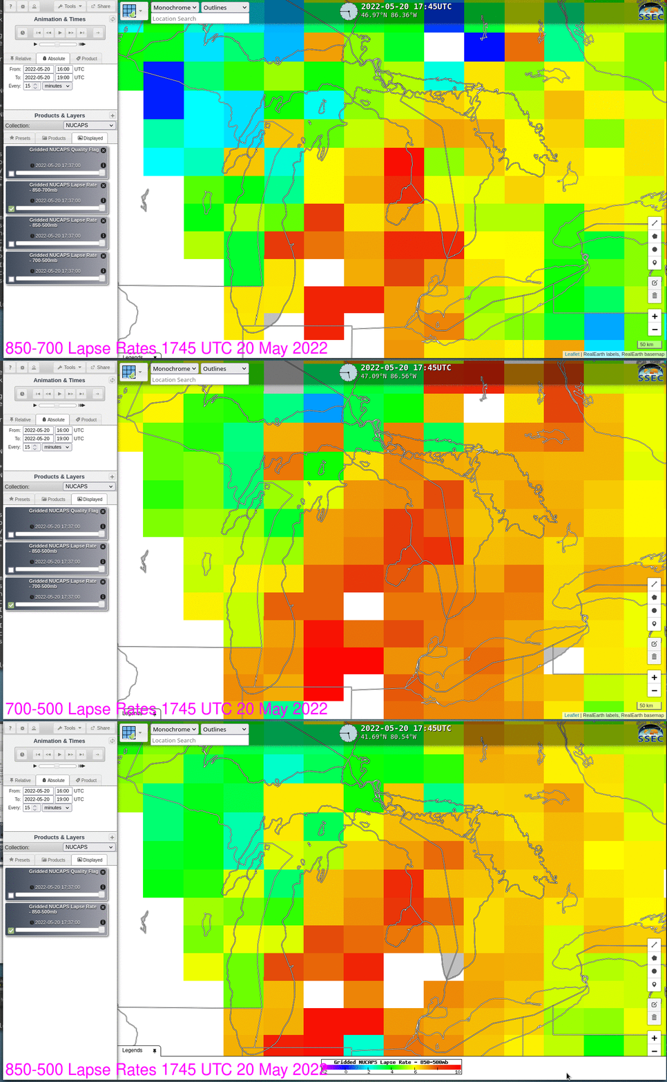
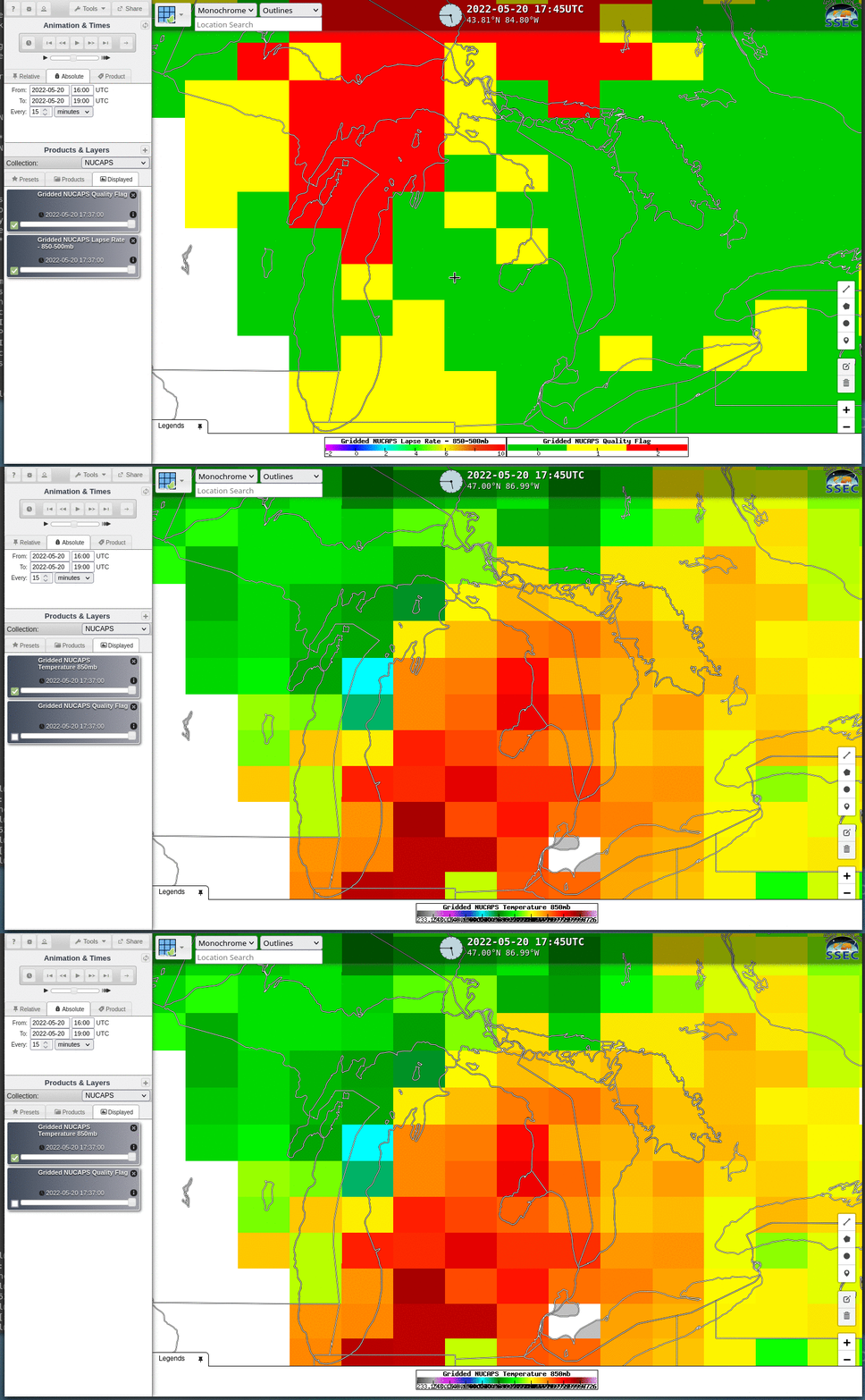
NOAA-20 overflew the region of severe weather just before 1800 UTC (link). Gridded NUCAPS fields from this site, below, show marked instability over the northwestern Lower Peninsula of Michigan, especially in the 700-500 mb layer, where gridded values exceed 7 C/km. The gridded values also show a decrease in stability for any storms moving into the Lower Peninsula from the west; however, Quality Control flags (shown below in a toggle with 850-mb Temperature), show profiles that did not converge over Lake Michigan.


