SAR Wind data off the Pacific Coast

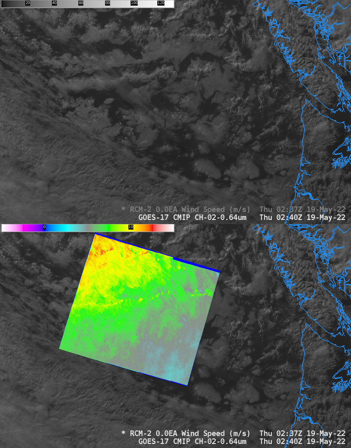
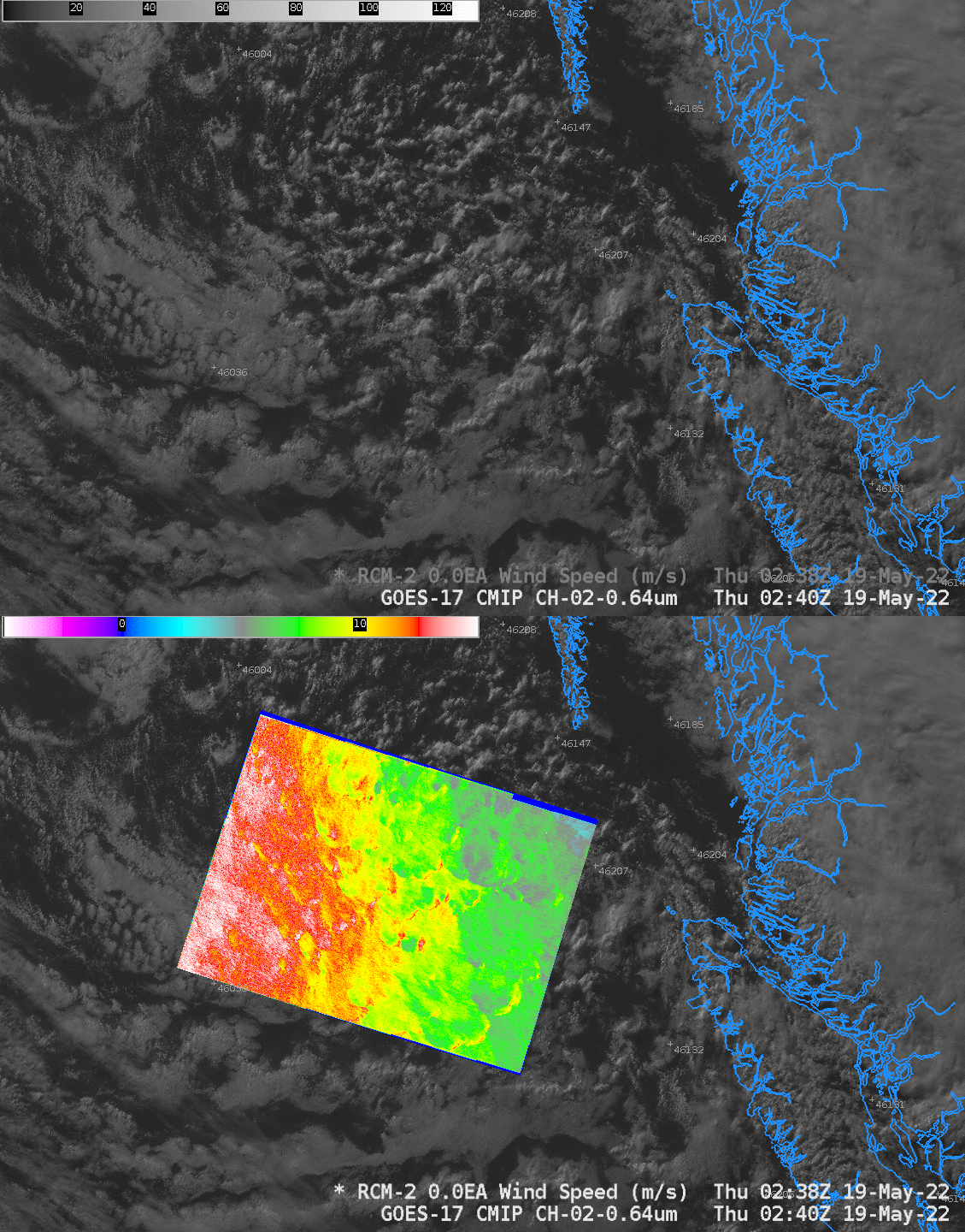
Synthetic Aperture Radar imagery can give very high-resolution observations of winds in regions where wind observations are otherwise sparse (or non-existent). The image above and below show data from an ascending pass of Canada’s RADARSAT Constellation Mission 2 (RCM2) satellite. These data are available online (click here for the image above, and here for the image below), but netcdf files can also be inserted into AWIPS for a direct comparison to other satellite imagery. The image above shows the increase in wind speeds (about 11 m/s) associated with a broken line of cumulus clouds, with stronger winds over the northwest part of the SAR domain. The later image, below, farther north, shows generally stronger winds, and it also shows local wind maxima out in front of cloud formations (in the southeast corner of the SAR domain).


