Fog in and around the Aleutians

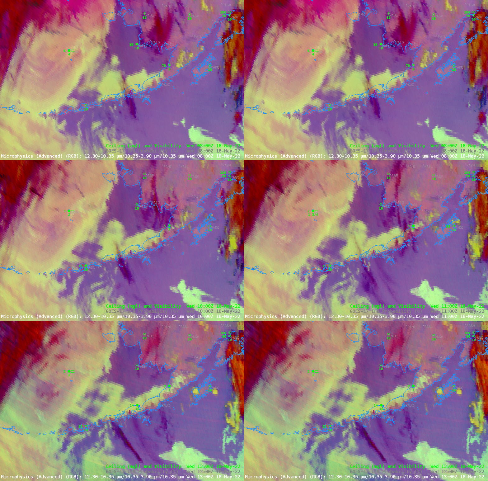
The hourly animation above shows the GOES-17 Night time Microsphysics RGB over and surrounding the Aleutian Islands, from 0800 – 1300 UTC on 18 May 2022. Yellowish features are low clouds in this RGB; low clouds at warmer temperatures have a blue/cyan tint because the inclusion of Band 13 infrared (10.3 µm) brightness temperatures in the ‘blue’ part of the RGB will change the color representation of low clouds. High clouds — red in the RGB — are also present along the western edge of the domain, over the Bering Sea — and are apparent as thin clouds over the low clouds over the Aleutians, visible as purple streaks.
Are the low clouds shown above fog — that is, are the clouds touching the surface? That’s hard to tell with certainty over Marine Environments. The single surface observation — at St Paul Island (PASN) in the Bering Sea, does show fog/low stratus present, and IFR conditions. An inference from that observation might be extended into the entire region. Real-time webcams and ship observations can also help with the determination of whether low clouds are actually banks of fog.
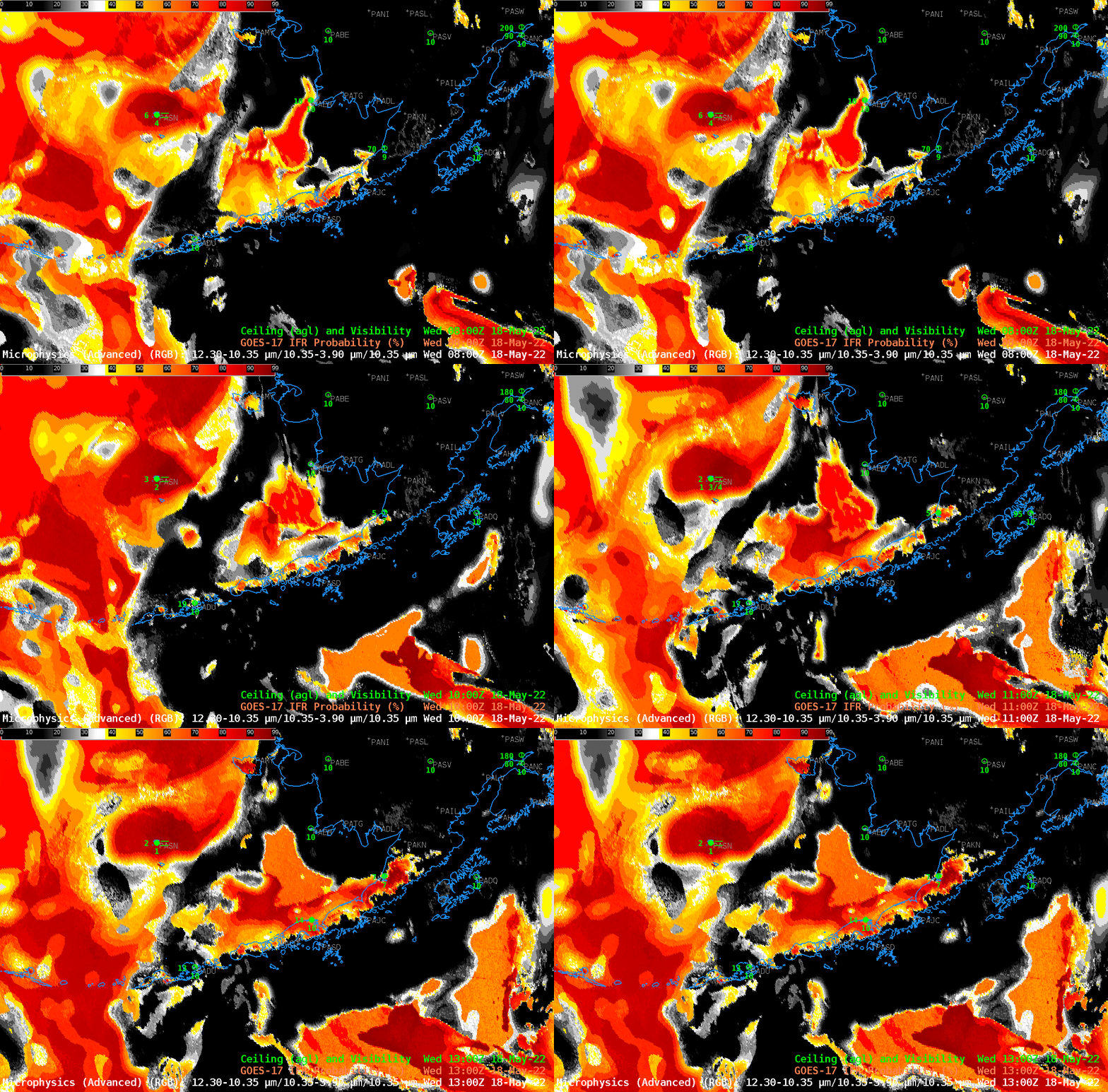
IFR Probability fields, below, for the same 6 observation times, incorporate model-derived estimates of low-level saturation, suggesting more low-level variability to the low clouds/fog over the Bering Sea (and in the Gulf of Alaska south of the Aleutians); that’s shown more clearly in this toggle between the two fields at 1200 UTC. Note also that a useful signal is produced underneath the high clouds at the western edge of the domain: even though the satellite gives no direct observations of the low-level clouds there, model estimates can nevertheless give information on low-level saturation.

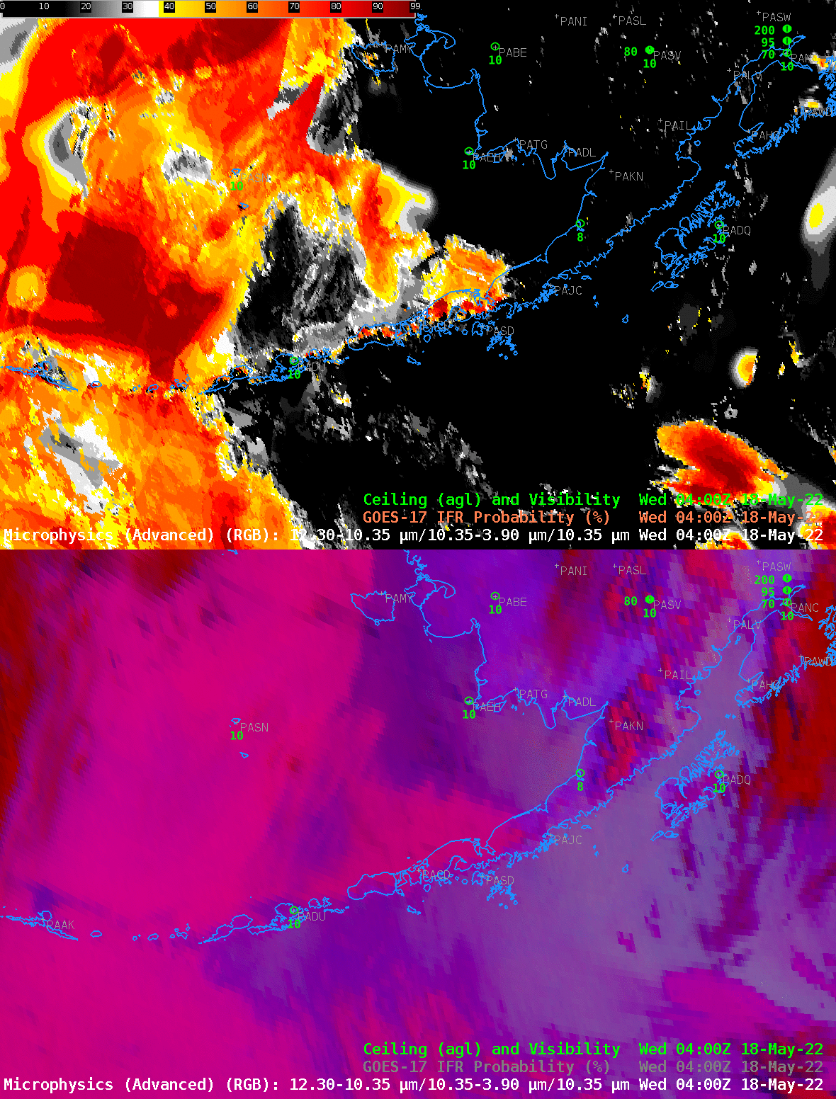
When the sun is above the horizon, the Night time Brightness temperature difference field (10.3 µm – 3.9 µm) signal flips sign because of the large amounts of 3.9 µm solar reflectance; thus the Nighttime Microphysics RGB is less useful in low-cloud detection. The toggle below compares the Night Time Microphysics RGB and the IFR Probability field at 0400 UTC. Note that the observation at St Paul Island at this time does not show IFR conditions — and IFR Probabilities there are not quite so large as later, as displayed in the animations above.

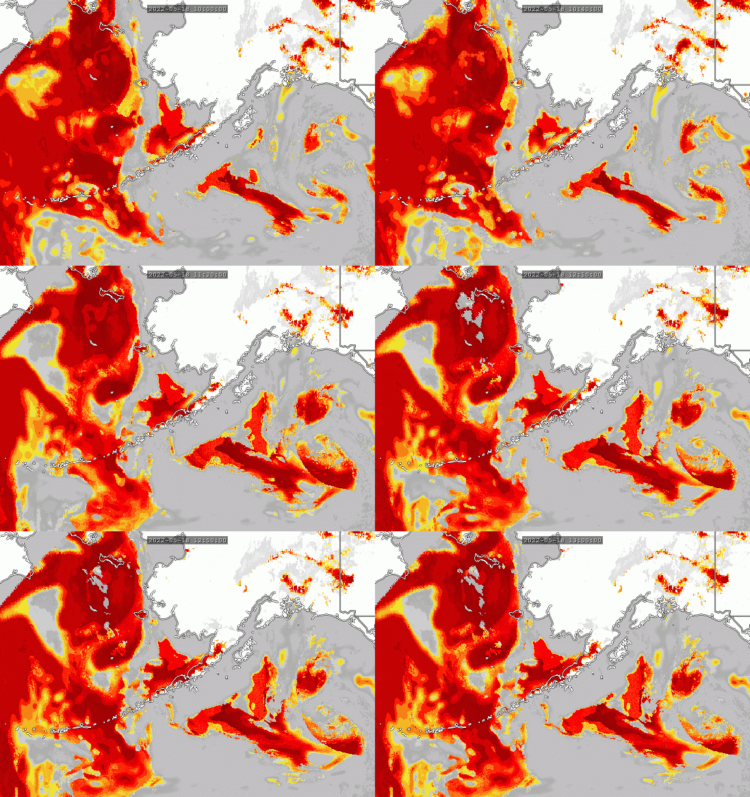
The imagery above were all captured using a National Weather Service AWIPS machine, with dataflow over the Satellite Broadcast Network (SBN) that supplies data products to the offices. What if you don’t have that resource? RealEarth contains Full-Disk IFR and Low IFR Probability fields from GOES-16 and GOES-17 (search for IFR within the search box at the RealEarth website). An animation of IFR Probability from GOES-17, from 1000 UTC – 1250 UTC, at 10-minute steps (the scanning cadence of GOES-17 Full Disk imagery) is below.

GOES-17 Full-Disk Nighttime microphysics RGB imagery is available from a variety of sources. For example, it’s at the NOAA/NESDIS Imagery viewer (link); at the CIRA Slider ; the mp4 animation below is taken from a coming upgrade to the CSPP Geosphere site that shows Night time Microphysics RGB imagery at night (and true color imagery during the day).

