Hail swath in South Dakota

GOES-16 Day Snow-Fog RGB and Near-Infrared “Snow/Ice” (1.61 µm) images, with time-matched Local Storm Reports of hail plotted in red [click to play animated GIF | MP4]
A slightly modified version of the Day Snow-Fog RGB — created using Geo2Grid — provided more contrast, making the hail swath a bit easier to see (below).
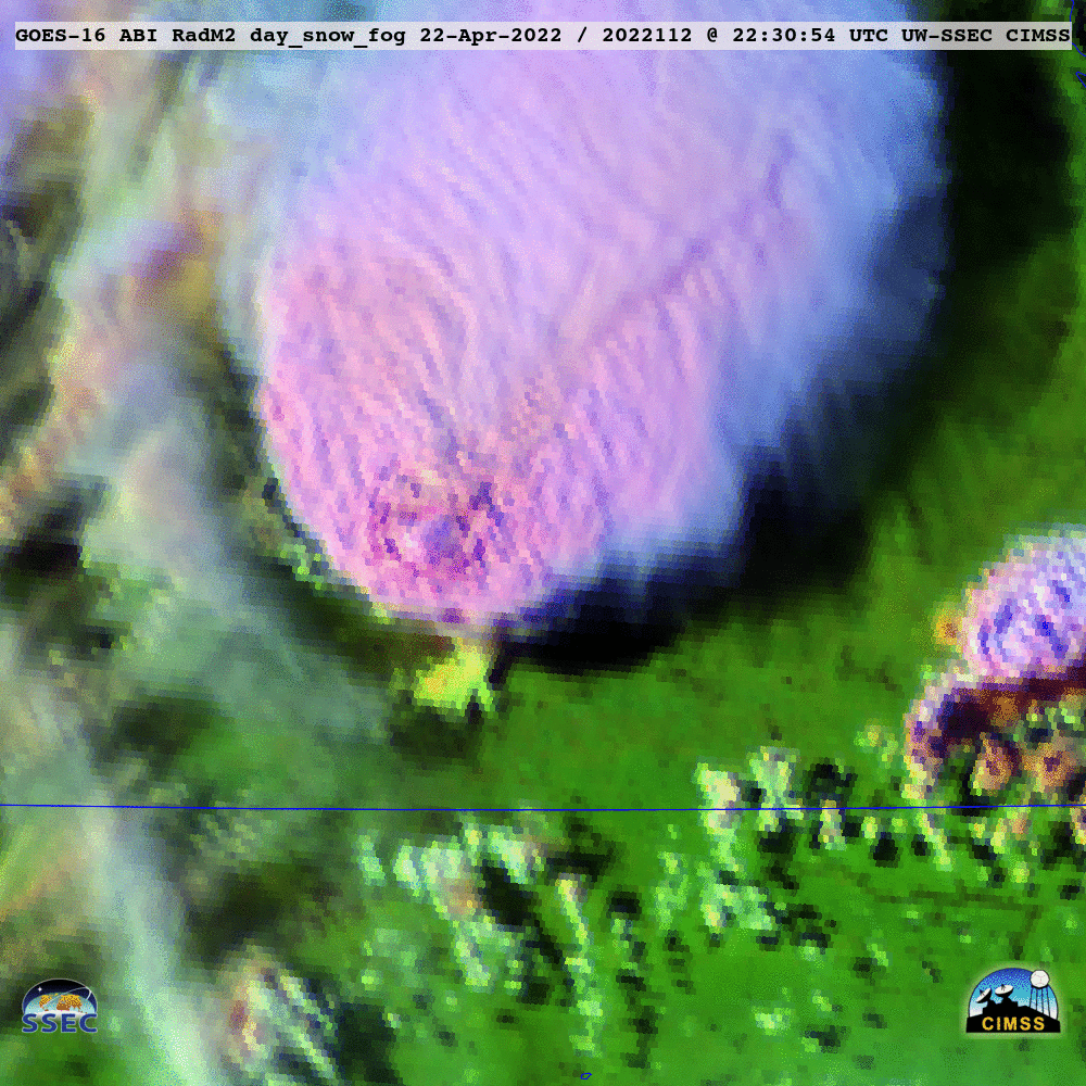
GOES-16 Day Snow-Fog RGB images [click to play animated GIF | MP4]

GOES-16 “Red” Visible (0.64 µm) and “Clean” Infrared Window (10.35 µm) images, with time-matched Local Storm Reports of hail plotted in red [click to play animated GIF | MP4]