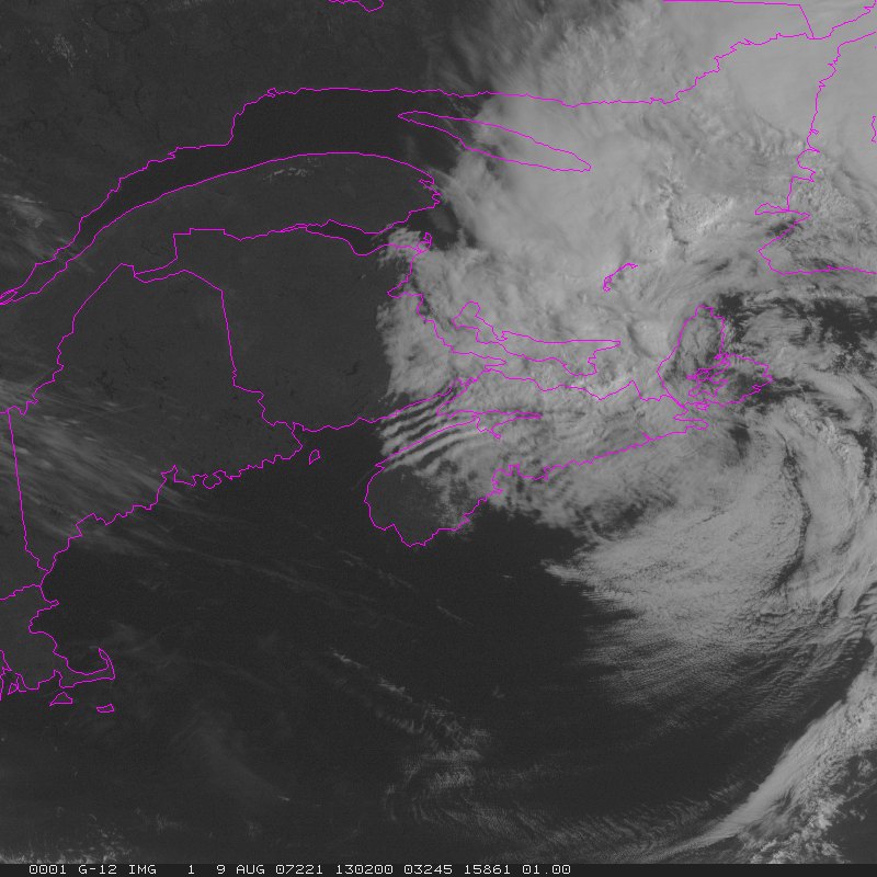
Wave Clouds over the Bay of Fundy
Wave clouds downstream of mountain ridges are a fairly common sight for regular observers of satellite data. See, for example, the parallel bands of clouds over southern Virginia in this image from the Record-setting Nor’easter in April of 2007. Such clouds develop as air is forced upward by the ridges of the Appalachian mountains. A standing wave develops, usually downstream of the mountain ridge, with clouds in the region of upward motion (if moisture is sufficient to allow for condensation) and clearing in regions of downward motion.
An excellent example of Wave Clouds occurred August 9th over the Bay of Fundy, in the Canadian Maritimes. The region is not noted for its tall mountains; however, the Caledonia Hills parallel the north shore of the Bay of Fundy, and North Mountain is along the south shore of the Bay of Fundy in Nova Scotia. (As shown here). The clouds formed in the northwest flow behind a departing low pressure system and gradually dissipated during the day as downward motion behind the departing the storm increased.
(Click on the image for a loop — note how the parallel bands of clouds are stationary). Clouds of this type generally are capped by an inversion, and such was the case on this day. This link shows the upper-air sounding from Yarmouth, on the southeast coast of Nova Scotia. An inversion exists above strong north-northwesterly winds that would be perpendicular to the coastline and the mountains that parallel the coast. The Caledonian Mountains along the coast of the Bay of Fundy aren’t particularly tall (they’re mostly below 400m at their peaks). The mountains on the north shore of Nova Scotia that surround the Annapolis Valley are also of modest height (less than 400 m). They are tall enough, however, to cause the atmospheric motions that give rise to the Wave Clouds in the images.


