Combining GOES-R and NUCAPS TPW fields in AWIPS

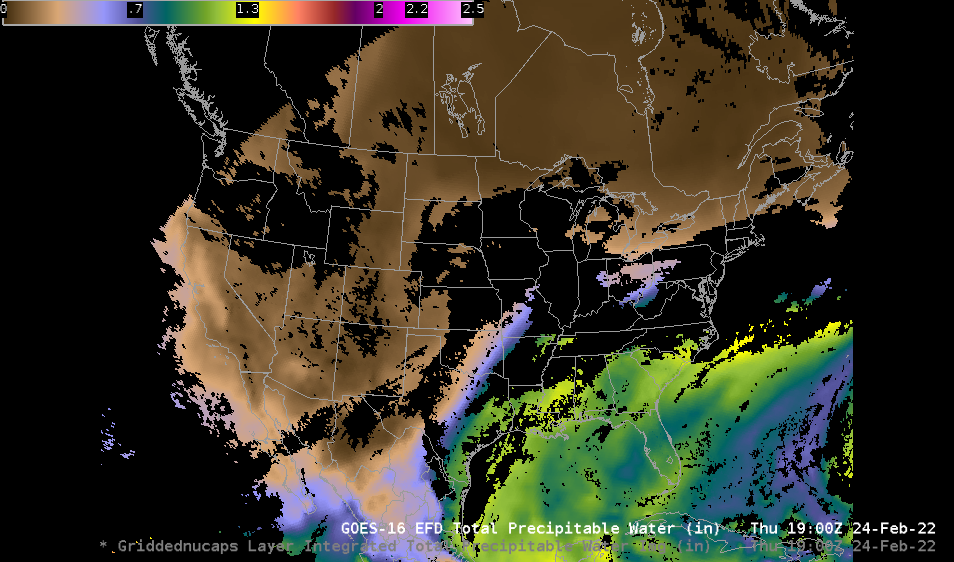
Total Precipitable Water is a Level 2 Derived Product created from ABI (and ancillary) data (link to information on this product) The image above shows the product at 1900 UTC on 24 February 2022. It is immediately apparent that cloudy regions have no data! There are ways to fill in those gaps at different times of day.
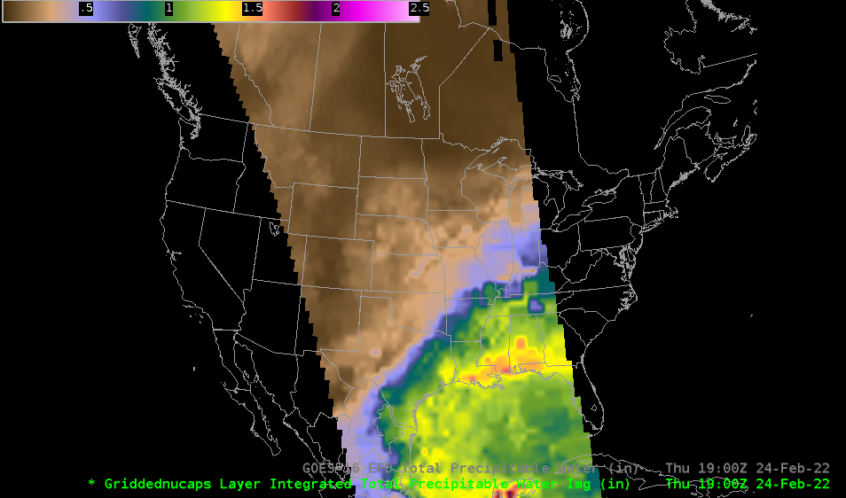
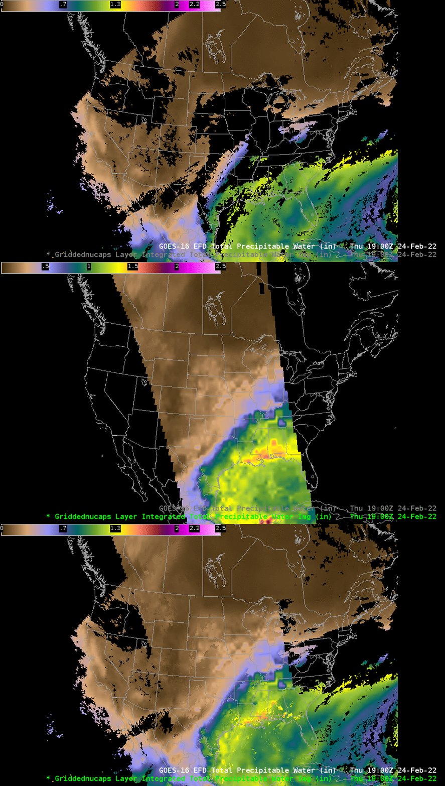
NUCAPS thermodynamic profiles in AWIPS are derived from data from the CrIS (Cross-track Infrared Sounder) and ATMS (Advanced Technology Microwave Sounder) instruments on board NOAA-20. That thermodynamic data can be used to create fields of Total Precipitable Water, as shown below. Of course, the NUCAPS swath is limited geographically to the width of the CrIS and ATMS swaths, but values are created in clear and cloudy regions. Note that in AWIPS (which display system was used to create the imagery in this blog post) the gridded NUCAPS field has a different default color enhancement than what is shown below; create an AWIPS Procedure to load and enhance the swath with the same GOES-R enhancement used as a default in the image above.

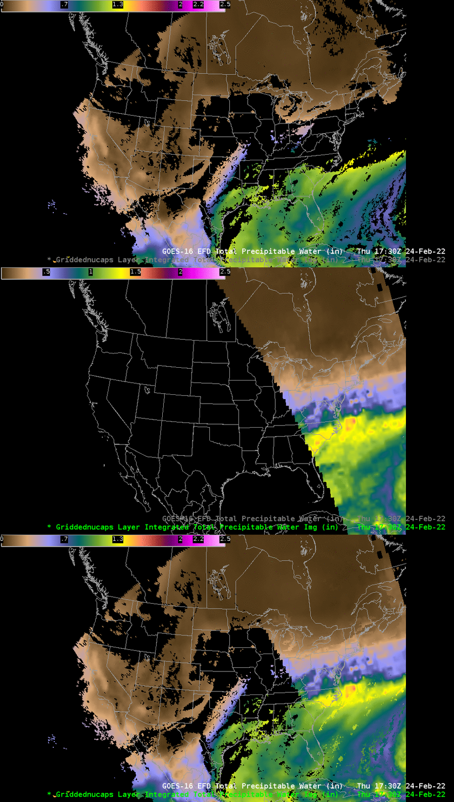
If you combine both the GOES-R TPW estimates with NUCAPS estimates at the same time, you will get enhanced coverage in regions where interesting weather might be happening (near gradients in TPW, for example) beneath cloud cover. NOAA-20 NUCAPS swaths occur every 90 minutes in the afternoon. moving east to west across the CONUS. Thus, at 1730 UTC, a NUCAPS TPW swath was available over the eastern part of the United States, and it could be combined with GOES-R values at that time, as shown at bottom. At 2030 UTC, a swath along the west coast (not showed) occurred. A similar set of swaths will occur east-to-west between about 0530 UTC and 1000 UTC in the morning.


AWIPS users can create a procedure to load gridded TPW fields in conjunction with GOES-R TPW fields, and use them as needed. AWIPS imagery in this blog post was created using the NOAA/NESDIS TOWR-S AWIPS Cloud Instance.

