Lake effect clouds downwind of Lake Sakakawea

GOES-16 Night Fog BTD (10.3 – 3.9 µm) and Day Snow Fog RGB images [click to play animated GIF | MP4]
As cold arctic air moved across the still-unfrozen waters of Lake Sakakawea on 06 December 2021, a lake effect cloud plume was seen downwind (southeast) of the lake in GOES-16 (GOES-East) Night Fog BTD (10.3 – 3.9 µm) and Day Snow Fog RGB images (above).
In a comparison of NOAA-20 VIIRS True Color RGB, False Color RGB and Infrared Window (11.45 µm) images at 1925 UTC (below), the lake effect cloud plume was diminishing as winds across/along the lake became lighter — and the unfrozen portions of Lake Sakakawea appeared dark in RGB imagery, with surface infrared brightness temperatures in the 1 to 2ºC range (darker shades of orange).
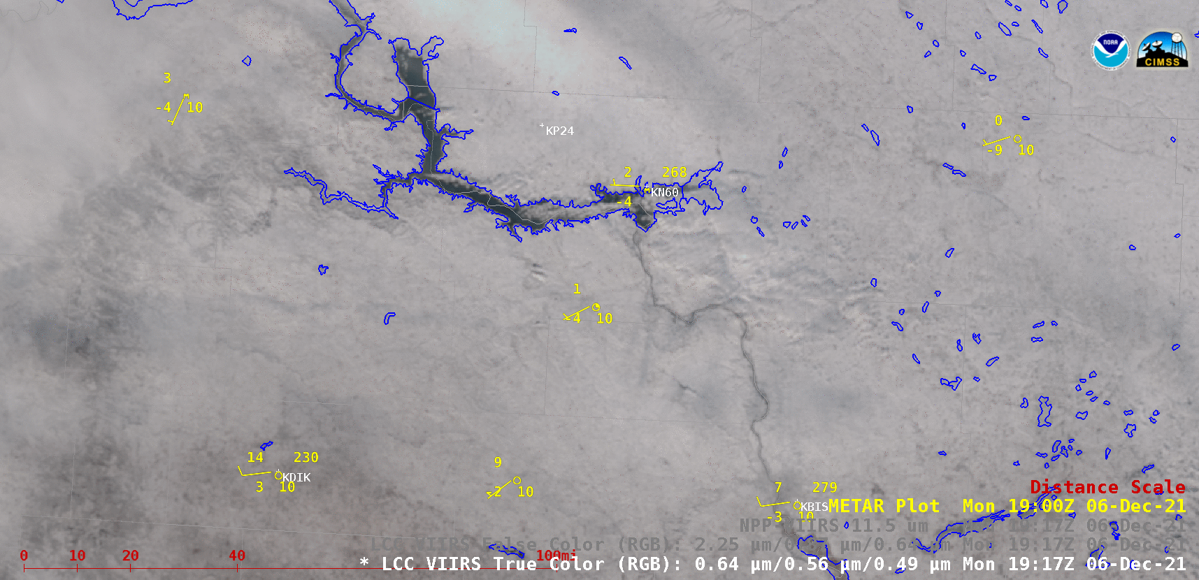
NOAA-20 VIIRS True Color RGB, False Color RGB and Infrared Window (11.45 µm) images [click to enlarge]