Mesoscale Convective Vortex in Brazil

GOES-16 “Clean” Infrared Window (10.35 µm) and “Red” Visible (0.64 µm) images [click to play animated GIF | MP4]
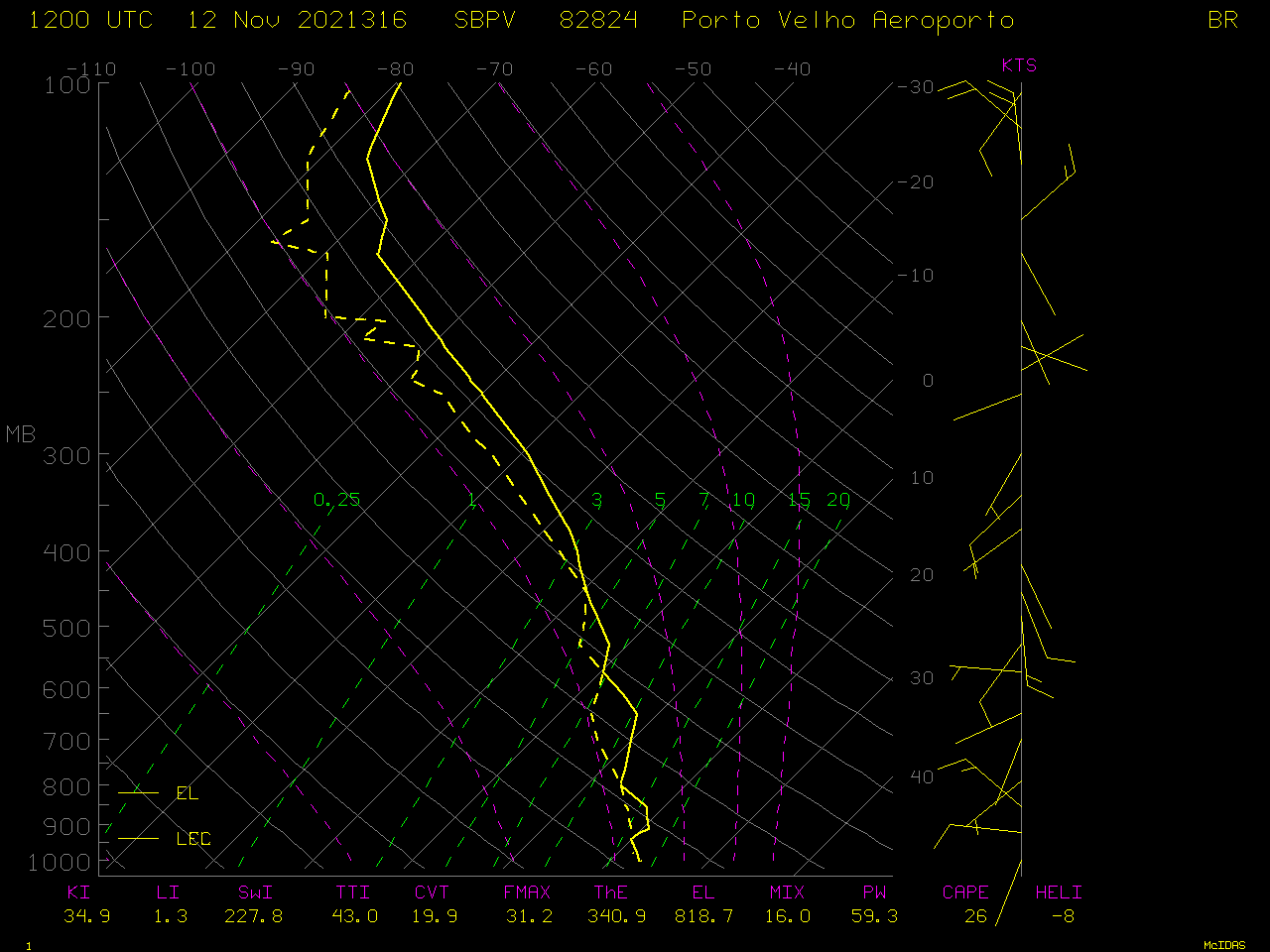
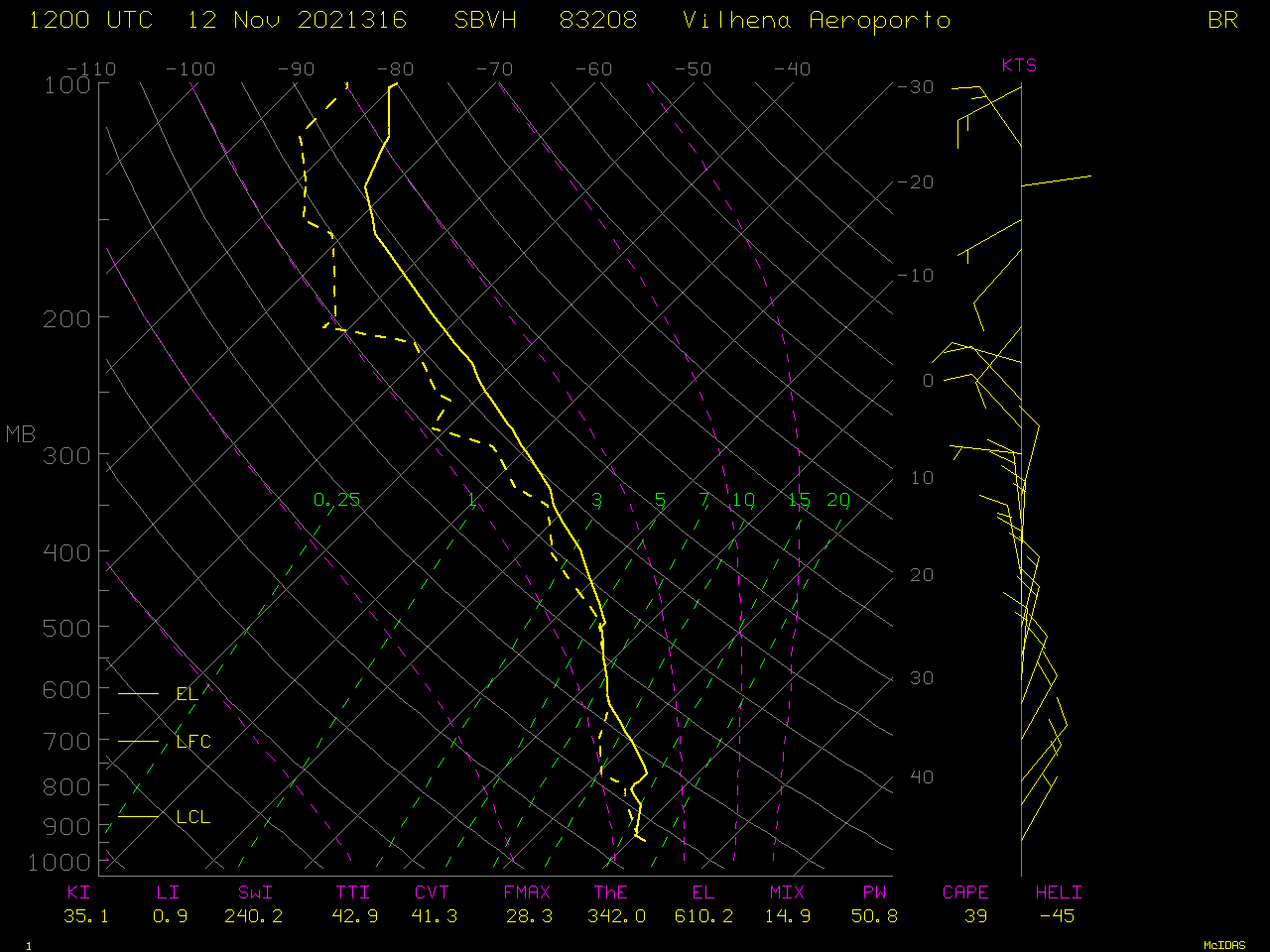
GOES-16 Visible images combined with the clear-sky Total Precipitable Water product (below) revealed TPW values in the 2.2 to 2.5 inch range in the vicinity of the MCV. This environment of high moisture likely aided the development of new convection as the MCV approached. Nearby 12 UTC soundings from Porto Velho (SBPV) and Vilhena (SBVH) showed minimal instability across far southwestern Brazil, but the sounding TPW values (2.0 to 2.3 inches) were in good agreement with the TPW values derived from GOES-16.
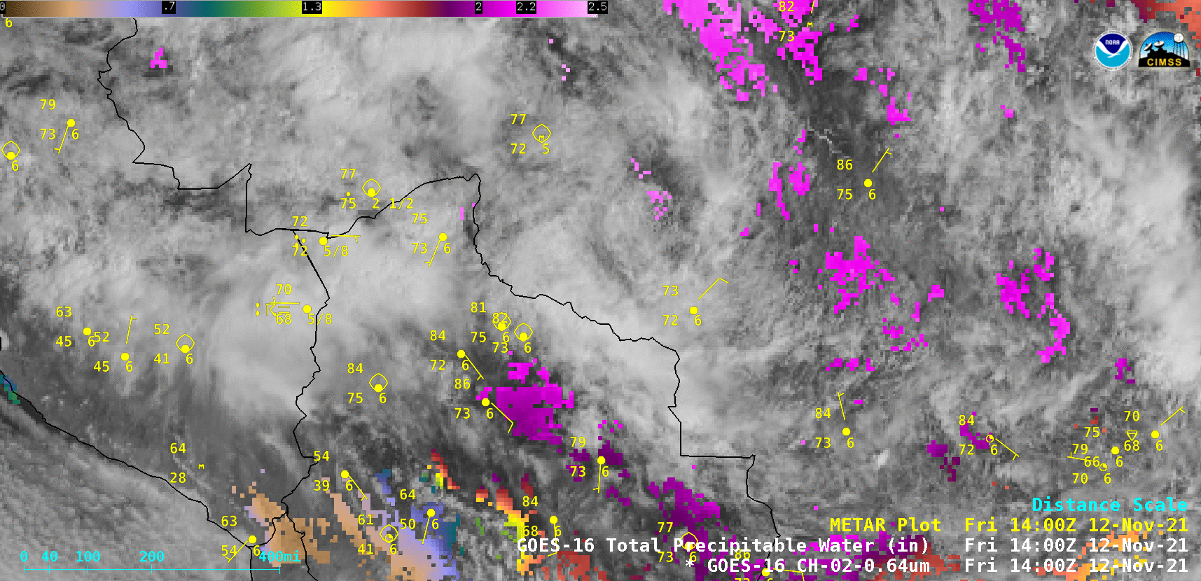
GOES-16 “Red” Visible (0.64 µm) images, combined with the clear-sky Total Precipitable Water product [click to play animated GIF | MP4]
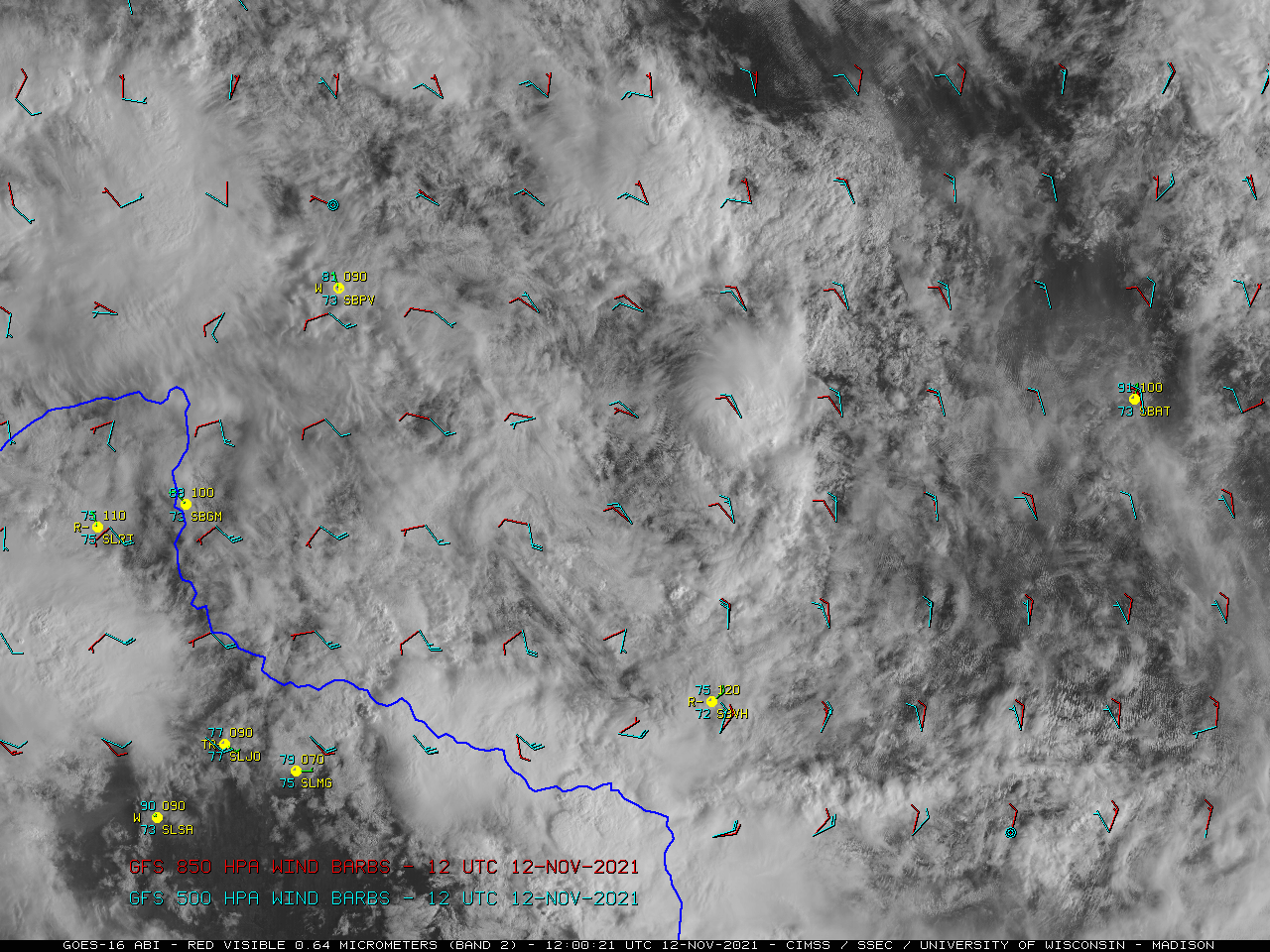
GOES-16 “Red” Visible (0.64 µm) images at 1200 UTC and 1800 UTC, with plots of GFS wind barbs at 850 hPa and 500 hPa [click to enlarge]