Day Cloud Phase Distinction RGB and Lake Effect Snow

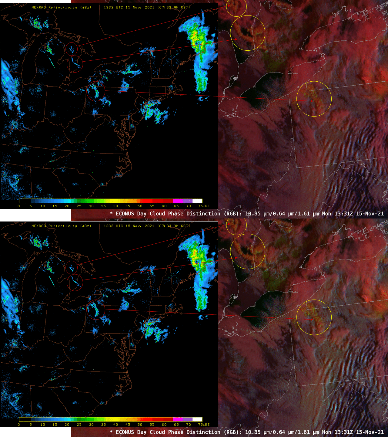
The toggle above shows NEXRAD radar (source) inset during lake-effect precipitation with two versions of the GOES-16 Day Cloud Phase Distinction RGB, one with default values, and one with ‘Green’ (ABI Band 2 Visible imagery at 0.64 ?m) and ‘Blue’ (ABI Band 5 at 1.61 ?m) reduced from default values, from 79% to 60% for Band 2, and from 59% to 50% for Band 5 (by using the composite option feature in AWIPS). It can be advantageous to alter the bounds on some RGBs during periods of low light (i.e., sunrise and sunset) to accentuate features. However, make certain at some point to reload with the default value! As the sun rises higher into the sky, features will start to look unfamiliar if the modified RGB menu remains.
The radar/satellite comparison bears comment. First, note that the location of circled features is not quite the same, due to parallax (discussed here and here): The effect of parallax is that clouds are shifted away from the sub-satellite point in AWIPS. The effect is most pronounced for towering summertime thunderstorms, but even clouds producing lake-effect snow, clouds that are far more shallow, will be shifted.
The Day Cloud Phase Distinction RGB will show clouds with more of a yellow tint when those clouds glaciate, as might be expected in more intense lake-effect snow-producing clouds. As clouds glaciate, the ‘blue’ part of this particular RGB is reduced: ice crystals within the cloud absorb (rather than reflect) solar energy at 1.61 ?m. In the toggle above, clouds with a modest yellow enhancement in the RGB align well in three circled regions where radar suggests vigorous precipitation might be falling. This is a seasonal reminder, then, to use the Day Cloud Phase Distinction to highlight regions — during the day — where lake-effect might be most impactful.

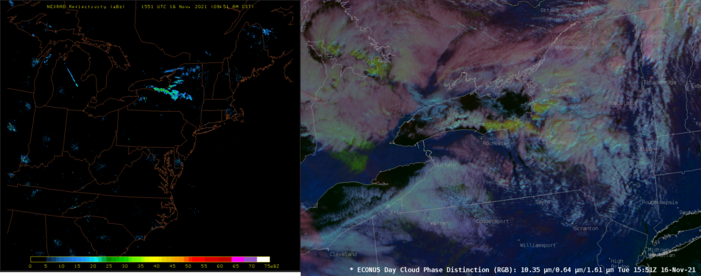
A similar example is shown above from 16 November. NEXRAD Radar (on the right) shows a single band with strongest returns stretching east-southeastward from just north of Rochester. Note the distinct color change to the cloud band in the RGB that overlays the strongest radar returns. Similar colors in the RGB are also present east of eastern Lake Ontario, where radar returns are also present.

