Historic rainfall and floods in middle Tennessee
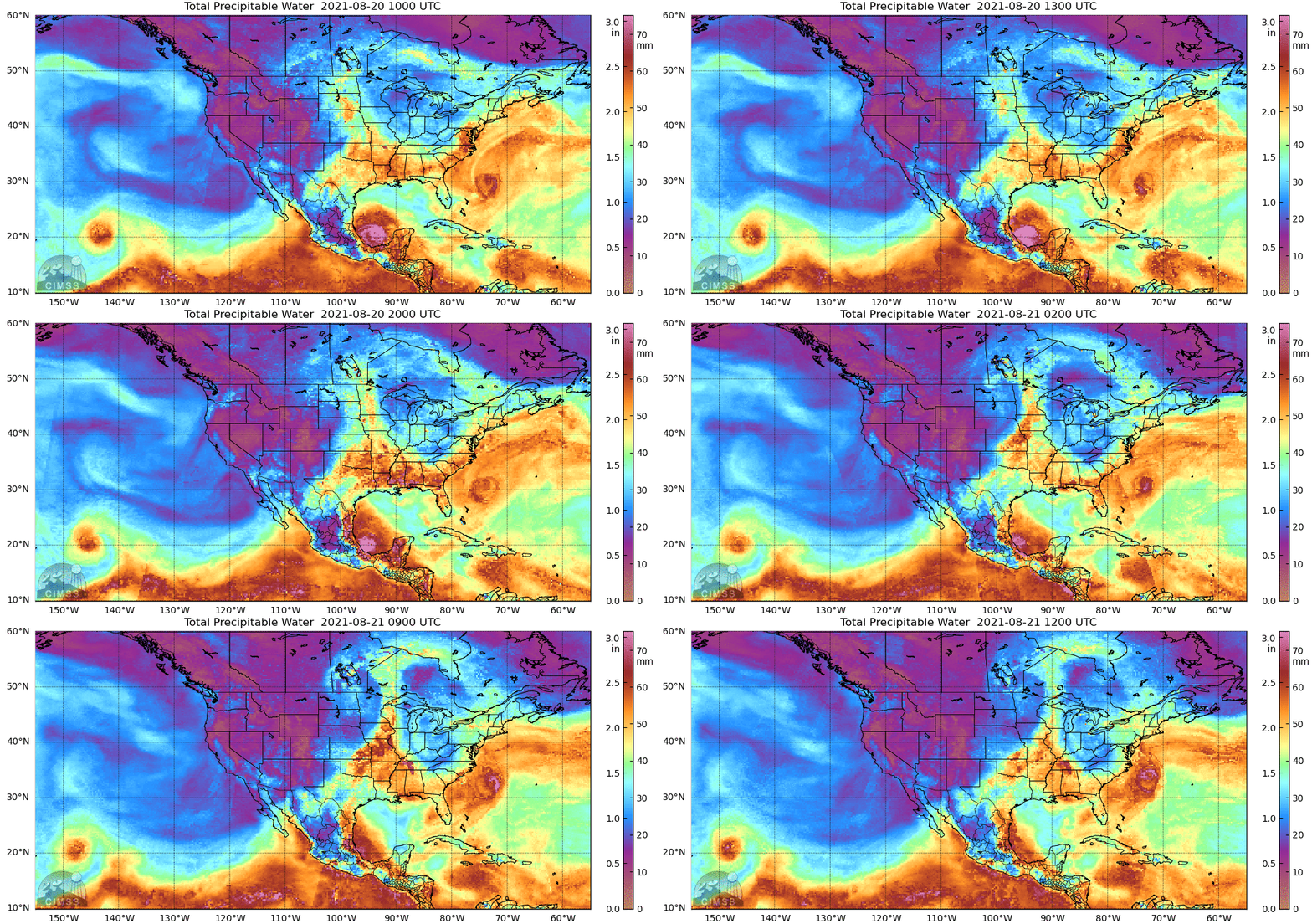
Training thunderstorms early Saturday caused historic rains and devastating (and deadly) flash floods early on Saturday morning 21 August 2021. (Click here for a listing of hourly precipitation totals at McEwen, TN; this excellent tweet from Tomer Burg shows the radar in the region). Were there satellite products that described the environment, rich in moisture, that allowed the flooding rains to occur? The animation above shows MIMIC Total Precipitable water at hourly timesteps from 1000 UTC on 20 August 2021 to 1200 UTC on 21 August 2021. There is a pronounce gradient in moisture established over middle Tennessee by 0400 UTC on 21 August, and the amount of moisture is very large!
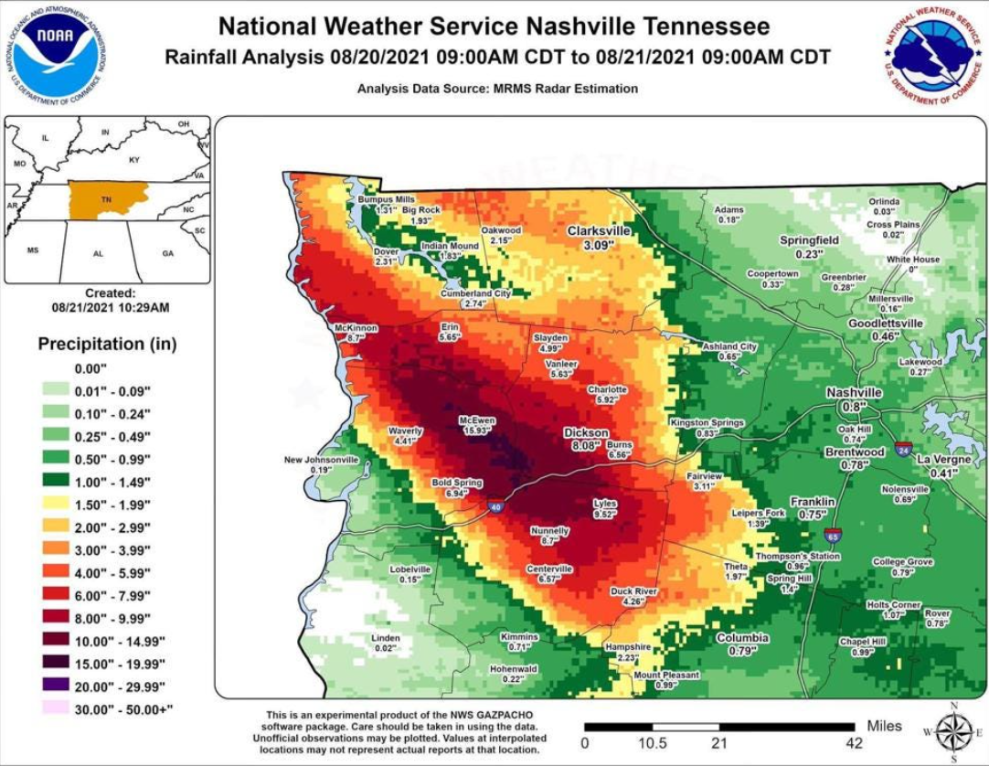
The rain that fell is analyzed below (data source: MRMS). The heavy rain caused drastic (and record-setting) stream flows and water heights on the Big Piney River. The flooding also closed I-40 temporarily.
The animation below shows the GOES-16 Low-level water vapor imagery. A pronounced boundary is apparent near the region where the flooding rains developed. (Band 8 imagery — upper-level water vapor infrared (6.19 µm) imagery — shows a gradient in the same region as well)
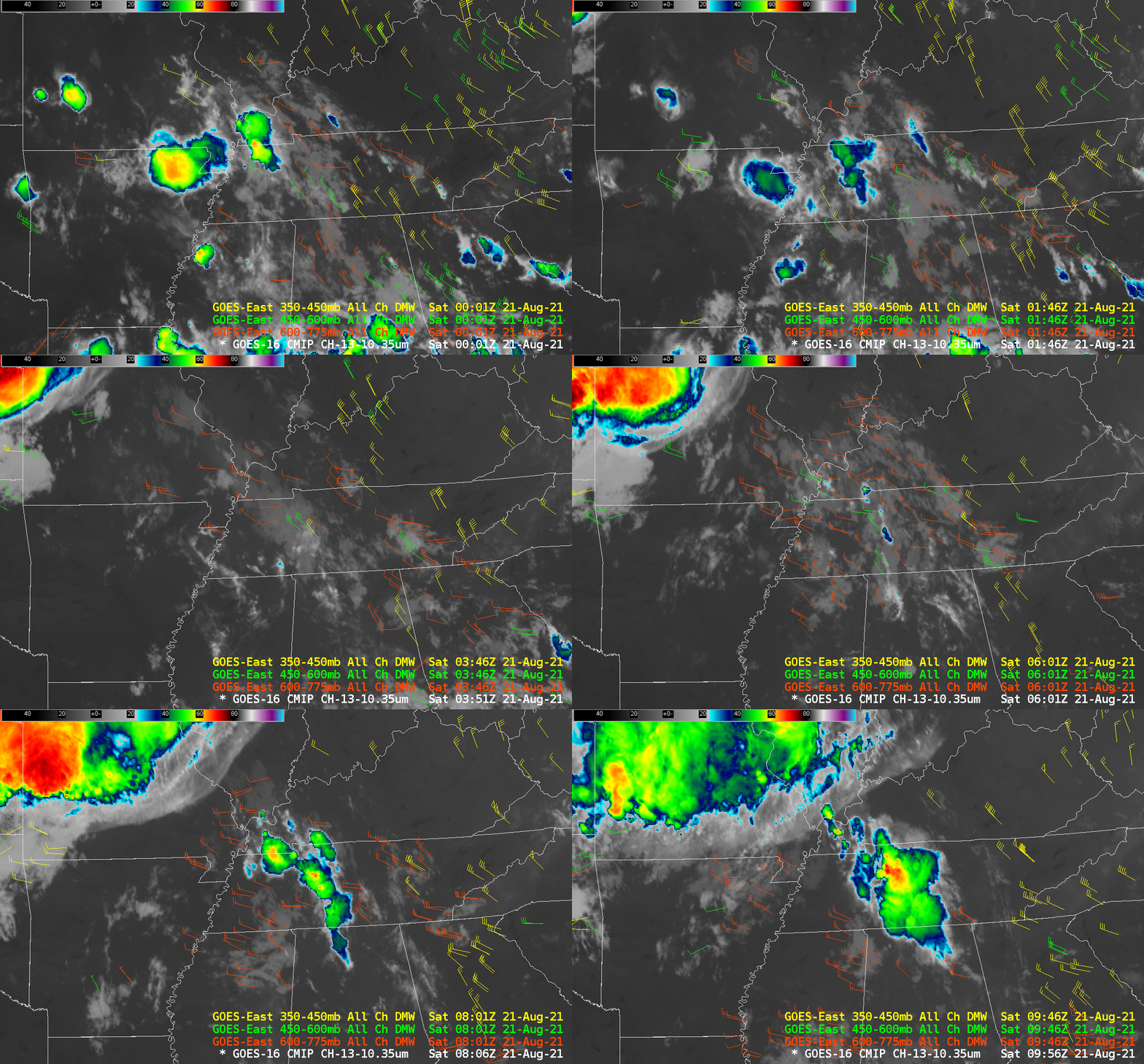
GOES-16 Band 13 Clean Window infrared (10.3 µm) imagery, below, overlain on top of the Level 2 Total Precipitable Water (TPW) product document the development of the training thunderstorms along the TPW gradient. The motion of the storms is along the gradient. Numerous blog entries at the Hazardous Weather Testbed discuss how convective development is favorable along gradients, and in this case the developing thunderstorms maintain access to the moisture.
Derived Motion Winds can be used to estimate the winds surrounding the developing convection, and the animation below, from 0000 to 0956 UTC, show primarily northwesterly flow, so if the storms are moving with the ambient flow — and there’s no guarantee that that’s happening — you can infer their motion. Derived motion winds in the vicinity of the developing storms are primarily northwest and north-northwest. That might help a forecaster anticipate training with convection.
How do you know when anticipated thunderstorms within a primed region are ready to erupt — especially at night when visible imagery are unavailable (except for Day Night Band imagery; with Suomi-NPP (flying over at 0641 UTC and NOAA-20, flying over at 0720 UTC you can get a 50-minute animation in the middle of the night, shown here, with data from VIIRS Today). The animation below, of the GOES-16 Night Time Microphysics RGB, follows an example discussed here by Carl Jones, WFO FGF. The appearance of red values in the RGB over west-central TN around 0501 UTC heralds the development of deeper convection. This should also be the time when GLM lightning observations develop. See the second animation below.
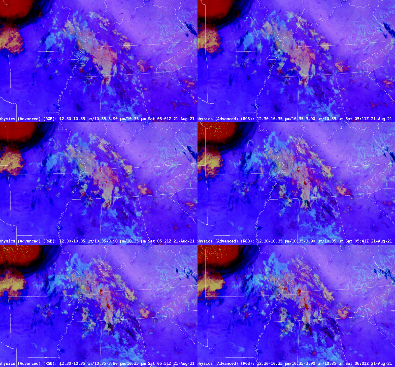
It turns out the relationship between color change in the RGB and lightning initiation isn’t quite so clear-cut. The stepping animation below shows the Night Time Microphysics and the GOES-16 Cloud Phase product. It is a challenge to relate a cloud phase to a particular color. GLM observations are occurring in regions where ice clouds are present. However, there are also regions where ice clouds are diagnosed and lightning is not happening.
The Weather Prediction Center (WPC) had two Mesoscale Discussions on this event, here and here.
This event was discussed at an FDTD Webinar (link) led by Matt Reagan and Brendan Schaper from the Nashville forecast office. (Storyboard Link)

