Microwave rain estimates with an MCS

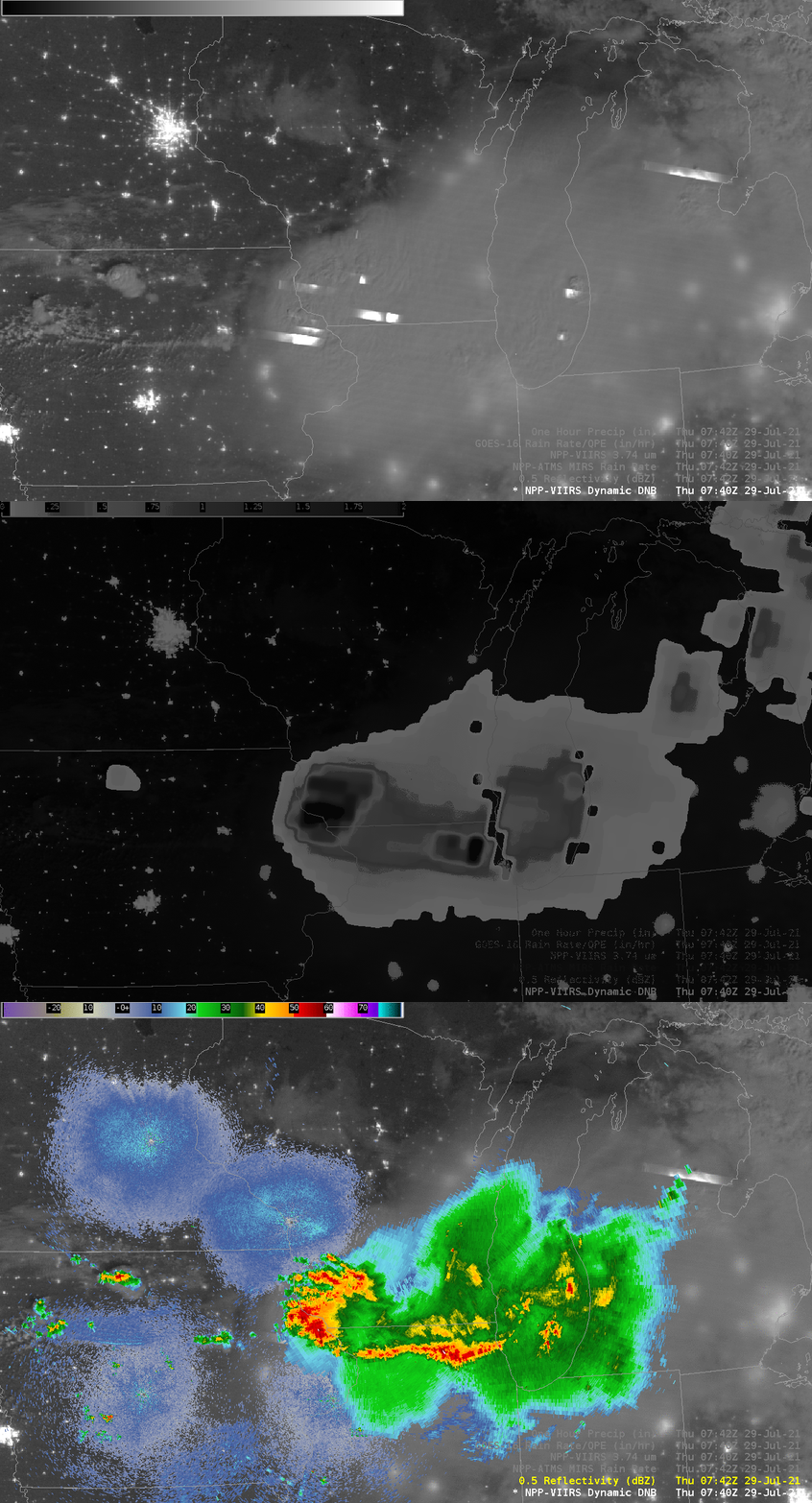
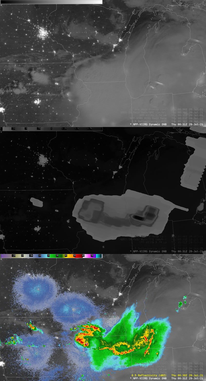
Severe thunderstorms developed (in a moderate risk region from the Storm Prediction Center; here are the Storm Reports) over northern Wisconsin late in the day on 28 July 2021 and moved to the southeast (here is an mp4 animation of GOES-16 imagery courtesy of Tim Schmit, NOAA). The Day Night Band imagery, above, from Suomi NPP (0740 UTC) and NOAA-20 (0831 UTC), shows snapshots of the storms as they moved southward into Illinois. The 0740 UTC image include more evidence of lightning — especially in southwestern Wisconsin (the horizontal streaks of light) and just southwest of Dubuque. At 0831 UTC, lightning is not detected in the Day Night Band image.
In addition to carrying the VIIRS (Visible-Infrared Imaging Radiometer Suite) instrument, Suomi-NPP and NOAA-20 also carry the Advanced Technology Microwave Sounder (ATMS), and microwave data from that instrument can be used to infer rain rates (using MIRS — Microwave Integrated Retrieval System — algorithms, that are part of Community Satellite Processing Package — CSPP — software available to use at Direct Broadcast sites). The toggles show the Day Night Band image, the ATMS-derived Rain Rate (the green region at 0742 UTC is >3″/hour!), and the base reflectivity at 0740 UTC (below) and at 0831 UTC (bottom). The MIRS Rain Rate (0742 UTC; 0833 UTC) product does outline regions where rain is likely falling, and gives credible values where the heaviest rains are falling. Note the diminishing rain rate over southwestern WI, for example, between 0740 and 0830 UTC — indicative of weaker convection — an observation echoed in the changes in lightning detection with the Day Night band. Changes in radar to reflect that difference in microwave-estimated rain rate are a little more subtle.
Because microwave estimates of rain rate are affected by background emissivity, and because water has a much lower microwave emissivity than land, you can sometimes view land/water boundaries (as in the 0742 UTC Rain Rate, below).
MIRS Rain Rate gives useful information about rains when radar observations cannot be accessed.


MIRS Rain Rate products are available via an LDM feed from CIMSS; they are produced using the Direct Broadcast antenna at CIMSS and are thus very timely.

