NUCAPS and dry air in the Upper Midwest
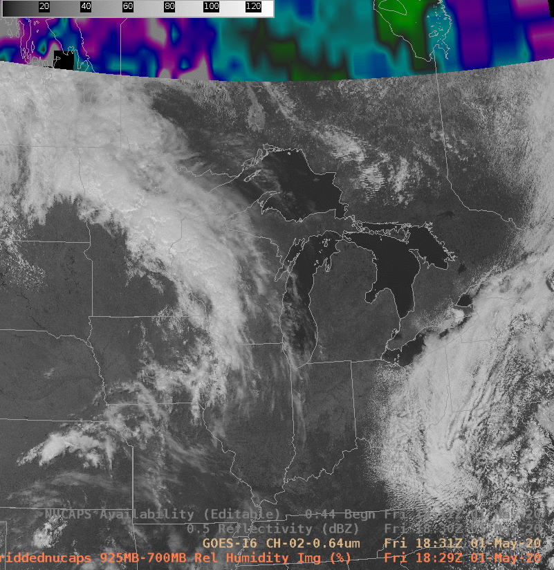
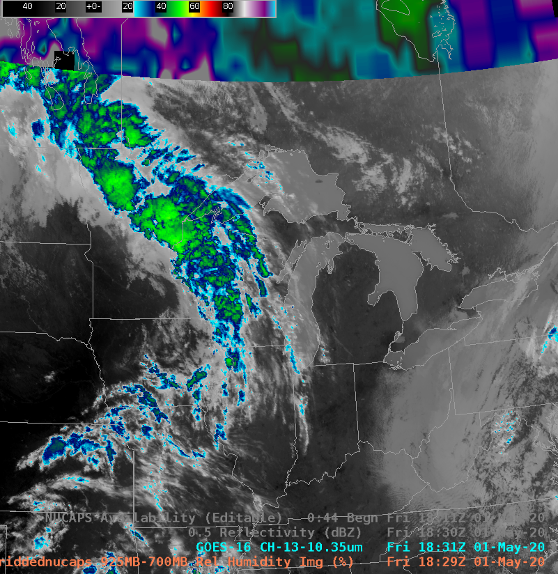
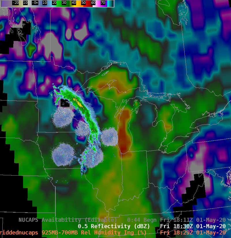
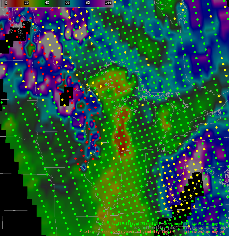
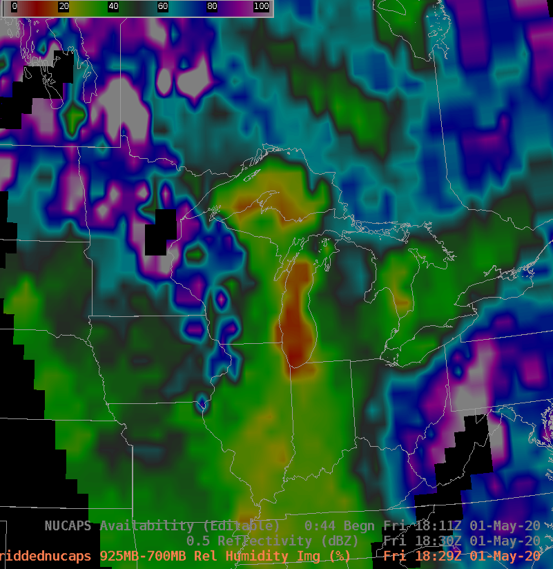
GOES-16 ABI Band 2 (0.64 µm, visible) and Band 13 (10.3 µm, infrared) along with gridded NUCAPS fields of 925-700mb Relative Humidity, Midwest Base Reflectivity and NUCAPS Sounding availability points (Click to enlarge)
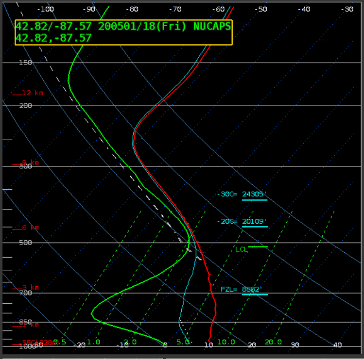
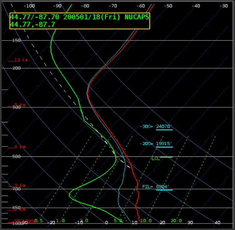
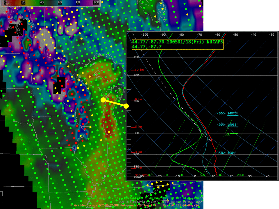
A cloud band passing through the upper midwest on 1 May 2020, shown above in the GOES-16 ABI Visible and Infrared imagery (toggled with NUCAPS products and radar), was accompanied by radar echoes. Would you expect that radar-indicated precipitation to reach the ground? Gridded NUCAPS fields (shown here with NUCAPS Sounding availability points) show very dry air in the lower troposphere over eastern Wisconsin. Individual NUCAPS soundings, one over Lake Michigan just east of Racine, and one over Green Bay, toggled below, similarly show very dry air.
NUCAPS Profiles over Lake Michigan and Green Bay (Click to enlarge)