Signature of ice accrual across the Upper Midwest
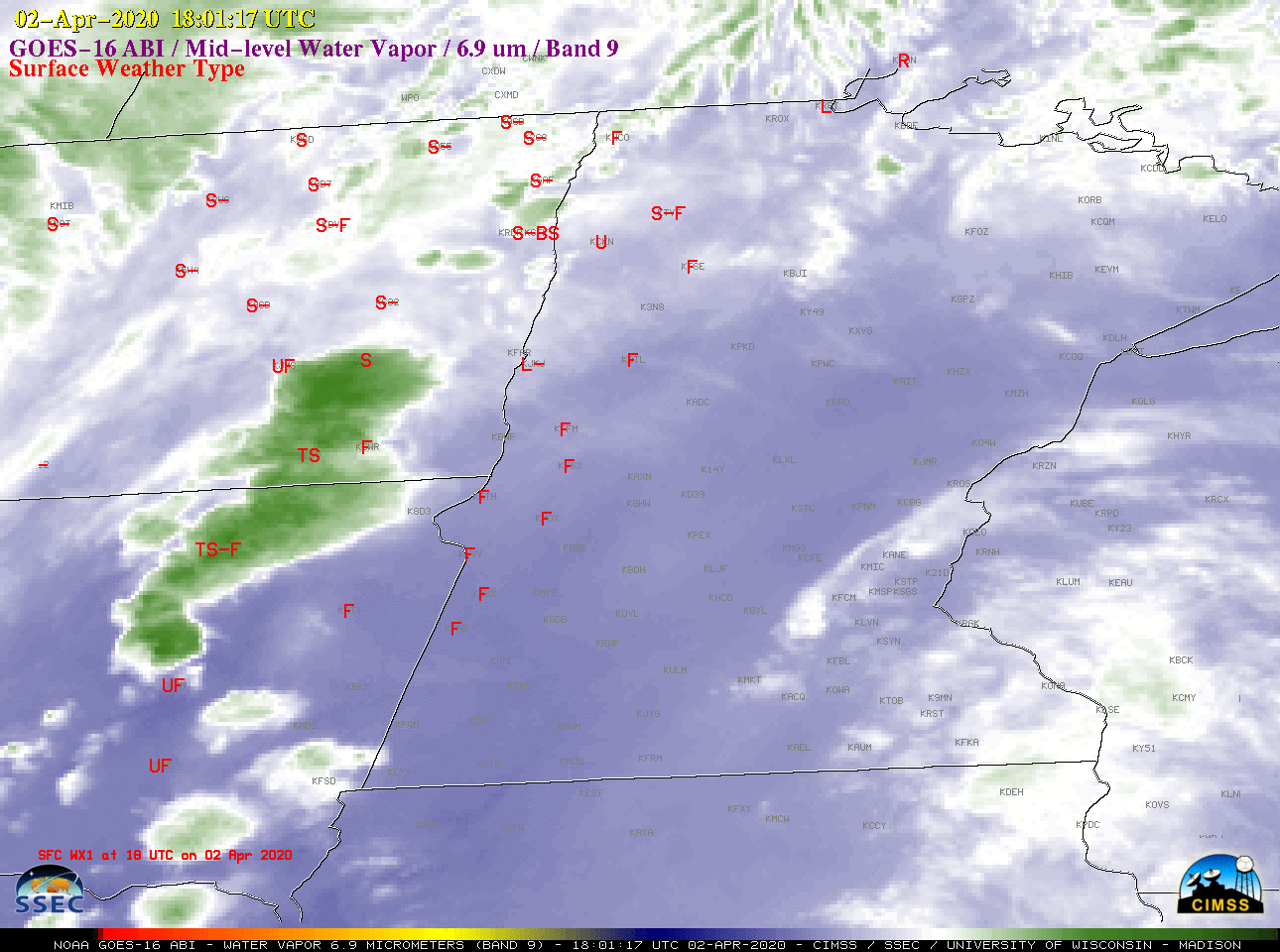
![GOES-16 Mid-level Water Vapor (6.9 µm) images, with hourly precipitation type plotted in red [click to play animation | MP4]](https://cimss.ssec.wisc.edu/satellite-blog/images/2020/04/200402_200403_goes16_waterVapor_precipitationType_Upper_Midwest_anim.gif)
GOES-16 Mid-level Water Vapor (6.9 µm) images, with hourly precipitation type plotted in red [click to play animation | MP4]
On the following day, in a comparison of GOES-16 “Red” Visible (0.64 µm) and Day Snow Fog Red-Green-Blue (RGB) images (below), the RGB images revealed darker red swaths across southeastern South Dakota, northwestern Iowa and western Minnesota (at the 1.61 µm wavelength, ice absorbs radiation more strongly than snow — which contributed to the darker appearance of those swaths). Note that these ice accrual swaths exhibited no signature in the Visible imagery.
![GOES-16 "Red" Visible (0.64 µm) and Day Snow Fog RGB images [click to play animation | MP4]](https://cimss.ssec.wisc.edu/satellite-blog/images/2020/04/200404_goes16_visible_daySnowFogRGB_Upper_Midwest_ice_acretion_anim.gif)
GOES-16 “Red” Visible (0.64 µm) and Day Snow Fog RGB images [click to play animation | MP4]
Dark red swath extending through Minnesota is #ice accretion from April 2-3 winter storm. Strong infrared absorption in the 1.61 component of the Day Snow-Fog RGB makes it darker compared to snow. Clearly shows where ice accretion occurred whereas visible cannot. #ndwx #mnwx pic.twitter.com/L1rs7EskLa
— Carl Jones (@northflwx) April 4, 2020