Comparing Gridded NUCAPS data to model fields

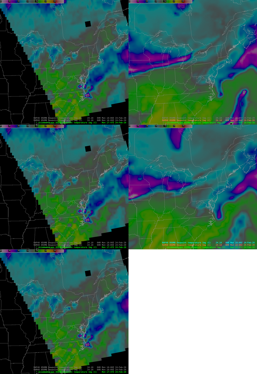
NUCAPS fields of 850-mb dewpoint Temperature toggled with NAM40 and RAP40 estimates at approximately the same time, ~1800 UTC on 24 February 2020 (Click to enlarge)
Gridded NUCAPS fields include 850-mb dewpoint temperature fields, and this blog post compares the NUCAPS fields to model fields, and this is part of an ongoing series of blog posts on these horizontal fields. The imagery above compares NUCAPS fields at 850 mb with NAM40 and RAP40 data over the southeastern part of the United States. Very dry air is indicated over the western Atlantic Ocean north and west of the Gulf Stream. There is generally good agreement between the NUCAPS and model fields. Model fields appear dryer (or NUCAPS fields are more moist). Model fields show a pronounced gradient over the upper midwest that, at this scan time, were too far west to be viewed by NUCAPS. (Click here to view the NUCAPS points — green, yellow and red — for this time, to show something about the data that has been input into the gridded fields).
However, the following pass from NOAA-20 (click here to view NOAA-20 orbit paths) included midwestern data. Again, the general good agreement is obvious, especially with regard to the placement of the gradient. Is the atmosphere as dry as the model suggests at 850 mb? That’s a hard question to answer given 1200 UTC Soundings at Omaha, Minneapolis/Chanhassen, and Green Bay. Note that NAM12 and RAP13 data are being shown in this example; they gave mostly the same answer as NAM40/RAP40 used above.


