Fresh snow cover in Montana and Alberta
![GOES-16 Day Cloud Phase Distinction RGB images [click to play animation | MP4]](https://cimss.ssec.wisc.edu/satellite-blog/wp-content/uploads/sites/5/2019/09/190930_goes16_dayCloudPhaseDistinctionRGB_MT_anim.gif)
GOES-16 Day Cloud Phase Distinction RGB images [click to play animation | MP4]
New Weather Graphic Issued: Snow Reports. More info at https://t.co/9noRXI71Sk. #mtwx pic.twitter.com/WlJ5aC4JIy
— NWS Great Falls (@NWSGreatFalls) September 30, 2019
The 36″ of snow at Galata 16SW, MT, Coop station on Sep 29, 2019, is a North America calendar day record for AN OFFICIAL CLIMATE STATION in September. Baseline, Alberta, had 31.9″ on 9/14/2006 and Cokedale, MT, had 29″ on 9/21/1895. More data may come in tomorrow. @NWSGreatFalls pic.twitter.com/69C7EHxt9b
— Brian Brettschneider (@Climatologist49) October 1, 2019
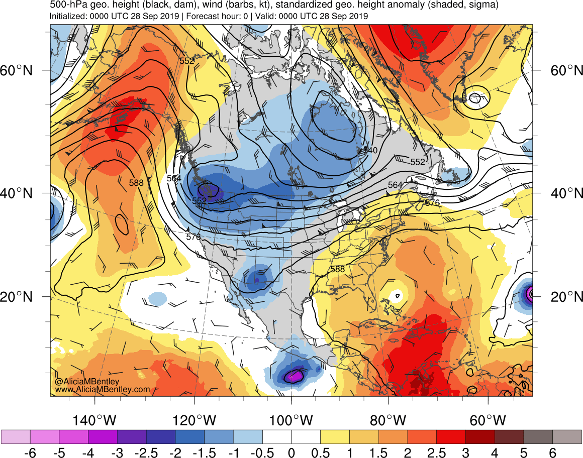
GOES-16 Mid-level Water Vapor (6.9 µm) images from 0001 UTC on 28 September to 0901 UTC on 30 September (below) covered the duration of the winter storm — the circulation of an anomalously-deep mid-tropospheric low over the Pacific Northwest was evident, in addition to a long fetch of middle/high-level moisture from the southwestern US toward Montana. Another notable feature included widespread mountain waves over Colorado beginning on 29 September, which eventually extended downwind over western Nebraska/Kansas; Colorado had a peak wind gust of 81 mph during this event (WPC storm summary).
![GOES-16 Mid-level Water Vapor images, with hourly plots of precipitation type [click to play animation | MP4]](https://cimss.ssec.wisc.edu/satellite-blog/wp-content/uploads/sites/5/2019/09/190928_190930_goes16_waterVapor_precipitationType_Northern_Rockies_snowstorm_anim.gif)
GOES-16 Mid-level Water Vapor (6.9 µm) images, with hourly plots of precipitation type [click to play animation | MP4]
===== 01 October Update =====
![GOES-16 Day Cloud Phase Distinction and Day Snow-Fog RGB images [click to play animation | MP4]](https://cimss.ssec.wisc.edu/satellite-blog/wp-content/uploads/sites/5/2019/10/191001_goes16_dayCloudPhaseDistinctionRGB_daySnowFogRGB_MT_anim.gif)
GOES-16 Day Cloud Phase Distinction and Day Snow-Fog RGB images [click to play animation | MP4]
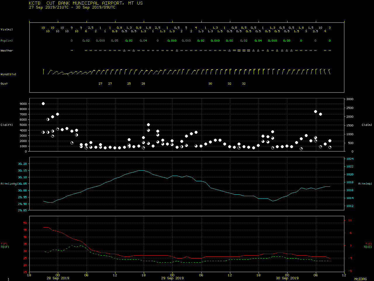
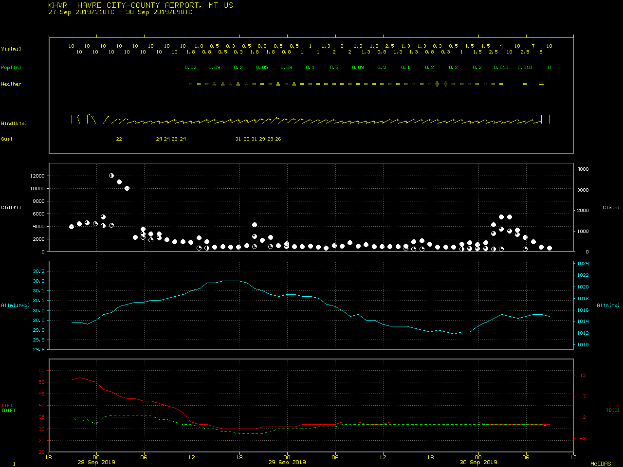
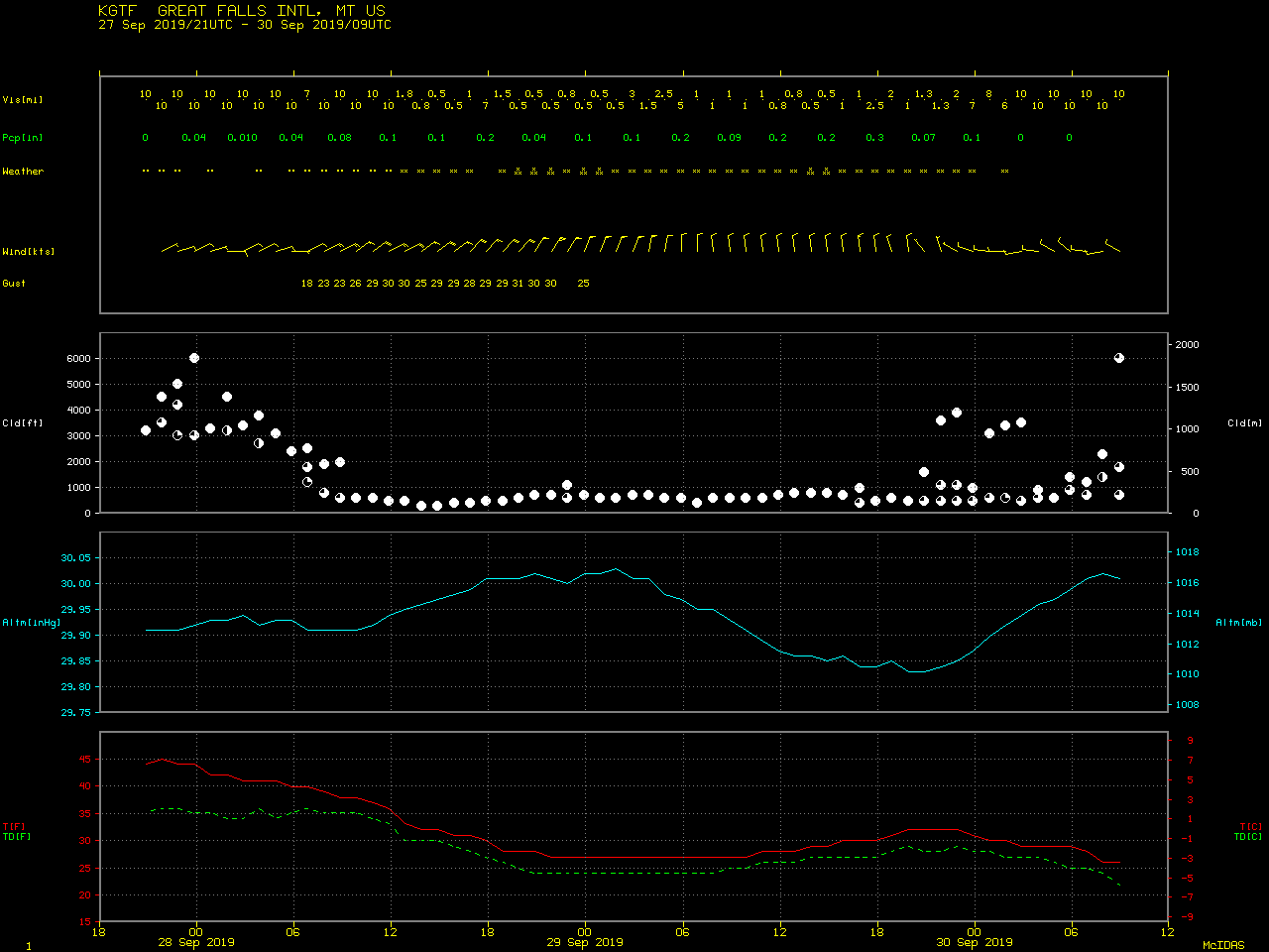
In a toggle between GOES-16 Day Cloud Phase Distinction RGB and Topography images (below), note the darker blue gaps in snow cover in Montana and Alberta – with easterly/northeasterly winds during the snow event (Cut Bank | Havre | Great Falls), those areas experienced downslope flow which warmed the boundary layer air and minimized snow accumulation.
![GOES-16 Day Cloud Phase Distinction RGB and Topography images [click to enlarge]](https://cimss.ssec.wisc.edu/satellite-blog/wp-content/uploads/sites/5/2019/10/191001_goes16_dayCloudPhaseDistinctionRGB_topography_MT_AB_anim.gif)
GOES-16 Day Cloud Phase Distinction RGB and Topography images [click to enlarge]