Satellite views of a Spacecraft Freighter Launch from Tanegashima Island in Japan
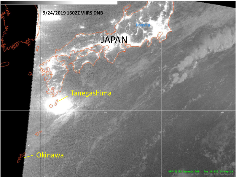
NOAA-20 Day Night Band visible (0.7 µm) imagery at 1602 UTC on 24 September 2019 (Click to enlarge) (Image courtesy Mike Ziobro and Brandon Aydlett, WFO Guam)
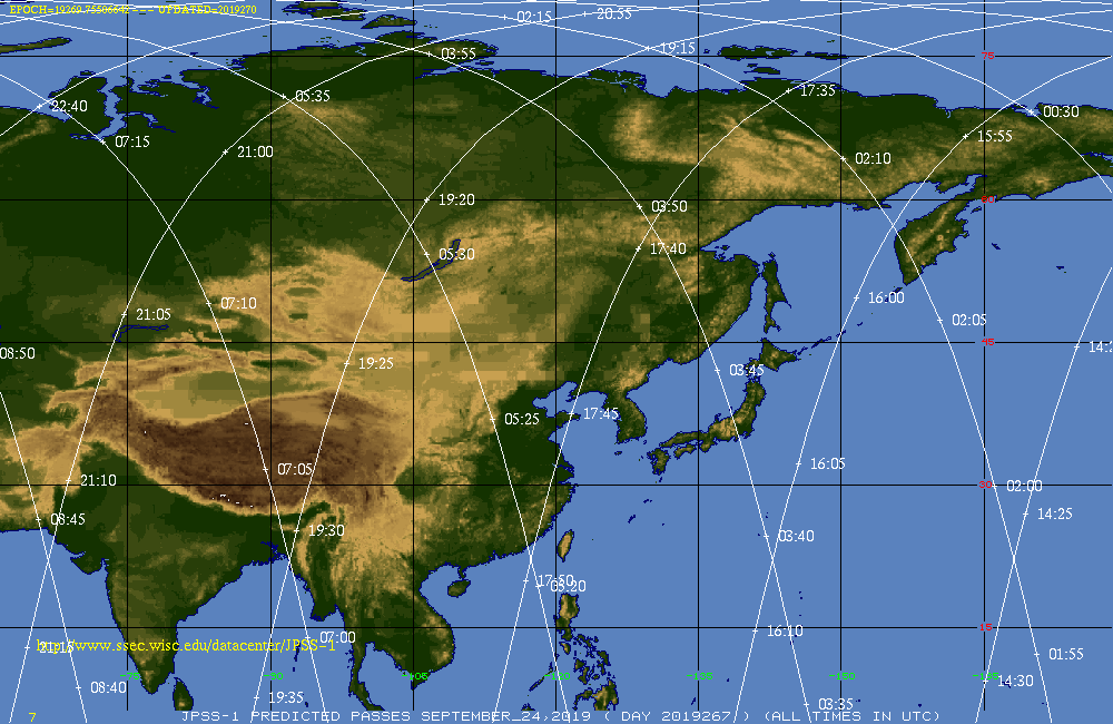
NOAA-20 has viewed the launch from Tanegashima Island of a Japanese Spacecraft (NASA Blog Coverage; YouTube video, launch is at minute 35 in the video). Brandon Aydlett, NWS Guam, noted the appearance of a very bright spot in the Day Night Band imagery from NOAA-20 at 1602 UTC on 24 September (and a hot spot as well in the infrared imagery shown below). (NOAA-20 and Suomi-NPP data in this blog post were downloaded at the Direct Broadcast Antenna at the Forecast Office in Guam). NOAA-20 Orbital passes (from this site) show an overpass near the island at 1605 UTC; Suomi NPP had a more direct overpass over the island around 1657 UTC. Compare the NOAA-20 image, above, timestamped 1602 UTC, to the Suomi NPP image, below, timestamped at 1654 UTC. The bright signal over Tanegashima at 1602 UTC is missing from the 1654 UTC Suomi NPP imagery.

Suomi-NPP Day Night Band visible imagery (0.7 µm) at 1654 UTC on 24 September 2019 (Click to enlarge) (Image courtesy Mike Ziobro and Brandon Aydlett, WFO Guam)
Infrared Imagery captured the thermal signature of this launch as well. The hot spots in VIIRS imagery are obvious at 1602 UTC from NOAA-20, but not at 1654 UTC from Suomi NPP, at both 3.74 and 11.45, as shown below.
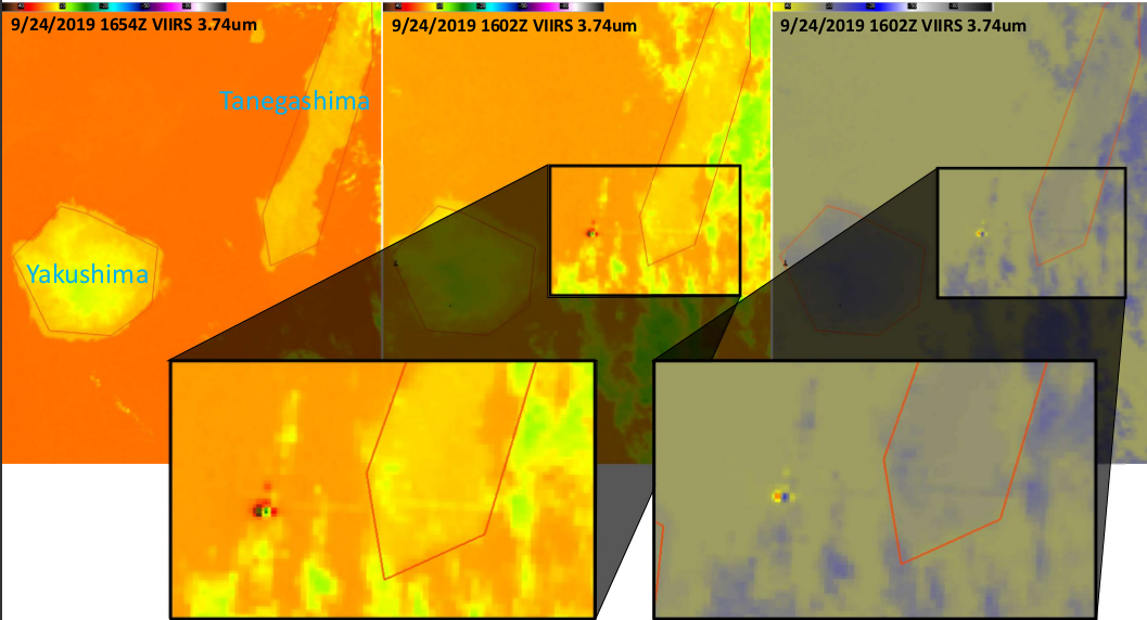
VIIRS shortwave infrared (3.74 µm) imagery at 1654 UTC (left) and at 1602 UTC (center, right, with two different color enhancements). Blown-up versions of the warm pixels are shown (Click to enlarge) (Image courtesy Mike Ziobro and Brandon Aydlett, WFO Guam)
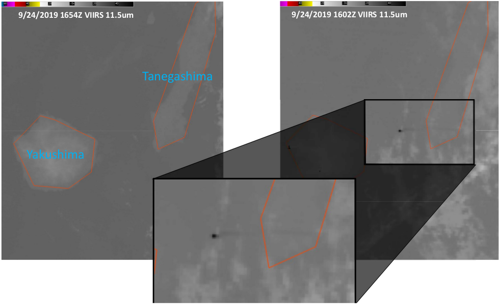
VIIRS infrared (11.45 µm) imagery at 1654 UTC (left) and at 1602 UTC (right, same color enhancements). Blown-up versions of the warm pixels are shown (Click to enlarge) (Image courtesy Mike Ziobro and Brandon Aydlett, WFO Guam)
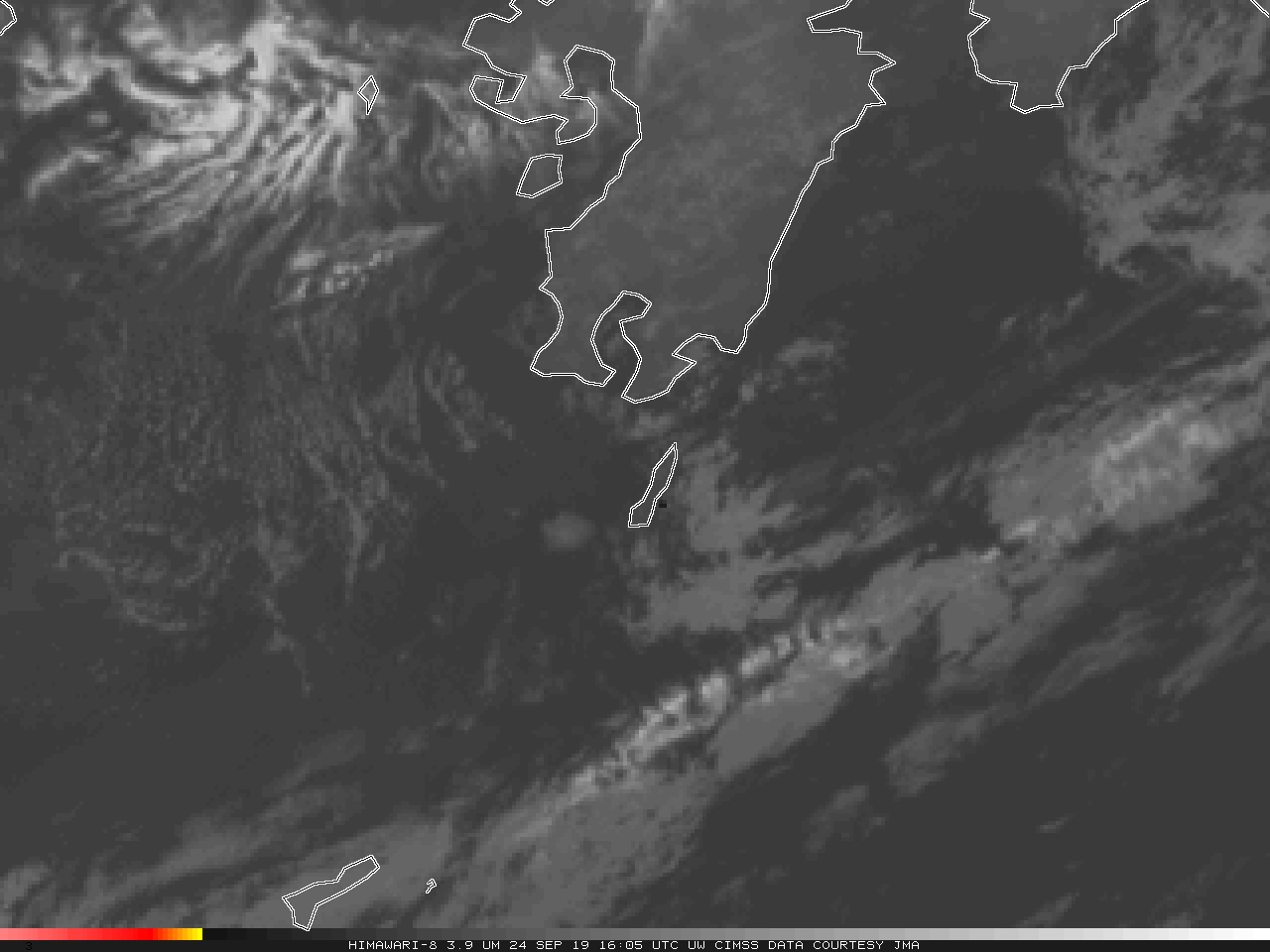
Himawari-8 shortwave infrared imagery also captured the launch, with a hot spot in a Japan Sector image at 1605 UTC on 24 September 2019, below.

Himawari-8 shortwave infrared (3.9 µm) imagery from 1600-1610 UTC on 24 September 2019 (Click to enlarge). Himawari data courtesy of JMA.
There is a considerable parallax shift in the NOAA-20 imagery, as the VIIRS instrument is scanning at the limb in the image, and the rocket at the time was very high in the atmosphere. The parallax shift in the Himawari-8 imagery is less noticeable.