Snow melt across the Upper Midwest
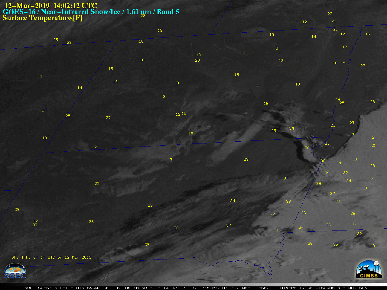
GOES-16 Near-Infrared “Snow/Ice” (1.61 µm) images, with hourly plots of surface temperature [click to play animation | MP4]
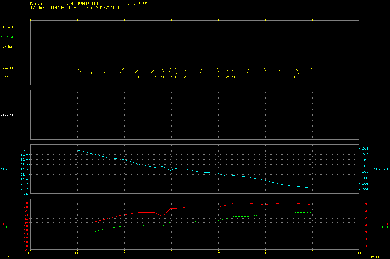
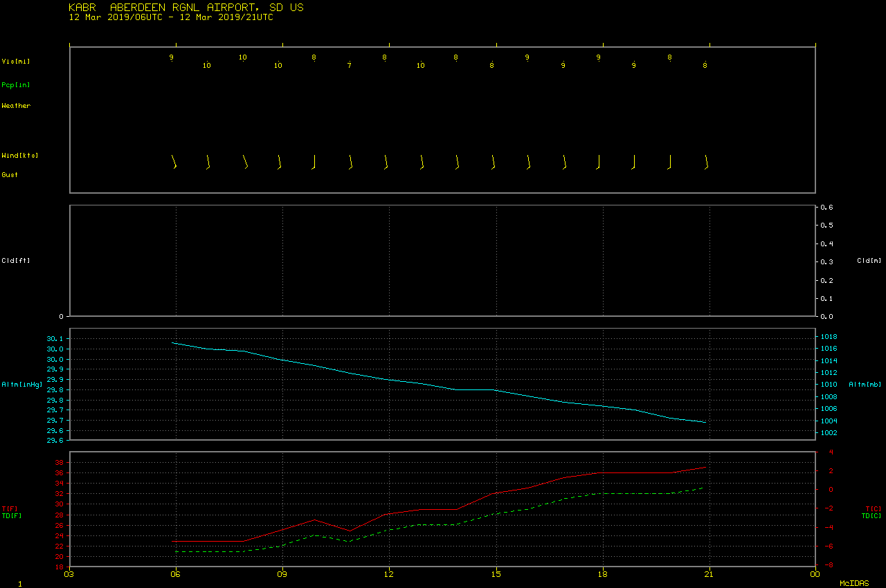
GOES-16 Snow/Ice images centered over the North Dakota / South Dakota / Minnesota border region (below) provided a closer view of the progressive northward darkening of this snow melt signature. Also of interest was a packet of standing waves to the lee (northeast) of the Coteau des Prairies — downsloping flow contributed to localized warming and melting at that location early in the day. The effect of the arrival of southwesterly downslope flow at Sisseton (located approximately midway between Browns Valley and Veblen) was very apparent in a time series of surface data. In contrast, the warm-up was much more gradual and the wind speeds significantly lighter not far to the west at Aberdeen.
![GOES-16 Near-Infrared "Snow/Ice" (1.61 µm) images [click to play animation | MP4]](https://cimss.ssec.wisc.edu/satellite-blog/wp-content/uploads/sites/5/2019/03/190312_goes16_snowIce_SD_anim.gif)
GOES-16 Near-Infrared “Snow/Ice” (1.61 µm) images [click to play animation | MP4]
![GOES-16 Low-level Water Vapor (7.3 µm), "Red" Visible (0.64 µm) and Near-Infrared "Snow/Ice" (1.61 µm) images [click to play MP4 animation]](https://cimss.ssec.wisc.edu/satellite-blog/wp-content/uploads/sites/5/2019/03/sd_vis-20190312_205212.png)
GOES-16 Low-level Water Vapor (7.3 µm), “Red” Visible (0.64 µm) and Near-Infrared “Snow/Ice” (1.61 µm) images [click to play MP4 animation]
Interesting satellite microphysics going on today on lee side of the Coteau de Prairie. Rotors coming off the Coteau I believe are mixing down warm air and melting the surface layer of the snow changing the reflective properties in Band 5. @CIMSS_Satellite @UWCIMSS @weatherdak pic.twitter.com/tL0SI51405
— James Hyde (@wxmeddler) March 12, 2019