NUCAPS Profiles across a Saharan Air Layer (SAL) Outbreak

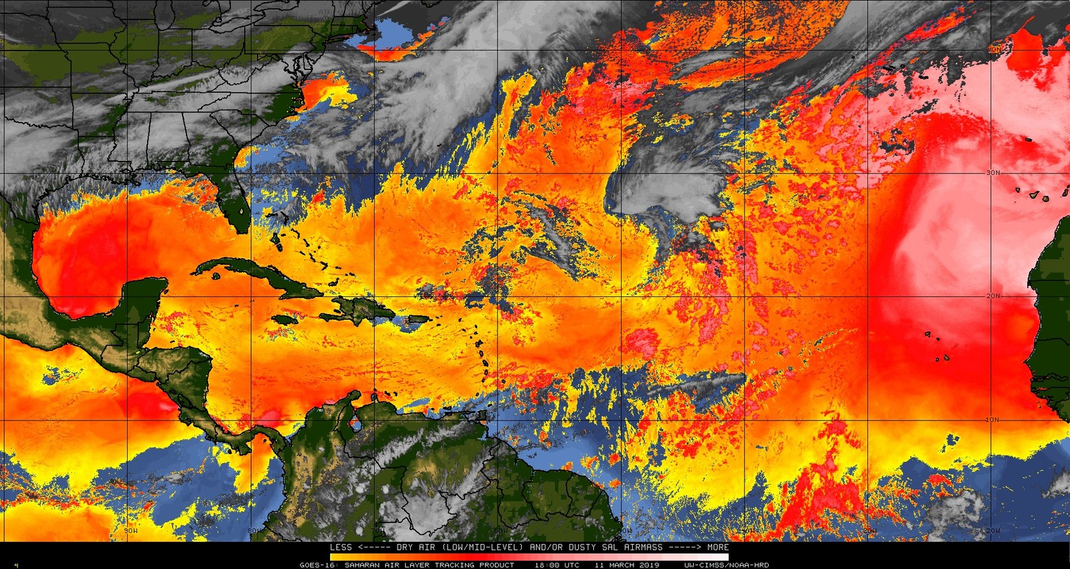
Split Window Difference imagery over the Atlantic Basin, 1800 UTC 11 March through 1800 UTC 12 March 2019 (Click to animate)
A Saharan Air Layer (SAL) outbreak is occurring over the eastern Atlantic Ocean on 11-12 March 2019. The animation above shows the Split-Window Difference (10.3 µm – 12.3 µm) (link, from this website) color-enhanced to accentuate in red/pink/white the regions where Saharan Dust has been lofted into the atmosphere. This outbreak has been developing — this animation (courtesy Arunas Kuciauskas, NRL in Monterey) from 0400 UTC on 8 March to 1400 UTC on 11 March of the DEBRA product (now the Dynamic Enhanced Background Reduction Algorithm, from this website) shows the dust originating west of a departing cyclone over northwest Africa).
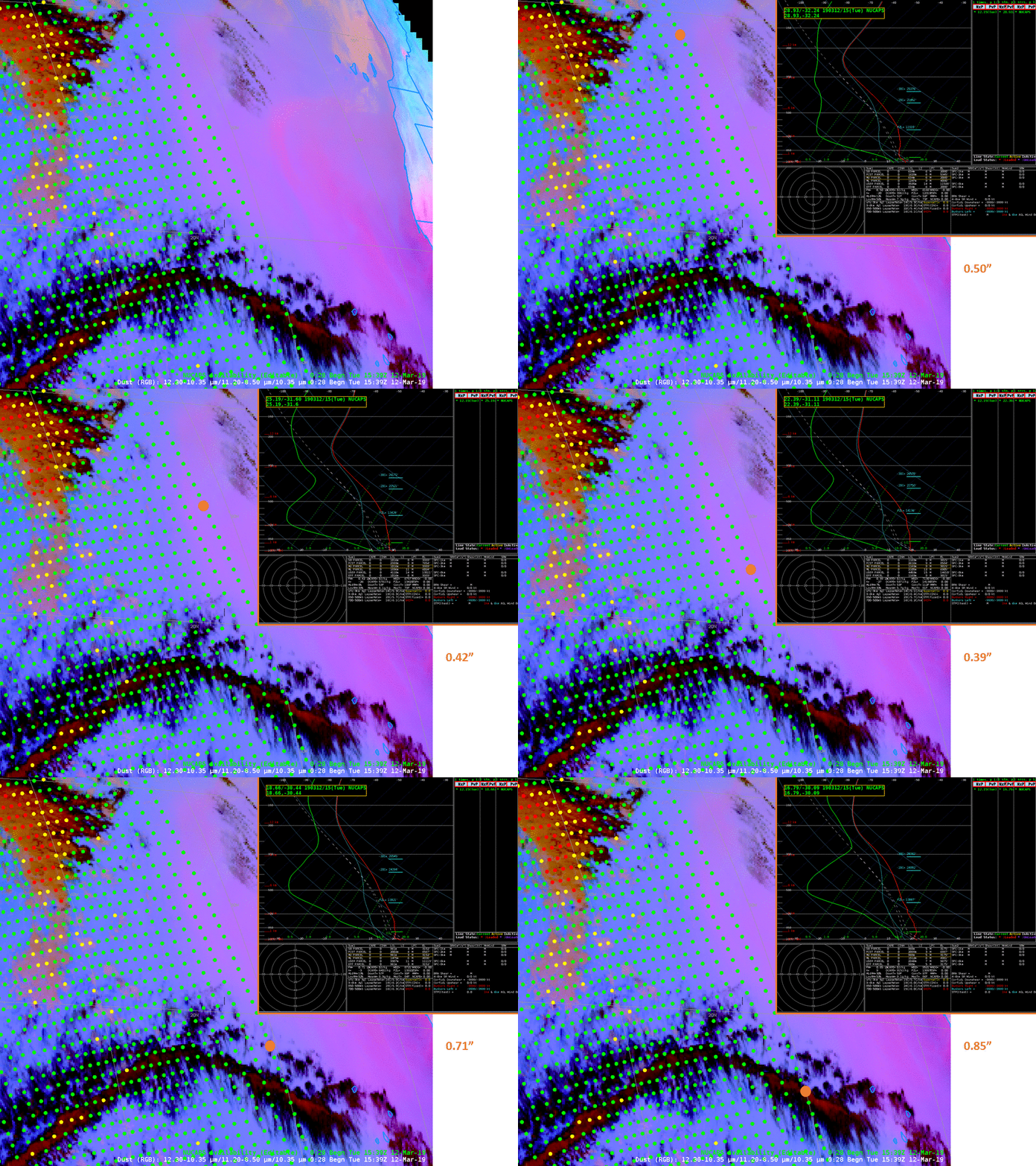
NUCAPS Profiles sampled a region of the SAL on Tuesday 12 March, and those are shown below. (This has been discussed previously on this blog, here) The swath of points is shown on top of a GOES-16 Red/Green/Blue image composite designed to highlight dust in pink. Sounding locations shown are denoted by the orange dot, and Precipitable Water associated with the sounding is indicated. The accentuated mid-level drying associated with the SAL air, inferred by the pink in the RGB, is readily apparent.

GOES-16 Dust RGB at 1530 UTC on 12 March 2019 superimposed with NUCAPS sounding locations. Inset: NUCAPS Sounding in the location indicated by the orange dot. Total Precipitable Water for the sounding as indicated (Click to enlarge)
============= Update 13 March 2019 ==============

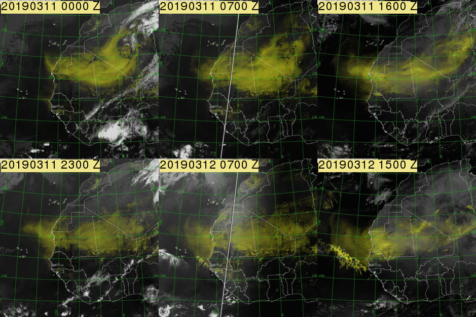
DEBRA dust product from MSG Seviri data, hourly from 0000 UTC on 11 March to 1500 UTC 12 March 2019 (Click to enlarge)
The animation above and the one below are courtesy Arunas Kuciauskas from the Naval Research Lab in Monterey CA. The Dynamic Enhanced Background Reduction Algorithm (DEBRA) dust product animation, above, is a product developed at both NRL and the Cooperate Institute for Research in the Atmosphere (CIRA) by Steve Miller. DEBRA was derived from the MSG SEVIRI dataset. The background is gray-scaled to enhance the yellow-shaded lofted dust. Brighter yellow shades suggest greater confidence that a pixel is dusty.
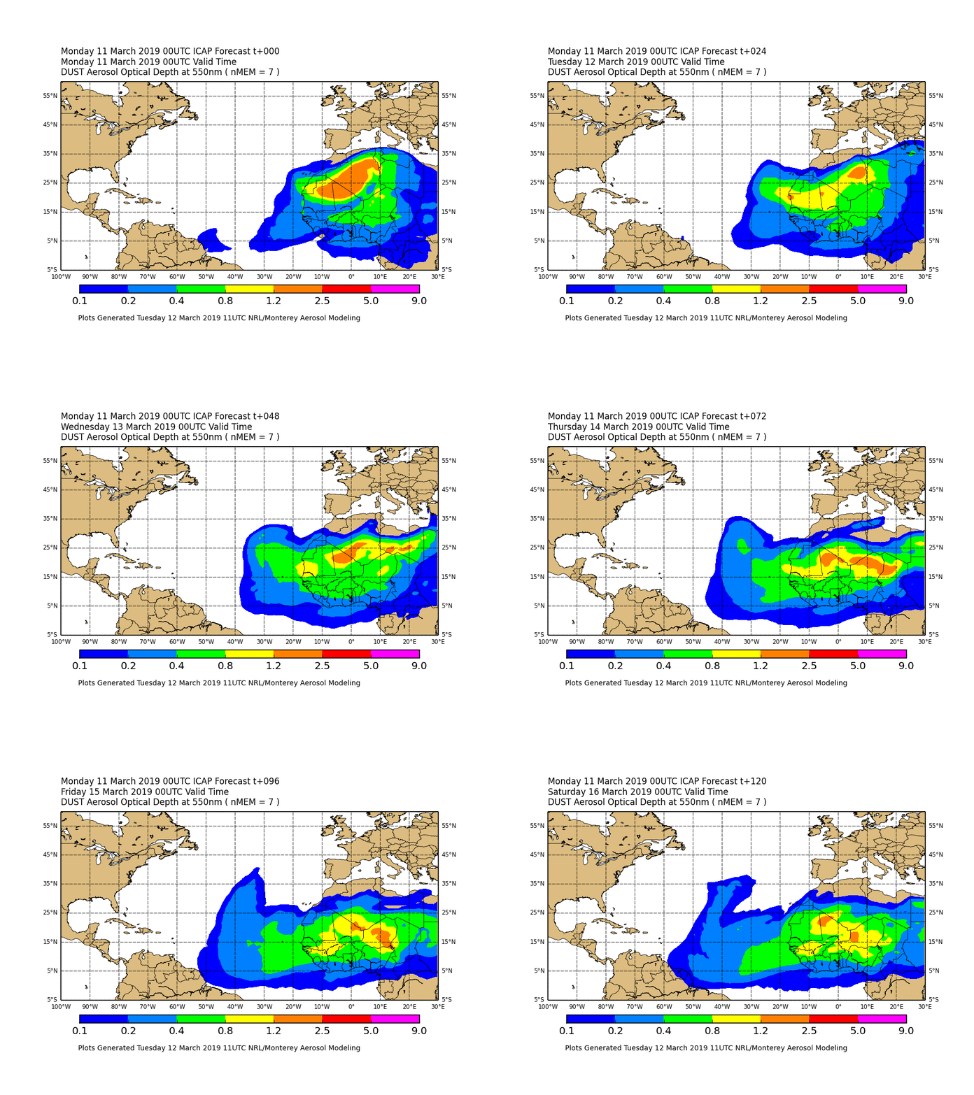
The animation below shows output from the ICAP model; this is an Aerosol optical depth (AOD) prediction model that was initialized with data from 0000 UTC 11 March 2019; it provides 6-hourly forecasts of AOD (colored contours) through 0000 UTC on 16 March 2019. This ICAP Multi Model Ensemble (ICAP MME) is a consensus style 550 nm aerosol optical thickness (AOT) forecast ensemble from the following systems: ECMWF MACC, JMA MASINGAR, NASA GSFC/GMAO, FNMOC/NRL NAAPS, NOAA NGAC, Barcelona Supercomputing Centre NMMB/BSC-CTM and UK Met office unified model.

Aerosol Optical Depth predictions from the ICAP MME, 0000 UTC 11 March through 0000 UTC 16 March 2019 (Click to enlarge)
Suomi NPP overflew the leading edge of the SAL in the eastern Atlantic around 1500 UTC on 13 March 2019. The animation below shows the NUCAPS points superimposed on the GOES-16 Baseline Total Precipitable Water Product (very dry air is indicated) and on the Dust RGB that highlights the SAL in Red. Additionally, 6 NUCAPS Soundings are shown. They captured the very dry air associated with the SAL. Total Precipitable Water estimates from the GOES Baseline Product and from the NUCAPS sounding are indicated. The GOES moisture estimates are heavily constrained by GFS model data as the Advanced Baseline Imager (ABI) has only 3 infrared bands (at 6.19 µm, 6.95 µm and 7.34 µm, Bands 8, 9 and 10) that are sensitive to water vapor. In contrast, the Cross-track Infrared Sounder (CrIS) on Suomi NPP has many more bands that are sensitive to Water Vapor. More than 60 are used in the NUCAPS retrieval.


